SITE CONTENT
Antique Maps & Prints
Britain
Antique Maps - World
Antique Books
Cartographers
Early Prints
Other Stock
|
| Maps, Prints & Books of Britain |
Images |
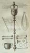
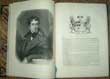
(Code No. 6967)
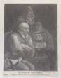
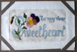
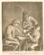
The Psalm Smiters.
(Antique Print).
Date. [c.1769].
London, Printed for Bowles & Carver. Image size [4 1/2 x 6ins.] Original mezzotint engraved print, Dust marks to edge of margins.....
But at my stumbling they rejoiced and gathered themselves together;
The smiters whom I did not know gathered together against me,
They slandered me without ceasing. —Psalm 35:15 ... £35.00 |
Click on picture above to view more images
How to order |
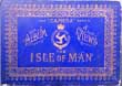
(Code No. 6944)
Album of Camera Views,
The Isle of Man.: The "Camera" Series.
Date. (c.1900).
The Isle of Man, Douglas, Mark Parkinson. Oblong 8vo [12 x 8 1/2ins]. . Many photogravure photographs on 19 leaves, one plate with centre fold split, no loss. Loose gilt decorated boards, splits with some surface loss. Damage to edge of map, no image loss....... £30.00 |
Click on picture above to view more images
How to order |
(Code No. 6875)
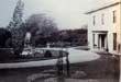
Anon.
(2 Antique photographs on one leaf, laid on to card).
Victorian gardens.
Date. (c.1860).
England. Image size [9 1/4 x 7 3/4ins]. 2 Original albumen photographs recto and verso of a Victorian garden......... £70.00 |
Click on picture above to view more images
How to order |
(Code No. 6796).
Ordnance Survey Atlas of England & Wales.
No date. [c.1920].
Southampton. Ordnance Survey Office. No Date, 4to, [ 8 1/2 x 14 ins.] Errata (v. blank) + Title page (as above) + Scales (v. blank) + 24 Double page linen backed folding coloured maps. Map image size 28 x 10 ins, Some folding maps worked loose.. Quarter inch to the mile + pp. 1-21 index. Original cloth, slight fraying...... £65.00
|
Click on picture above to view more images
How to order |
(Code No. 6743)
James, Montague. Rhodes. (1862-1936).
Abbeys with an additional chapter on Monastic Life and Buildings.
Date. 1925, 1st edition.
London, Great Western Railway. 4to, [8 x 10ins]. Pp. x, 154 + Illustrations throughout + Folding plans of Glastonbury, Tewkesbury, Malmesbury. Tintern Abbeys and other abbeys + folding map, very good condition. Original cloth gilt, glazed protective cover......... £30.00 |
Click on picture above to view more images
How to order |
(Code No. 6742)
Woodward, Ann, Guy la Bedoyere & Michael Parker Pearson.
Bronze Age Britain, Roman Towns in Britain and Shrines & Sacrifices.
(English Heritage Series).
3 Volumes.
Date. 1992-94.
London, Batsford Ltd. 4to, [8 x 10ins]. Pp. 143,.as new. Original cloth. Dust jackets, as new...... £40.00 |
Click on picture above to view more images
How to order |
(Code No. 6734)
Bacon. G, A. A.
Bacon's Bold-Feature Map of the British Isles.
ISOTHERM.
( Bacon's Excelsior)
Date. [c.1920].
London, G W. Bacon. [Size approx 38 1/4 x 30ins]. Folding to [10 x 13ins]Folding linen backed sectional coloured wall map, showing Isotherm (contour line) – a type of equal temperature at a given date or time on a geographic map....... £40.00 |
Click on picture above to view more images
How to order |
(Code No. 6733)
Kelly.
Kelly's Directory of CAMBRIDGE, 1962.
Date. 1962.
London, Kelly's Directories Ltd. 12mo, [5 x 71/2ins]. Pp. xviii, 728, last page with split and creased, no loss. Lacks town plan. Original cloth, slight split to front hinge, marked. Listing:- The history and the names, trades and addresses of the inhabitants, transport, postal and telegraph information. The accountants to the Woollen Drapers........ £30.00 |
Click on picture above to view more images
How to order |
(Code No. 6781)
Tunnicliff, William A.
Topographical Survey of the Counties of Somerset, Gloucester, Worcester, Stafford, Chester and Lancaster.
Date. 1789.
Bath. R, Cruttwell; . 8vo [218 x 135 mm] Pp 118, slight foxing. One folding map of Somersetshire. Lacks 5 other county maps. 44 printed pages of coat of arms regarding the county families. Directory for the principal Inns markets days, names and addresses plus trades of each town described. Original half calf, marbled boards, upper board detached. Rubbed. .... £88.00 |
Click on picture above to view more images
How to order |
(Code No. 6780)
Aldin Cecil.
(Antique Chromolithographic Print).
Card Game.
Date. 1901.
SIGNED IN PENCIL BY CECIL ALDIN in bottom left hand blank margin,mark to bottom right hand corner. Size 27 x 19 ins. Image size 15 x 24 ins. Entered at Stationers' Hall - Copyright - Entered According to Act of Congress in the Year 1901, by Lawrence & Bullen Ltd in the Office of Librarian of Congress, at Washington. and Copyright Published by Lawrence & Bullen Ltd 16 Henrietta Street, Covent Garden, London, WC. Contemporary Mount. Guaranteed to be 100 years old. £300.00 |
Click on picture above to view more images
How to order |
| (Code No. 6779)
(Antique Print)
Johnston.
Valley Crusis Abbey Cardigonshire, Valley Crucis Abbey, North Wales.
Date. [c.1800].
London. Deacon & Co. Page size 18 1/4 x 13 1/2 ins. Image size 18 x 12 3/4 ins. Original hand coloured copper engraved & drawn plate by Johnston, nicks to edges of print. £90.00 |
Click on picture above to view more images
How to order |
|
(Code No. 6706)
Album of 105 various Postcards.
British and Europe.
Date. (c.1918].
Album size, [9 x 11ins]. 105 mostly coloured postcards, including (approx) 30 sentimental cards + (approx) 3 Views + (approx) 7 Views + (approx) 45 Greeting cards + (approx) 4 pullout concertina style view cards + (approx) 4 silk embroidered cards + (approx) 11 comical cards. Used & unused cards with French & English stamps. Inserted in slits easily removable. Decorated cloth, slight crease to corner of front cover. .....£70.00
|
Click on picture above to view more images
How to order
|
|
(Code No. 6681)
Metcalfe, John. Henry.
A Great Historic Peerage: The Earldom of Wiltes.
2 signed author's letters.
Date. 1899. 500 copies printed of which only 6 are for presentation.
London, Printed for the author at the Chiswick Press. 4to, [8 x 10ins]. Pp. 58, 8 + 4 plates one folding + a loose prospectus. Pages unopened (pages have not been severed from neighbouring pages, unread).
2 loose letters from the author John Metcalfe to the Duke of Westminster, one letter with the Duke's wax seal (damaged). Family names referred to:- Scrope, Bolingbroke, Percy, Clifford, Coke, Chelmsford, etc. Printed cloth, slight marks...... £100.00
|
Click on picture above to view more images
How to order
|
|
(Code No. 6672)Bowen, Emanuel and John Ogilby.BRITANNIA DEPICTA or OGILBY IMPROV'D.Date. 1720.London. Printed for, & Sold by Tho: Bowles Print & Map Seller Next ye Chapter House in St Pauls Church-Yard & Em Bowen next ye King of Spain in Katherins. 8vo.Title page + 53 of 54 ENGLISH and WELSH COUNTY MAPS, lacks East Riding of Yorkshire. Denbigh and Flintshire maps with outline colour, Cheshire reduced margin and Westmoreland map worm holes, including 1-53 strip maps of the roads, (at the back of each county map). Reduced from John Ogilby's road book Britannia of 1675.Thomas Bowles was competing with Gardener and Senex road maps books, he was determined to be first to publish, this led to him making many printing errors, corrected in the later editions. All maps loose....
|
SOLD.
|
|
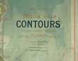
(Code No. 6651)
Bacon. G.
A Map of the British Isles Contours.
( Bacon's New Series of Physical Wall Atlases ).
Date. [c.1920].
London. G W. Bacon. [Size approx 38 1/4 x 30ins. Folding to 10 x 13ins] Folding linen backed sectional coloured wall map, showing Map of the British Isles Contours. Colour coded explanation in bold feature. Some slight marks. Also showing Trunk Railways and Roman Roads........£40.00
|
Click on picture above to view more images
How to order
|
|
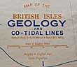
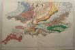
(Code No. 6650)
Bacon. G, A.
British Isles Geology, etc.
( Bacon's New Series of Physical Wall Atlases ).
Date. [c.1920].
London. G W, Bacon. [Size approx 38 1/4 x 30ins. Folding to 10 x 13ins] Folding linen backed sectional coloured wall map, showing Map of the British Isles and Co-Tidal Lines, Mesozoic, Palaeozoic Pre-Cambrian, Permian, Carboniferous, Etc. Colour coded explanation in bold feature. Some slight marks to surface........£60.00
|
Click on picture above to view more images
How to order
|
|
(Code No. 6647)
Directory of named UK members of the civil service, bankers, armed forces, MPs, charities, doctors, universities, etc between 17th to the 19th century.
Date. [c.1820].
London, 8vo, [4 x 6 1/4ins]. Pp. 284, lacks front index, fly leaves & title.
Listing: - thousand of names and occupations with some of their addresses. Original full calf, disbound....... £40.00
|
Click on picture above to view more images
How to order
|
|
(Code No. 6629)
Burnet, Gilbert.
The Memoirs of the Lives and Actions of James and William, Dukes of Hamilton and Castleherald.
Date. 1677.
London. Printed by J. Grover. Folio, [9 x 13ins]. Pp. [6], 436, [12], some pages marked, (water stained), + 3 Copper engraved portraits, James & William Hamilton and Charles 1st, split to one margin. Original full calf gilt, hinges split, just holding.
From Sir Richard Grosvenor's 1st Baronet (1585 – 1645), library at Eaton Hall with his bookplate.. Listing: - Letters to and from Charles 1st to the, Dukes of Hamilton and others in which an account is given of the rise and progress of the Civil War in Scotland with other great transactions both in England and Germany, from the year 1625, to the year 1652....... £155.00
|
Click on picture above to view more images
How to order
|
|
(Code no. 6617)
FADEN, william. Geographer to the King..
(Antique Map).
THE ROADS OF GREAT BRITAIN.
Date. May 10th 1790.
London, 8vo, [8 x 5 1/2ins]. Map size, [23 1/2 x 30ins] . . 20 Sectional hand-coloured in outline map, mounted on linen. Inset map of roads to north Scotland, marks. Scale 15 miles to the inch. With the original slipcase, splits to top edge and faded...
William Faden (1749 - 1836) was an English cartographer and a publisher of maps. He was the royal geographer to King George III. He replaced Thomas Jeffreys in that role. The title of "geographer to the king" was given to various people in the 18th century, including John Senex, Herman Moll, Emmanuel Bowen and Thomas Jeffreys. All of these men, including William Faden, were engravers and publishers, not scholars or academics. Their part was to publish and supply maps to the crown and parliament....... £110.00
|
Click on picture above to view more images
How to order
|
|
(Code No. 6585)Storer, James Sargant. 1771-1853.6 of 7 volumes only.Lacks Volume 6.The Antiquarian Itinerary, comprising specimens of Architecture, monastic, castellated, and domestic; with other vestiges of antiquity in Great Britain; accompanied with descriptions.Date. 1815-1818.London: Published for the proprietors, W. Clarke & others. 8vo, [5 x 8ins]. (Approx), 281 copper engraved prints with descriptive text of the antiquities in Great Britain, (image sizes approx, (3 1/2 x 2 1/2ins), marginal foxing. Original diced calf gilt, all covers disbound.James Storer was born in 1771, and devoted himself to the production of works on topography and ancient architecture, the plates in which he drew and engraved himself on a small scale. From 1814 James Storer worked wholly in conjunction with his eldest son Henry, whom he outlived. He was one of the artists employed on John Britton and Edward Wedlake Brayley's Beauties of England and Wales.SOLD AS A COLLECTION OF PRINTS ONLY......
|
SOLD.
|
|
(Code No. 6573)Jenner, Thomas.A DIRECTION FOR THE ENGLISH TRAVILLER . . .Date. 1643.London: Jenner, Thomas..16mo, [5 x 5ins]. Pp. 3 + 39 English county maps, including 2 larger folding maps of England and Wales. a few spots to the margins & marginal split just affecting one image (1mm).The maps are in inclined position and squeezed into the triangular space below the distance table. They show rivers, towns (with the names spelt in full) and some hills. A pair of dividers measures off the new scale of 10 miles (= 7 /16ins.). It is thought the maps were originally produced at the orders of Oliver Cromwell, for the use of the Parliamentary Army in the English Civil War. Sir H. G. Fordham, however, considered that they were produced simply as a commercial venture of Thomas Jenner to meet an emergency demand. Original half calf, leather loss to spine.........
|
SOLD.
|
|
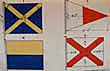
(Code No. 6514)
Mcgregor, Evan.
Signalman's Hand Book. for use in the Royal Navy.
Date. 1898.
[London], Admiralty. 12mo, [4 1/4 x 7ins]. Owner's book plate on front past down Pp. [9, including 4 Coloured Flags of Admirals & Flags of Different Nations], 79 + 20 Coloured lithographic Flags and Pendants by Wyman and Sons Ltd, very good condition.
Listing:- Admiral's flags, flags of different nations. flashing signals, flag waving, heliograph, telegraph, time codes, semaphore, gun signals, union flags, white ensign, with their measurements. Owner's book plate on front past down. Original cloth gilt, very good condition..... £120.00
|
Click on picture above to view more images
How to order
|
|
(Code No. 6500)
Higgs, Joseph.
A guide to justices; or modern English precedents, for the direction of justices of peace and their clerks, in making out warrants, mittimus's, recognizances, Supersedeas's, Affidavits, Informations, Inquisitions, Summon.......
Date. 1742, 2nd edition.
London, Printed by Henry Lintot. 12mo, [4 1/4 x 7ins]. Pp. [6], 344, [14 ]. Full title:- A guide to justices : or modern English precedents, for the direction of justices of peace and their clerks, in making out warrants, mittimus's, recognizances, Supersedeas's, Affidavits, Informations, Inquisitions, Summons, Precepts, Certificates for the Poor, and Warrants for their Removal, Bonds, &c. Not being in any Book Extant: Also necessary for all Deputy-Lieutenants, Commissioners of Sewers, &c. to assist them in the Execution of their several Offices.
Approv'd and published at the Request of his Majesty's Justices of the Peace for the County of Gloucester. The second edition corrected, with large additions. By Joseph Higgs, Gent. who has been Clerk to the Commission of the Peace, from the Reign of King Charles the Second to the present Time. Original full calf, rubbed and strained, hinges split. Holding firm.....£350.00
|
Click on picture above to view more images
How to order
|
|
(Code No. 6483)Cole and Roper.THE BRITISH ATLAS; COMPRISING A COMPLETE SET OF COUNTY MAPS, OF ENGLAND AND WALES . ... . AND PLANS OF CITIES AND PRINCIPAL TOWNS.Date. 1810.London. Vernor, Hood and Sharpe; Longman Hurst....and other. Folio,[11 x 15ins]. Pp. [2] + 58 Hand coloured County maps of England and Wales + 21 Town plans, Shrewsbury town plan not published. All maps and plans in excellent condition..This atlas is the large paper edition with the County maps fully coloured. Original cloth gilt, hinge splits to top and bottom of spine. Holding firm........
|
SOLD.
|
|
(Code No. 6481)
WICKES, Charles.
The Spires and Towers of the Medieval Churches of England.
Date. [c.1850].
London, John Weale Ackermann & Co. Page sizes, ( approx), [14 1/2 x 22ins]. 50 loose lithographic prints by Day & Sons, a few prints water stained and outer edge nicks, many duplicates. No covers or text. Sold as a collection of prints. Heavy item........ £90.00
|
Click on picture above to view more images
How to order
|
|
(Code No. 6456)Burnet, Gilbert.The Memoirs of the Lives and Actions of James and William, Dukes of Hamilton and Castleherald .....Date. 1677. London. Printed by J. Grover. Folio, [9 x 13ins]. Pp. [6], 436, [12] + 3 Copper engraved portraits, James & William Hamilton and Charles 1st, very good. Modern full calf gilt, very good condition. From Sir Robert Grosvenor (1695 -1755), library at Eaton Hall with his bookplate..Listing: - Letters to and from Charles 1st to the, Dukes of Hamilton and others in which an account is given of the rise and progress of the Civil War in Scotland with other great transactions both in England and Germany, from the year 1625, to the year 1652.......
|
SOLD.
|
|
(Code No.6451)
The Naval History of Great Britain : with the lives of the most illustrious Admirals and Commanders, from the reign of Queen Elizabeth.
Volume 3 only of 4.
Date. 1758.
London, printed for James Rivington and James Fletcher. 8vo, [7 x 5ins]. Copper engraved portrait frontis, pp. xi, 339 + Folding map of Africa by T. Kitchin, split into engraved area. Original quarter calf, split hinges with surface loss..... £60.00
|
Click on picture above to view more images
How to order
|
|
(Code No. 6425)Wyld, James, 1812-1887.(Antique Map).A Map of England, Wales, & Scotland describing all the Direct and principal Cross Roads in Great Britian, with the Distances measured between the Market Towns and from London. likewise the great rivers and navigable canals and railroads.Date. 1837.London, Published by James Wyld. 24 Seconal hand-coloured linen backed map. Includes inset of North Part of Scotland.. Page size [25 1/4 x 30ins]. Folding to [4 1/4 x 7 1/2ins].James Wyld was educated for the army at Woolwich, but soon decided to continue his father's pursuits. He acquired the map business of Faden, and in 1830 joined the Royal Geographical Society. In 1854 he had an establishment in Charing Cross East, the Royal Exchange, becoming the resort of public men, whom he kept supplied with maps of those countries whose affairs occupied the attention of the moment. ....
|
SOLD
|
|
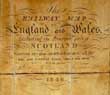
(Code No. 6423)
Anon.
(Antique Map).
The Railway Map of England and Wales including the Principal Part of Scotland, whereon are also carefully delineated all the Mail and Turnpike Roads, Direct & Cross with the various Alterations, Additions & Improvements up to the present time..
Date. 1846.
(London), Page size [25 1/2 x 32ins] folding to [5 x 8 1/4ins] in hard covers with printed title. Original 24 sectional linen backed coloured and glazed map, (as issued), brown marks and a few worm holes.....£150.00
|
Click on picture above to view more images
How to order
|
|
(Code No. 6419)Dix, Thomas.(Antique Map).A New Map of the County of LINCOLNSHIRE, Divided into Wapentakes, etc.Date. June 16th 1820.London, Published by William Darton. 8vo, [4 1/4 x 7ins]. Folding 12 sectional linen backed hand-coloured map of Lincolnshire, size [16 x 19 1/2ins]. With a vignette of Louth Steeple, etc from the S.E..Scale, (approx) 5 1/2 ins to the mile, split to one fold, no loss. Slip case with some surface loss......
|
SOLD
|
|
(Code No. 6407)
Leigh, Samuel & Sidney Hall.
Leigh's new road map of England, Wales and Scotland, drawn from the most recent surveys & engraved by Sidney Hall.
Date. [c.1838]
London : Leigh & Son, 421, Strand. 8vo, [7 x 5ins]. 21 x 2 Sectional maps size 30 x 20ins each. Contents: [southern part] + [northern part with inset map]: 1 map on 2 sheets :hand coloured, some splits to folds no loss. sheets in leather slipcase, some leather loss, poor. Scale [ca. 1:750 000]. British statute miles, 40[=85mm]...... £60.00
|
Click on picture above to view more images
How to order
|
|
(Code No. 6365)SPEED, John.(Antique Map).LINCOLNSHIRE, The countie and citie of Lyncolne described with the armes of them that have been Earles thereof since the conquest.Date. 1676.London, Bassett & Chiswell. Page size [24 x 20ins]. Image size [20 x 15 ins].... Original copper engraved coloured map, with two columns of arms + a plan of the city of Lincoln. Slight edge nick not affecting engraved image.With plain back .The following entry appeared in the Term Catalogue of 10 Feb. 1676."At the Shops of the said Thomas Basset and Richard Chiswell, theParticular Maps of . . . any Shire and County in the Kingdoms ofGreat Britain and Ireland, will be Sold by themselves, without theDescription, to such as desire them, each Map, 6d."
|
SOLD.
|
|
(Code No. 6320)
CAMDEN, THEOPHILUS..
The Imperial History of England from the Landing of Julius Caesar to the Commencement of the Reign of George the Third.
2 Volumes bound in one.
Date. 1809 - 11.
London. Stratford. Folio [10 x 15 ins]. Pp iv 556. 576, a few marginal wormholes not affecting text or images, and slight foxing. Two engraved frontis + Folding Map + 61 COPPER ENGRAVED PLATES. showing battles, royalty and various historical incidents etc. Half calf, marked and rubbed. Raised spine bands gilt, hinges split and rubbed. Holding firm. Heavy Book..... £110.00
|
Click on picture above to view more images
How to order
|
|
(Code No. 6321)
Read, Thomas.
Map of HERTFORDSHIRE + Text.
Dates. 1743-46.
London. Page size, [8 3/4 x 6 3/4ins]. Pp. 251-338 + Original Copper engraved folding map of Hertfordshire by Thomas Read.
The county maps with a topographical description were published alphabetically in weekly parts, 1743-46 by Thomas Read. Only 29 county maps in three volumes have been located up to the county of Shropshire. The fourth volume does not appear to have been traced. Volume four must have at some time been published because John Rocque was able to acquire the complete set of 52 plates in about 1750, updating some of the maps with an altered scale bar. The Read maps + text are very rare, the John Rocque reprint less so..... £100.00
|
Click on picture above to view more images
How to order
|
|
(Code No. 6294)J. PIGOT & CO. British Atlas: Countries of England, Comprising the Counties of England with Additional Maps of England and Wales, Ireland and Scotland and a circular one of the County round London....Date. 1837- 44.Manchester, L. Slater. Folio, [11 1/2 x 16ins]. Title + Pp 8 + 44 Tissue guarded hand-coloured steel engraved maps including 4 Large folding maps of England and Wales, Ireland and Scotland + A circular map of the County round London, light foxing to 4 maps, otherwise excellent condition. Each map decorated with a beautiful vignette engraving.Map Listing: - Topographical accounts, exhibiting the general statistics of each county; its ancient history, and modern localities, and divisions; commerce, manufactures, and population; tables of distances, etc. Original gilt decorated cloth, some rubbing and creasing.....
|
SOLD.
|
|
(Code No. 6292)
Picturesque Europe.
The British Isles.
( 2 Volumes).
Date. [c.1870].
London, Cassell, Peter and Galpin. 4to, [10 x13 ins]. Pp xii, 288, vii, 288 + 24 Steel engraved plates + Many wood engravings throughout, very good condition. Original full leather, gilt-tooled roll frame with large floral centrepiece, spine in six compartments with elaborate gilt-tooled devices. Gilt edges, rubbed & some surface leather loss. All holding firm. Heavy books. (Approx), 6.1kg...... £85.00
|
Click on picture above to view more images
How to order
|
|
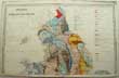
(Code No. 6272)
Geological map of England and Wales.
(Geological map in two parts, nos 62 & 63).
Date. [c.1870].
London, Size of the 2 parts, (approx), [20 x 26ins]. Original hand coloured engraved, north & south maps, 15 miles to 1in. Including a colour coded reference to the several Geological Groups, slight nick to outer edge not affecting engraved image.....£35.00
|
Click on picture above to view more images
How to order
|
|
(Code No. 6245)
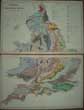
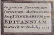
Stukeley, William (1687-1765). Cartographer.
(Antique Map).
In gratiam Itinerantium Curiosorum Antonini Aug. Itinerarium per Britanniam / tentavit . ( Roads of Roman Britain).
Date. 1723.
London, printed for the Author. Page size, [16 x 13 3/4ins]. Image soze, [10 3/4 x 9 3/4ins]. Original copper engraved map, slight foxing. Engraved by Herman Moll.
Showing :- A General map, through all the direct and principal cross-roads in England and Wales. Published in 'Itinerarium Curiosum. Or, an account of the antiquity and remarkable curiositys in nature or art ... By William Stukeley", Scale, 80 roman miles = 52.1 mm...... £70.00
|
Click on picture above to view more images
How to order
|
|
(Code No. 6244)BLAEU, WILLEM.Anglia Regnum.( Map of ENGLAND and WALES).No Date. Later reprint.Image size, 40cm x 31cm. Beautiful double-page hand-coloured engraved map, decorated with coats-of-arms and ships. In bottom left corner, "Apud Joh. et Cornel. Blaeu". In bottom right hand corner "Ediz. PV 33". Very good condition......
|
SOLD.
|
|
(Code No. 6197)
Bartholomew, John.
The Imperial Map of England & Wales According to the Ordnance Survey,
with the Latest Additions;shewing clearly every feature of the Country, Railways and their Stations, Roads, Canals, Rivers, Gentlemen's Seats, &c. &c.
Date. [c.1860].
London & Edinburgh. A. Fullarton & Co. Imperial Folio, [ 21 1/2 x !6ins ]. Hand coloured engraved 17 sectional maps of England & Wales. Showing Railways and their Stations, Roads, Canals, Rivers, Gentlemen's Seats etc. Scale of 4 ins to the Mile. Drawn and Engraved by John Bartholomew. Map size, (approx), 27 x 18ins. 3 Maps water stained to corners, nicks to blank margins throughout not affecting maps.. No Text or covers.......£90.00
|
Click on picture above to view more images
How to order
|
|
(Code No. 6173)
Bonney, T. G. [ed.]
Cathedrals, Abbeys & Churches of England and Wales.
(2 Volumes).
Date. 1891.
London, Cassell. Folio, [12 1/2 x 9ins] Pp. xxvi, vii 838 + 16 Full page plates + Text illustrations throughout, marginal foxing. Original gilt decorated cloth, rubbed...... £60.00
|
Click on picture above to view more images
How to order
|
|
(Code No. 6146)Weller, Edward.(28 Loose Antique County Maps).English County Maps. (Compiled from the Maps of the Board of Ordnance and other surveys).Date. [c.1875]. London, George Philip and Son. Page sizes [20 x 13ins]. 28 Original engraved county folding maps with hand-colour slight marginal nicks. Scale (approx), 1 inch to 2 miles. Showing railways and stations.English county maps listed :- 2 x Cumberland & Westmorland, (north & South) - Channel Islands - 2 x Lancashire, (north & South) -Huntingdonshire - Oxfordshire - Nottinghamshire - Northumberland - .Northamptonshire - Lincolnshire - Leicestershire & Rutlandshire - Cambridgeshire - 2 x Shropshire, (north & south) - Staffordshire - Suffolk - Sussex - Warwickshire - Hertfordshire - Northamptonshire - Orkney Islands & Shetland Islands - Derbyshire - 2 x Devonshire, (north & south) - Dorsetshire - Kent - Essex - Berkshire - Norfolk - Herefordshire - Cheshire. No Covers or Text.....
|
SOLD.
|
|
(Code No. 6145)
WEALE, John.
4 Volumes.
Quarterly Papers on Architecture.
Date. 1844-45.
London, John Weale, 4to, [12 x 9 1/2ins]. . Total of 241steel and lithographic engraved prints, including 81 hand coloured + 160 Uncoloured and tinted plates + a few text illustrations, some plates foxed. Describing and showing Church architecture throughout Europe, ground plans, coats of arms, stained glass windows, gargoyles, fonts, and fine views of the exterior and interior of English Churches, etc. Original full & half morocco gilt. Raised spine bands with elaborate gilt decoration, slight rubbing. Different gilt decorations for the two book covers dated 1845; the four volumes 1844-45 have the same gilt design on the spines. Gilt edges.
John Weale (1791-1862) was an English publisher of popular scientific, architectural, engineering and educational works....... £800.00
|
Click on picture above to view more images
How to order
|
|
(Code No. 6138)YOUNG, Arthur.Volume 2 of 4.A Six Months Tour Through the North of England. Containing, an Account of the Present State of Agriculture, Manufactures and Population, in Several Counties of this Kingdom.Date. 1770.London, Printed for W. Strahan, W. Nicoll..... 8vo, [ 5 1/2 x 8 1/4ins]. Pp. vi. 502 + 8 Copper engraved plates, some folding. Pp 187, slightly loss, very good condition.Listing: - Farm wages and sizes, accounts, animal husbandry, agricultural machinery, state of husbandry from Richmond to Massham, Massham to Craikhill, Craikhill to Danby, and new experiments being carried out on various farms. Original reverse calf, slight marks........
|
SOLD.
|
|
(Code No. 6124)
Hall, Mrs. S.C.
Pilgrimages to English Shrines.
Date. 1853.
London, Arthur Hall, Virtue & Co. 8vo, [9 x 7ins]. Pp. viii, 588, [16 adverts] + Text illustrations throughout by F.W. Fairholt. Quarter calf gilt. Gilt edges....... £65.00
|
Click on picture above to view more images
How to order
|
|
(Code No. 6103)WOODWARD, Horace B.Stanford's Geological Atlas of Great Britain,[Based on Reynold's Geological Atlas], with Plates of Characteristic Fossils....Date. 1904.London , Edward.Stanford. 8vo, [6 x 7 1/2ins]. Pp. Lacks title, x, 139 + 33 of 34 Coloured geological British double page county maps, lacks Monmouthshire, very good + 16 black & white plates of fossils, very good. some pages loose, (perished gutta-percha}. Original cloth gilt, slight rubbing and closed cloth hinge split.......
|
SOLD
|
|
(Code No. 6082)
THOMSON, John.
(Antique Map).
Remote British Islands.
Date. 1817.
Edinburgh, John Thomson. Page size, [21 1/8 x 28 1/2ins]. Original outline hand-coloured map engraved by H. R. Hewitt from The New General Atlas, slight closed fold split and outer marginal nicks not affecting image.
Showing:- Isles of Guernsey, Hern, Sark and Alderney, Isle of Jersey, Isles of Scilly, Isle of Man and Isle of Wight + 2 vignettes views of Eddystone Lighthouse and Freshwater...... £100.00
|
Click on picture above to view more images
How to order
|
|
(Code No. 6051)
Galloway, Robert.
2 Volumes, (complete).
Annals of Coal Mining and the Coal Trade.
Date. 1971. (1st series, up to 1835 & 2nd series, 1836-1850).
Devon, David & Charles. 8vo, Pp. 533, 409 + Illustrations throughout. Original cloth, gilt. Dust jacket, very good. This work has been universally accepted as one of the finest technical histories of any British industry and almost all later writers on coal mining has been indebted to it. ........£45.00
|
Click on picture above to view more images
How to order
|
|
(Code No. 6015)
Geographia.
Road Map of England and Wales.
(Antique Sectional Map).
Date. [c.1924].
London, Geographia Ltd..Size [49 x 41ins]. Folding to [7 1/4 x 10ins]. 30-section folding linen-backed map with 23 insets of major cities around edges, slight marks. Scale, (approx 10 miles to the inch). Cloth covers, slight marks...... £50.00
|
Click on picture above to view more images
How to order
|
|
(Code No. 5994)
Hume - Smollett.
The History of England with a continuation to the year 1872.....
4 Volumes bound up into the, (ending 1862,)
10 of 12 Divisions .
Date. [c.1870].
London, James Virtue. 4to, [7 1/2 x 11ins]. Pp. (approx) 170 per division + 16 World maps + 26 misc prints + 70 Portraits + 27 Views + Engraved titles. Total:- (approx), 139 Steel engraved plates. Original gilt decorated cloth, faded spines and one volume chipped. Top edges gilt. All volumes holding firm. Heavy Item...... £90.00
|
Click on picture above to view more images
How to order
|
|
(Code No. 5988)
Ordnance Survey Atlas of England & Wales.
Date. 1922.
Southampton. Ordnance Survey Office. 4to, [ 8 1/2 x 14 ins.] Title page (as above) + (v index map) + Scales (v. blank) + 24 Double page linen backed coloured maps, neat ink marginal annotations & one map stained. Quarter inch to the mile. Map image size 28 x 10 ins, vg + pp. 1-21 index. Original quarter morocco gilt, faded & marked...... £60.00
|
Click on picture above to view more images
How to order
|
|
(Code No. 5978)
The Universal Magazine of Knowledge and Pleasure . and other Arts and Sciences .....
Volume. 88.
Date. January to June 1791.
London, Published under His Majesty's Royal Licence, by W. Bent, 8vo, [5 1/4 x 9ins].. Pp. 480 + Engraved frontis + 12 Copper engraved prints, lacks one plate, (publishing/binding error) + 4 English county copper engraved maps, (Bedfordshire, Berkshire, Buckinghamshire, Cambridgeshire by B. Baker)..
Listing: - Speeches by Benjamin Franklin & George Washington, Daily weather conditions, Fire engine design, The Theatre and plays, World politics, Births, Marriages and Deaths etc. Original quarter calf gilt, lacks part of spine leather. Holding firm........ £110.00
|
Click on picture above to view more images
How to order
|
|
(Code No. 5917)
Geological map of England and Wales.
(Geological map of North England sheet, no.99.)
Date. [c.1870].
London. Page size, (approx), [20 3/4 x 13 1/2ins]. Original hand coloured engraved map, Scale 15 miles to the 1in. Including a colour coded reference to the several Geological Groups, slight nicks to outer edges, no loss....... £25.00
|
Click on picture above to view more images
How to order
|
|
(Code no. 5916)
Geological map of England and Wales.
(Geological map in two parts, nos 62 & 63.)
Date. [c.1870].
London, Size of the 2 parts, (approx), [20 x 26ins]. Original hand coloured engraved, north & south maps, 15 miles to 1in. Including a colour coded reference to the several Geological Groups, slight nick to outer edge not affecting engraved image...... £35.00
|
Click on picture above to view more images
How to order
|
|
(Code No. 5880)Tales of Highwaymen; or, Life on the Road.(17 Numbered Weekly Penny Dreadfuls, including, The True History of John Ketch).Date. Oct 1865 to Feb 1866. London, 4to, Number 40 - Vol.1 to Number 57 - Vol 1. Pp. 323 to 450 Illustrations throughout + pp. (314 to 456 True History of John Ketch), ink marks. Soft covers with printed title panel, frayed edges & marks. Penny dreadful (also called penny horrible, penny awful, penny number and penny blood), was a type of British fiction publication in the 19th century that usually featured lurid serial stories appearing in parts over a number of weeks, each part costing an (old) penny. The term, however, soon came to encompass a variety of publications that featured cheap sensational fiction, such as story papers and booklet "libraries". The penny dreadfuls were printed on cheap pulp paper and were aimed primarily at working class adolescents......
|
SOLD.
|
|
(Code No. 5864)Ordnance Survey Atlas of England & Wales.Date. 1922.Southampton. Ordnance Survey Office. No Date, 4to, [ 8 1/2 x 14 ins.] Errata (v. blank) + Title page (as above) + (v index map) + Scales (v. blank) + 24 Double page linen backed coloured maps, very fine condition. Quarter inch to the mile. Map image size 28 x 10 ins, vg + pp. 1-21 index. Original gilt decorated cloth, slight split to cloth......
|
SOLD.
|
|
(Code No. 5825)Bawden, T. A, L. S. Garrad, J.K. Qualtrough and J.W. Scatchard.The Industrial Archaeology of the Isle of Man.Date. 1972.Newton Abbott, David & Charles. 8vo,. Pp. 266 + Illustrations throughout, very good condition. Original cloth gilt. Dust jacket, fine condition.
|
SOLD.
|
|
(Code No. 5821)Buck, Samuel & Nathaniel.The Castles, Abbeys, and Priories, of The County of CUMBERLAND.Including the City of Carlisle, delineated as they stood in 1739.Date. 1837, 3rd edition .Carlisle, Hudson Scott. Oblong folio, [17 1/2 x 11ins]. Title, Preface and List of plates, damaged with crude tape + 18 Copper engraved view prints, (as listed), each with descriptive text, slight marginal foxing. The loose panorama of the City of Carlisle, page size [33 x 12 1/2ins], split to fold, repaired.The brothers, Samuel and Nathaniel Buck made a series of etched panoramas and views of British towns, castles and abbeys. These engravings describe the history of the castles from Norman times and the numerous changes of ownership. Original printed boards, surface loss. The publishers used the original Buck copper plates for this work......
|
SOLD.
|
|
(Code No. 5801)
Howard, Joseph Jackson; Frederick. Arthur Crisp.
Visitation of England and Wales.
Volume 2.
Family pedigrees.
Date. 1894.
Privately Printed. 4to, [8 1/2 x 11 1/2ins.] No. 393 of 500 limited copies. Pp [4], 193, [vi, additions.] + Black & white & coloured plates throughout. Listing:- Named family pedigrees, their signatures, coats of arms, engraved portraits and silhouettes, etc. Original quarter velum styled gilt, poor, holding firm. Top edges gilt other edges untrimmed........ £60.00
|
Click on picture above to view more images
How to order
|
|
(Code No. 5795)
Out of Place & Unpensioned and Grey Peas & Bacon.
( 2 Antique Satirical Mezzotint Prints).
Date. [c.1769].
London, Printed for Carrington & Bowles.. Image size [4 1/2 x 6ins.] 2 Original engraved mezzotint prints, slight marginal marks, not affecting image.
The first image shows three persons examining their "Grey Peas & Bacon" meal. The other print depicts an elderly gent contemplating his future, "Out of Place & Unpensioned".
London mezzotint print satires or drolls flourished between 1760 and 1800. Ref - Yale Centre for British Art....... £50.00
|
Click on picture above to view more images
How to order
|
|
(Code No. 5794)
The Depth of ye Jug Discovered.
( 2 Antique Mezzotint Satirical Print).
(The 2 images are in reverse to one another).
Date. [c.1769]
London, Printed for Ryland & Bryer. Image size [4 1/2 x 6ins.] 2 Original mezzotint engraved prints, (one image in the reverse), of "The Depth of ye Jug Discovered". Showing the three Gentlemen examining an empty beer jug, possibly the one seated being tricked in some way.
London mezzotint print satires or drolls flourished between 1760 and 1800. Ref - Yale Centre for British Art...... £60.00
|
Click on picture above to view more images
How to order
|
|
(Code No. 5773)CALEY, John ; William ILLINGWORTH, Barrister-at-Law.Testa De Nevill Sive Liber Feodorum in Curia Scaccarii. Temp. Hen. III. & Edw. I.Date. 1807.London, Printed by G. Eyre and A. Strahan. folio, Pp. 599. (Latin Text).Original marbled boards, boards detached. Printed by command of His Majesty King George III. in pursuance of an address of the House of commons of Great Britain.Ralph de Nevill was an accountant in the Exchequer and Collector of Aids in the Reign of Henry III. The Liber Feodorum is not as informative as was the Domesday Book, the information contained is mainly lists of English County hundreds for the use of landholders.......
|
SOLD.
|
|
(Code No. 5757)
St. James's day.
(Antique Print).
Date. 24th May 1797.
Published in London by L. Evans.... Image size [9 x 7ins].. Original etched print, damage to bottom right corner.
An oyster-stall: two tubs filled with oysters are on a table (left), a man (seated) and a young woman open oysters. A barber kneels upon a wig-box to eat oysters; a small boy picks his pocket of a comb. A man stands behind, stiffly expectant. A woman walks off to the right carrying a plate of oysters and a small covered pot to an eager cobbler in his stall. A knock-kneed sweep (right) inspects an oyster in his hand. On the ground (left) is an empty tub and a mound of oyster-shells. Behind are roofs and spires. ...... £45.00
|
Click on picture above to view more images
How to order
|
|
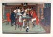
(Code No. 5756)
Evans, J.
(Antique Print).
The Soldier Return'd.
Date. May 19th 1796.
Published in London, Evans, J. Image size, (approx), [9 1/4 x 7ins]. Original etched with stipple print, slight creasing & marks.
A social satire; a soldier in uniform stands lost in an account of his experiences, spilling his drink and unwittingly hitting a gentleman, seated at a table to his right, on the head, who drops his pipe and knocks his glass over; another man with a stick, two others seated, one with glasses, listen enthralled, as does a serving maid, who leans on the back of a chair; below the image is a rhyme: "Fought all his Battles o'er again; And thrice he slew the Slain!!",.......£65.00
|
Click on picture above to view more images
How to order
|
|
(Code No. 5737)Rolt, L T C.Brunel, Isambard Kingdom, a Biography:Date. 1957.London, New York, Longmans, Green and Co. 8vo, [6 x 9ins]. Pp. xiv, [1] , 345 + Illustrations throughout, very good. Original cloth gilt, Dustjacket, very good.Isambard Kingdom Brunel, FRS (1806 – 1859), was an English civil engineer who built bridges and dockyards including the construction of the first major British railway, the Great Western Railway; a series of steamships, including the first propeller-driven transatlantic steamship; and numerous important bridges and tunnels. His designs revolutionised public transport and modern engineering.....
|
SOLD.
|
|
(Code No. 5721)
Millard, J.. Editor from 1814-1830.
TIMES TELESCOPE year 1821;
or, A Guide to the Almanack: containing an Explanation.... Holidays.... British History, Antiquities, Notices of Obsolete Rites, Customs....... Astronomical Occurrences and Naturalist's Diary......
Date. 1821. (Published annually).
London. Sherwood Neely & Jones...8vo, [5 x 7 3/4ins]. . Pp. lxxxviii 319, [12, adverts], very good condition. Edges untrimmed. Original printed boards, some surface loss.
John Millard was assistant librarian for the Surrey Institution........ £50.00
|
Click on picture above to view more images
How to order
|
|
(Code No. 5722)
Millard, J.. Editor from 1814-1830.
TIMES TELESCOPE for the year 1822;
or, A Guide to the Almanac: containing... British History.....Sketches of Comparative Conchology....and the Naturalist's Diary.
Date. 1822. (Published annually).
London. Sherwood Neely & Jones...8vo, [5 x 7 3/4ins]. Pp. lxiii 319, [1, adverts], lacks frontis? . Edges untrimmed. Original printed boards, some surface loss.
John Millard was assistant librarian for the Surrey Institution...... £50.00
|
Click on picture above to view more images
How to order
|
|
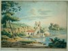
(Code No. 5707)
Ninham, Henry.
(Antique Print).
Norwich Cathedral from Cowgate Street. St Edmunds, near the New Yard Factory.
Date. [c.1830]
Norwich & London, Charles Muskett. Page size [13 x 10ins]. Image size [9 1/2 x 6 1/2ins]. Original lithographic engraved print, slight marks & nick to outer blank margin, neither affecting the engraved area...... £60.00
|
Click on picture above to view more images
How to order
|
|
(Code No. 5686)
Thomas Wright.
The Ruins of the Roman City of Uriconium, at Wroxeter, near Shrewsbury.
(Signed and dedicated by the author).
Date. 1863, 4th edn.
Shrewsbury, J. O. Sandford. 12mo, [4 1/4 x 6 1/2ins]. Pp. iv, 101, [3 adverts] + 16 Lithographic full page prints. Original boards with printed title label.
Uriconium was a Roman town, one corner of which is now occupied by the small village of Wroxeter in the English county of Shropshire. At its peak, Viroconium is estimated to have been the fourth largest Roman settlement in Britain, a civitas capital with a population of more than 15,000 people. Probably lasted until the beginning of the eight century....... £50.00
|
Click on picture above to view more images
How to order
|
|
(Code No. 5684)
TILLOTSON, John, Miscellaneous Writer.
The New Waverley Album.
Illustrated with numerous engravings on steel, after designs by C. Stanfield, D. Roberts, W. Daniell, C. Fielding, G. Cattermole, S. Prout, S. Austin, etc. The text by J. Tillotson.
Date. [c.1859.]
London, Edinburgh, Darton & Co. 8vo, [8 x 10ins]. Pp. 64 + 25 steel engraved view prints. Original gilt-decorated cloth, slight rubbing and fading. All edges gilt..... £50.00
|
Click on picture above to view more images
How to order
|
|
(Code No. 5595)
Cromwell, Thomas.
History of Colchester.
2 Volumes.
Date. 1825 1st edn.
London. Jennings, 8vo [10 1/4 x 6 1/2ins.] Pp. x, 472, vg. 29 steel engraved plates including views, maps, plans etc. Half calf gilt with marbled boards and end papers.Top edge gilt, some rubbing, and leather loss. holding firm..... £110.00
|
Click on picture above to view more images
How to order
|
|
(Code No. 5587)Wilson, C. W.(4 Ordnance Survey Maps + Slipcase.)Date. [c.1901].Ordnance Survey of Birmingham, Hull, Doncaster, Leicester and Lincoln and their environs. Engraved at the Ordnance Survey Office, Southampton under the direction and revision of J. Farquharson. Folio slipcase, folding to [18 1/2 x 12 1/2ins]. 4 Sectional linen backed steel engraved maps, (Birmingham hand coloured). Piano key border. Scale 1 inch to 1 mile. Sizes, 2 maps, 39 x 36 1/2 ins, others 36 1/2 x 27 ins and 39 x 55 ins. Listing the Parishes, parks, railways, roads, boundaries, marches etc. Original morocco slipcase, rubbed with slight surface loss.....
|
SOLD.
|
|
(Code No. 5553)The English Liturgy from the Book of Common Prayer with Additional Collects, Epistles, and Gospels.Date. 1920.London: Rivingtons, 4to, [9 1/2 x 12ins]. Pp. xv, 327, marginal marks to some leaves. "Printed by T. and A. Constable Ltd. at Edinburgh, in the year of our lord 1920, with designs and initial letters by Laurence Housman. The music by G.H. Palmer, the pointing W. H. Frere. The additional services by the editors, Percy Dearmer, Bishop W. H. Frere and S.M. Taylor, under the sanctions of the Lord Bishop of Winchester. A.M.D.G". Original full morocco gilt. Raised spine bands, some marks. All edges gilt.....
|
SOLD.
|
|
(Code No. 5550)Knight, Charles, (1791-1873).Old England, a Pictorial Museum of Regal, Ecclesiastical, Municipal, Baronial, and Popular Antiquities.2 Volumes bound up in 1.Date, [c.1850.]London. James Sangster & Co. Folio, [10 1/2 x 14 ins.] Pp 392 & 404, some slight foxing + 42 chromolithographic plates ( using wood and metal relief blocks), marginal foxing + Hundreds of wood engravings. Original half morocco gilt, slight rubbing. All edges gilt.Charles Knight's colour printed plate books were the first ever published for the mass market. The number of coloured plates for this work varies between 24 and 42 depending on the edition.
|
SOLD.
|
|
(Code No. 5512)
Hume - Smollett -Tobias - Farr - Nolan.
The History of England with a continuation to the year 1859.....
3 Volumes bound up into the original 16 Divisions, (complete).
Date. [c.1870].
London, James Virtue. 4to, [7 1/2 x 11ins]. Pp. (approx) 170 per volume + 16 World maps + 12 Battle scenes + 64 Portraits + 29 Views + 3 Engraved titles. Total:- (approx), 129 Steel engraved plates + 3 Steel engraved titles. Original cloth gilt, faded and chipped. All edges gilt. All volumes holding firm. Heavy Item.... £90.00
|
Click on picture above to view more images
How to order |
|
(Code No. 5489)Jones.Jones Views of the Seats, Mansions, Castles, &c of Noblemen and Gentlemen in England, Wales, Scotland and Ireland, and other Picturesque Scenery.Northern Counties in their 5 original parts.Date. 1st June 1829, 1st edn.London, Jones and Co. 4to, [9 x 11 1/4ins.] . 80 Steel engraved plates with descriptive text + Engraved title + 5 Engraved printed soft covers, frayed edges and one split, repaired...
|
SOLD.
|
|
(Code No. 5488)Original copper printing plate.Date. [c.1840.]Hull, Bradley & Co's. Plate size [9 x 11 1/2ins.] Original copper printing plate, engraved on both sides. Bradley & Co's Whips from their Manufactory, Hull, Makers to the Emperor & Imperial Family of all the Russias, and on the other side a map of the County, forty miles round Hull by Richard Johnson, Hull + 2 Engravings, on modern paper, taken from this copper printing plate.In pure etching, a metal (usually copper, zinc or steel) plate is covered with a waxy ground which is resistant to acid. The artist then scratches off the ground with a pointed etching needle where he wants a line to appear in the finished piece, so exposing the bare metal. A tool with a slanted oval section is also used for swelling lines. The acid bites into the metal, where it is exposed, leaving behind lines sunk into the plate. The remaining ground is then cleaned off the plate. The plate is inked all over, and then the ink wiped off the surface, leaving only the ink in the etched lines. The plate is then put through a high-pressure printing press together with a sheet of paper, often moistened to soften it. The paper picks up the ink from the etched lines, making a print. The process can be repeated many times; typically several hundred impressions (copies) could be printed before the plate shows much sign of wear. The work on the plate can also be added to by repeating the whole process; this creates an etching which exists in more than one state. A very rare item....
|
SOLD.
|
|
(Code No. 5485)RUDING, Rogers. (1751-1820),4 Volumes, (complete) Annals of the Coinage of Britain and its Dependencies, from the earliest period of authentick history to the end of the fiftieth year of the reign of his present Majesty King George III.Date. 1817, 1st edn.London, Nichols, son, and Bentley. 4to, [9 x 11 1/4ins.] Pp. xxxvi, 518. 532. xxxvi, 542 + Plate volume, includes, Map + Plan + 2 Folding tables + 113 Copper engraved plates of British coins, slight foxing throughout. Original full calf gilt. Raised spine bands with gilt decorated panels, some slight leather loss and split to hinges. All volumes holding firm.Rogers Ruding proposed the restoring the ancient constitution of the Mint, as far as it relates to the expense of coinage, together with a plan for the improvement of money, and for increasing the difficulties of counterfeiting. This first edition was sold off in six months....
|
SOLD.
|
|
(Code No. 5470)
Smith, George Barnett.
Illustrated British Ballads, Old and New.
2 Volumes bound up in 1.
Date. 1886.
London, Cassell, & Company, Ltd. 4to, [8 x 10 1/2ins]. Pp. viii, 384. xvi, 384. Illustrated throughout. Original half calf gilt. Raised spine bands gilt, rubbed & chipping to bottom of spine. Marbled fore-edges & end papers..... £75.00
|
Click on picture above to view more images
How to order |
|
(Code No. 5428)Rowlandson, Thomas, 1756-1827.The Guards and Lessons of the Highland Broadsword, under the direction of ... H. Angelo and Son.Date. Jan 20th, 1799.London, Mr. Angelo, Berkley Square. Page size [21 x 16 1/2ins]. Image sizes [12 1/2 x 10ins] to [13 1/2 x 11 1/2ins] 6 Original etched plates, including title, with engraved aquatint borders designed and etched by T. Rowlandson.Written by or for soldiers in the British Army, particularly the famous Highland Regiments. In 1799, Henry Angelo (son of the great smallsword fencer Domenico Angelo) published these posters intended as a training broadsword manual for the English soldier's set play sequences. No covers, loose as published....
|
SOLD.
|
|
(Code No. 5426)MORDEN, Robert.(Antique Map).ENGLAND.Date. 1695.London:Abel Swale & John Churchill. Page size 17 x 15 ins. image size 16 3/4 x 14 1/2ins. Original copper engraved map with later colouring, creases, split, repaired on back of map & laid on to modern paper.Robert Morden (c.1650-1703) was a British bookseller, publisher, and maker of maps and globes. He was among the first successful commercial map makers. Between about 1675 and his death in 1703, he was based under the sign of the Atlas at premises in Cornhill and New Cheapside, London. His cartographical output was large and varied. His best known maps are those of English counties first published in a new edition of Camden's "Britannia" in 1695, and subsequently reissued in 1722, 1753 and 1772. These maps were based on new information from gentlemen of each county, and were newly engraved. Each had a decorated cartouche, and showed numerous place names . Morden also produced in 1701 a series of smaller county maps often known as Miniature Mordens...
|
SOLD.
|
|
(Code No. 5420)Nutter, M.E.(Antique Print).The Viaduct over the River Eden at Wetheral, (Cumbria).Date. 1835.Carlisle, Charles.Thurnam. Image size. [8 1/2 x 11ins] Hand coloured lithograph taken from a drawing by M. Nutter and printed by Day & Haghe.The Wetheral Viaduct, was designed by the Railway's Chief Engineer, Francis Giles, and was built by W.S. Denton for the Newcastle and Carlisle Railway company. between 1830 and 1834. Rare print...
|
SOLD.
|
|
(Code No. 5419)Cary, John.Cary’s New Itinerary: or, an accurate delineation of the Great Roads, both direct and cross, throughout England and Wales ... by John Cary, etc.Date. edn.1802, 2ndLondon, Printed for John Cary. 8vo, [5 1/2 x 7 1/2ins].", etc, split to fold, no loss, pp.1- 796 + With an additional map, "A New Map of the Cross Roads", etc pp.797- 868, (2) adverts. Original trade boards, split to front hinge, holding firm...
|
SOLD.
|
|
(Code No. 5402)
Smiles, Samuel.
The Story of the Life of George Stephenson, railway engineer.
Date. 1859.
London, John Murray, 8vo, [5 x 7 1/2ins.] Pp. xii, 356pp, [32, adverts], very good + Engraved text illustrations throughout. Original cloth gilt, very good condition.
George Stephenson, ( 1781 – 1848), was an English civil engineer and mechanical engineer who built the first public railway line in the world to use steam locomotives, and he is renowned as being the "Father of Railways". The Victorians considered him a great example of diligent application and thirst for improvement, with self-help advocate Samuel Smiles particularly praising his achievements. His rail gauge of 4 feet 8½ inches (1,435 mm), sometimes called "Stephenson gauge", is the world's standard gauge... £45.00.
|
Click on picture above to view more images
How to order |
|
(Code No. 5334)
Great Western Railway.
Railway Map 1910.
( Sessions 1910.)
Date. 1910
London, T. Kell & Co. 4to, [11 1/4 x 7 1/2ins.]. Linen backed map, dissected into 32 sections. Size, 60 x 46ins folding to 11 1/4 x 7 1/2ins. Including 2 inset panels, Great Western Railway, Map of London and its Environs & Great Western Railway sessions 1910, Plans of which were deposited, November 1909. Scale 6 Miles to the Inch. Some slight splits to linen sections. Morocco covers, with title panel, chipped to the edges.
The Great Western Railway (G.W.R.) was initially launched in the early 1830's to build a line from London (Paddington) to Bristol (Temple Meads). This was followed by lines to Bath, Windsor, Basingstoke, Hungerford, Oxford and Gloucester. Eventually the empire spread to much of the South West of England, and most of Wales. £60.00
|
Click on picture above to view more images
How to order |
|
(Code No. 5327)
BRITTON, John 1771-1857.
5 Volumes.
The Architectural Antiquities of Great Britain, Represented and Illustrated in a Series of Views, Elevations, Plans, Sections, and Details of Various Ancient English Edifices .
Date. 1806-35.
London, Longman, Hurst, Rees & Orme.... 4to, [9 x 11 1/2ins.] Pp. 113 [1],126 [1], 102 [1], 172 [7], 223 lxiv + 6 Engraved titles + 5 Additional titles + 358 Beautiful full page steel engraved plated, (as listed), slight foxing, good condition. Original half morocco gilt, rubbed. Raised spine bands with gilt-tooled decorated panels, rubbed with slight split to one hinge. All edges gilt and all volumes holding firm.
Britton's Architectural Antiquities of Great Britain represented and illustrated in a series of views, elevations, plans, sections, and details of various ancient English edifices, with historical and descriptive accounts of each. The artistic excellence of the illustrations secured success for what is pronounced to be the most beautiful work of its kind up to this date. It cost eight thousand pounds to publish, in which Britton held a third share. £800.00
|
Click on picture above to view more images
How to order |
|
(Code No. 5322)
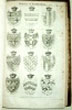
Debrett's Illustrated Peerage and Baronetage, Knightage, and House of Commons...
London, Dean & Sons. 8vo, [5 x 7ins.]
Date 1866.
Pp. 15, [1] 598, 65 + Illustrated Coats of Alms throughout, with their appropriate names, relations and location, etc. Original cloth gilt, chipping and marks. £55.00
|
Click on picture above to view more images
How to order |
|
(Code No. 5318)
BLACKNER, John.
THE HISTORY OF NOTTINGHAM, Embracing its Antiquities, Trade and Manufactures, from the Earliest Authentic Records to the Present Period.
Date. 1815.
Nottingham, Sutton and Son. 4to, [9 x 10 1/2 ins.] Pp. 459, [1] errata, slight foxing spots + Engraved aquatint print of a view of Nottingham + 7 Copper engraved prints + 2 Extra loose copper engraved prints, ( Road map of the Fosseway & Town plan of Leicester, [c.1750] ). Original half calf, lacks part of spine leather. £150.00
|
Click on picture above to view more images
How to order
|
|
(Code No. 5301)
Green, John Richard, (1837-1883).
4 Volumes, (complete.)
Short History of the English People.
Date. 1892 - 94.
London, MacMillan. 4to, [7 x 10ins.] . Pp. cvi,1906, [4 corrections] + 24 Chromolithographic, (printed colour), prints, some heightened in gold + Full page and text illustrations throughout, slight foxing. Original half morocco gilt with raised spine bands gilt. £130.00
|
Click on picture above to view more images
How to order
|
|
(Code No. 5281)Ingram, James.Memorials of Oxford.Date. [c.1837.]London, Henry Parker. 8vo, [6 x 9ins.] 26 Original parts bound up into 1 volume, dedication on title page. + 63 Steel engraved Oxford view plates, slight foxing. 20 (Approximate) printed pages per part. Listing - 10 Churches, 2 Libraries, 13 Colleges, (Brasenose, Corpus Christi, Exeter, Magdalene, University, Balliol, Merton, Oriel, Queens, Lincoln and New College), etc. Original cloth gilt, chipping to top and bottom of spine.
|
SOLD.
|
|
(Code No. 5274)
RICHARDSON, Mervyn. Captain.
Fourteen Years' Experience of Cold Water: Its Uses and Abuses.
Date. 1857
London, Longman, Brown, Green....8vo, [8 x 5ins]. . Pp. xiv [2] 175, [1] + Engraved frontis + Engraved plate, some pages unopened + Advert on rear past down. Original Cloth gilt.
The fame of the water-cure treatment grew, clinics were opened at Malvern and other places. Famous patients included Charles Darwin, Charles Dickens, Thomas Carlyle, Florence Nightingale, Lord Tennyson and Samuel Wilberforce. With the fame also attracted criticism: Sir Charles Hastings, a physician and founder of the British Medical Association, was a forthright critic of hydropathy. Patients at Malvern were woken at 5 am, undressed and wrapped in wet sheets then covered with blankets. An hour later, buckets of water were thrown upon the patients who then went on a five mile walk, carrying an alpenstock and a Gräfenberg flask of mineral water, stopping at wells for the waters. They returned to the Malvern pump room for a breakfast of dry biscuits and water. They then had the day to spend bathing in a range of kinds of baths, or in some cases wore a wet sheet called the "Neptune Girdle" round their middle at all times, removing it only at meal times. Dinner which was always boiled mutton and fish was followed by a few hours in a dry bed. The exercise, plain food and absence of alcohol together with the congenial company of other wealthy patrons proved generally beneficial. £150.00
|
Click on picture above to view more images
How to order
|
|
(Code No. 5263)Badeslade, T & W, H, Toms.( Antique Map.)a Map of the principal cross Roads from one great town, to another; thro' England and Wales.Date. 1741.London. W, H, Toms. Page size [6 1/2 x 7 1/4ins.] A copper engraved road map. Compass rose indicator. Left side showing a list of the distances of the principal cities and towns from each other. Title panel on base borderline and page number above top line. From the Atlas - "Chorographia Britanniae"
|
SOLD.
|
|
(Code No. 5250)
HENRY, Matthew, Nonconformist Minister.
4 Volumes bound up in 3, (complete.)
An Exposition on the Old and New Testament, wherein each Chapter is summed up in its Contents; The Sacred Text Inserted at Large in Distinct Paragraphs: ...(The Life of ... M. Henry, with anecdotes of his family, etc.).
Date. [c.1793.]
London, Printed by W. & J. Stratford. Folio, 11 x 17ins. Pp. Not paginated, double columns, including portrait frontispiece + 92 Full page copper engraved plates. Original reverse calf gilt with blind stamped roll frame, raised spine bands, splits to hinge leather with some leather loss. Holding firm.
Matthew Henry was born in the chapelry of Iscoyd, Flintshire, [Wales]. on October 18th, 1662 and was primarily home-educated by his father, Rev. Philip Henry, and also at the Thomas Doolittle academy from 1680-1682. Henry's reputation rests upon his renowned commentary. An Exposition of the Old and New Testaments (1708-10, known also as Matthew Henry’s Commentary on the Whole Bible). He lived to complete it only as far as to the end of the Acts. This work was long celebrated as the best of English commentaries for devotional purposes. Heavy Books. £280.00
|
Click on picture above to view more images
How to order
|
|
(Code No. 5246)
Phillips, J. & W. Hutchings.
A Map of the County of Stafford divided into Hundreds & Parishes from an Accurate Survey made in the Year 1831 and 1832.
Date.1831-1832.
London, Henry Teesdale. Size: 54 x 39 1/2ins folding to 10 x 5 1/2ins. A 40 sectional linen backed hand-coloured map, very good condition. Showing compass rose + 19 line colour coded "Explanation" + 10 Line colour coded "Notes" (polling places, boundary divisions, etc + Scale: one inch = one and one third miles + Large vignette of "South East view of Lichfield Cathedral". Original full leather slip case, gilt-tooled roll frame. Spine in seven compartments with elaborate gilt-tooling, slight rubbing. Marbled edges. £700.00
|
Click on picture above to view more images
How to order
|
|
(Code No. 5222)George Perry ,1718 - 1771; and Thomas Smith of Derby.(British designers.)South West Prospect of Coalbrook-Dale, and the Adjacent Country. (Shropshire, UK.)Date.1758. London, Published by G. Perry. Image size, (approx), [18 1/2 x 15ins.] Original copper engraved print, with all faults, In 1709, Abraham Darby I rebuilt Coalbrookdale Furnace, and used coke as his fuel. His business was that of an ironfounder, making cast iron pots and other goods, an activity in which he was particularly successful because of his patented foundry method, which enabled him to produce cheaper pots than his rivals. Coalbrookdale has been claimed as the home of the world's first coke-fired blast furnace; this is not strictly correct, but it was the first in Europe to operate successfully for more than a few years
In 1768, the Company began to produce the first cast iron rails for railways. In 1778, Abraham Darby III undertook the building of the world's first cast iron bridge, the iconic Iron Bridge, opened in 1780. The fame of this bridge leads many people today to associate the iron-making part of the Industrial Revolution with the neighbouring village of Ironbridge, but in fact most of the work was done at Coalbrookdale. Very rare print.
|
SOLD.
|
|
(Code No. 5204)
Dugdale. Thomas.
England and Wales Delineated.
6 volumes in 1 volume.
Date. [c.1840].
London, J. Tallis. 8vo, [6 1/2 x 9 1/2 ins]. 6 Engraved vignette title pages + 108 STEEL ENGRAVED VIEW PLATES, some slight foxing & marks. No text, as published. Half morocco gilt, slight rubbing and minor damage to bottom of spine. Views shown - Approx 56 views of South East of England and approx 26 views of the Midlands. £110.00
|
Click on picture above to view more images
How to order
|
|
(Code No. 5198)
MORDEN. ROBERT & William Camden.
Comitatus Rotelandiae Tabula Nova & Aucta.
(Antique map of the County of Rutland).
Date. 1722 2nd edn.
London. Abel, Wale, Awnsham and John Churchill. Map page size, 18 1/4 x 14 1/4 ins. Image size, 14 1/2 x 11 1/4 ins, (approx). Original copper engraved folding county map by Robert Morden, very good. £50.00
|
Click on picture above to view more images
How to order
|
|
(Code No. 5197)George Perry ,1718 - 1771; and Thomas Smith of Derby.(British designers.)A View of the Upper Works at Coalbrook Dale in the County of Salop, (Shropshire, UK.)Date. [c.1758].London, Published by G. Perry. Image size, (approx), [18 1/2 x 15ins.] Original copper engraved print, with all faults, by François Vivares (engraver), British, 1709 - 1780.In 1709, Abraham Darby I rebuilt Coalbrookdale Furnace, and used coke as his fuel. His business was that of an ironfounder, making cast iron pots and other goods, an activity in which he was particularly successful because of his patented foundry method, which enabled him to produce cheaper pots than his rivals. Coalbrookdale has been claimed as the home of the world's first coke-fired blast furnace; this is not strictly correct, but it was the first in Europe to operate successfully for more than a few yearsIn 1768, the Company began to produce the first cast iron rails for railways. In 1778, Abraham Darby III undertook the building of the world's first cast iron bridge, the iconic Iron Bridge, opened in 1780. The fame of this bridge leads many people today to associate the iron-making part of the Industrial Revolution with the neighbouring village of Ironbridge, but in fact most of the work was done at Coalbrookdale. Very rare print.
|
SOLD.
|
|
(Code No. 5192)CROSBY, Benjamin, & Co.Crosby’s Complete Pocket Gazetteer of England and Wales, or Traveller’s companion....Date. 1818.London : Baldwin, Cradock & Joy. 12mo, [4 x 7ins]. Pp. xv. 540 + 2 folding maps. Original floral blind stamped cloth gilt. Listing :- Public Buildings, Number of inhabitants, Antiquities, Commerce, Roads and Canals, Customs, Characters, Amusements, Churches, Market days, Post, Inns, Coaches, Distances from London, Gentleman's Seats, etc.
|
SOLD.
|
|
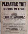
(Code No. 5191)
Original Advertising Poster for a. "Pleasure Trip to Beaumaris and Bangor" starting from Kingstown Harbour, Dublin.
Date. 1848.
Dublin, Dublin Steam Packet Company. Page size, 9 x 10 3/4ins. Original copper engraved Advertising Poster, nicks to edges and folds, printed by Mac Donnell, 18 Anglesey Street, Dublin. The Powerful Steam Ship "Duke of Cambridge," will be leaving Kingstown Harbour for Beaumaris and Bangor, Tuesday, July 18th, 1848 returning 21st July, at 9 o'clock in the morning, giving visitors' ample time to view the works now in progress for the Britannia Bridge, at Menai Straits, and also the Conway Tubular Bridge. Very Rare. £150.00
|
Click on picture above to view more images
How to order
|
|
(Code No. 5181)Evans, J M.Charles Frederick. Clark, A Brief Biography of a Great Character.Date. 1945. London. Caribonum Ltd. 4to, [7 x 9 1/2ins.] Pp.xvi 93 + 61 Photographs, very good condition. Half morocco gilt with raised spine bands gilt, slight rubbing.Biography of Charles Frederick Clark, managing Director of the Caribonum stationary products company.
|
SOLD.
|
|
(Code No. 5179)
MORDEN, (Robert).
[Antique Map]
The County of HUNTINGTONSHIRE.
Date,1722.
London. Swale, Awnsham and Churchill. Page Size, [19 x 16ins]. Copper engraved county map of HUNTINGTONSHIRE by Robert Morden, based on John Speed's map. Scale, six English miles [ =1 1/2 in.]. Shell-type cartouche containing the title and Morden's name. The maps have graduated borders, very good condition. Taken from Camden's Britannia of 1722. £60.00
|
Click on picture above to view more images
How to order
|
|
(Code No. 5170)The Holy Bible : containing the Old and New Testaments / translated out of the original tongues and with the former translations diligently compared and revised by His Majesty's special command ; Appointed to be read in churches .Date. [c.1870.]London, Charles Courtier & Sons. 16mo, [3 1/2 x 5 1/2ins.] (Not paginated), some slight marks throughout + 11 Steel engraved views + Scraps, (various), relating to the Gunson family. + 2 Woven bookmarks. Original full leather, gilt-tooled roll frame with gilt-tooled centrepiece. Spine in five compartments with gilt-tooled devices. Metal clasp and all gilt edges.
|
SOLD.
|
|
(Code No. 5165)Eyre Brothers.(Trade Catalogue for Berkshire, Cornwall, Devonshire, Dorsetshire, Essex,Gloucestershire, Kent, Oxfordshire, Buckinghamshire, Somersetshire, South Wales, Sussex, Worcesters) Eyre Bros Watering and Visiting Places of the South and West of England (including South Wales), 1880.A comprehensive guide with numerous illustrations, photographic views, and coloured maps.Date. 1880, 2nd edn.London. Eyre Brothers. 4to, [7 1/2 x 10ins]. Pp 461 Contains introduction, index to illustrations and maps, list of advertisers, and topographical and general description, trades directory, places of interest etc., of Swansea, pp.368-371 + 7 Full page photographs + 20 Steel engraved vignette plates on 10 pages, very good + 13 Printed coloured English & Welsh county maps :- Berkshire, Cornwall, Devonshire, Dorsetshire, Essex, Gloucestershire, Hampshire, Kent, Oxfordshire & Buckinghamshire, Somersetshire, South Wales, Sussex, Worcestershire, very good. Original gilt-decorated cloth, faded.
|
SOLD.
|
|
(Code No. MG5183)Black's picturesque tourist and road-book of England and Wales.Date. 1845.Edinburgh, Adam and Charles Black. 8vo, [4 1/2 x 7ins.] Pp xvi, 429 + 7 engraved plates + 12 maps. Original blind stamped cloth gilt.Between the years 1840s to 1890s each subsequent edition of Black's tourist guides of England and Wales were up dated with extra illustrations and more information.
|
SOLD.
|
|
(Code No. MG5182)Our own Country : descriptive, historical, pictorial.3 Volumes of 6.Date. [1878-83]London, etc.: Cassell, Petter, Galpin & Co. 4to, [8 x 10ins.] . Pp. viii, 320,viii 320,viii 320. Full page and text illustrations throughout. Original half calf with raised spine bands gilt, slight rubbing. Marbled end papers and edges. "Our own Country" describes some of the most important and interesting places in Great Britain.
|
SOLD.
|
|
(Code No. 5151)
Anon.
The National Gallery.
Date. 1854.
London, George Henderson. Folio, [10 x 13 1/4ins.] 11 Large stipple engraved portraits with descriptive text, image size 7 x 9ins, marginal foxing + 44 small stipple engraved portraits, image size 4 1/2 x 5ins, marginal foxing + 5 copper engraved portraits with decorated boarders, image size 4 x 6 1/2ins, marginal foxing + 5 others. Original half calf, rubber with surface loss. Showing :- William Wilderforce, Sir Robert. Peel, Duke of Wellington, and others. £65.00
|
Click on picture above to view more images
How to order
|
|
(Code No. 5148 MG )Ellis, J.ELLIS’S ENGLISH ATLAS . . A Compleat Chorography of England and Wales in Fifty Maps.........Date. 1768.London. Printed for ROBERT SAYER No. 53, IN FLEET STREET. Oblong 4to, [11 x 9ins.] Engraved title + List of Maps + 50 Copper engraved English & Welsh County Maps, plain backs, as published. Cornwall cropped. Title states fifty maps. "Map list" calls for 52 maps. No maps cut out. Original half calf over marbled boards, slight rubbing. Rare Copy.
|
SOLD.
|
|
(Code No. 5131)Stockdale.(Antique Map)Index Map of the Canals, Rivers, Roads, etc.Date. 13th Nov 1794.London, Stockdale. Page size [9 x12ins.] Original hand-coloured, in out line, copper engraved map by L. Mutlow, very good condition. Showing the North West counties of N/E Wales, Shropshire, Staffordshire, Derbyshire, Yorkshire, Cheshire and Lancashire.
|
SOLD.
|
|
(Code No. 5115)
Ogilby. John.
( Antique Road Map).
The Road from Bristol, Chipping Sodbury, Tetbury, Cirencester, Burford, South Newton & Banbury.
Map number. 55.
Date. 1675 - 98.
London. Page size, (approx), [ 19 x 15 ins ]. Image Size [ 18 x 12 3/4 ins ]. Copper engraved Strip Road Map, some creasing . Each map strip shows towns, villages, mansions with owner's name, castles, wind mills, beacons, gallows, woods, rivers, and hills etc. Elaborate title cartouche and compass roses to each map strip. Guaranteed to be over 300 years old. £120.00
John Ogilby was a topographer, printer, and map-maker, born in Edinburgh, EC Scotland, UK. A dancing teacher and theatre owner, he lost everything in the Civil War, but after the Restoration obtained court recognition and became a London publisher. The great fire of 1666 destroyed his stock but got him the job of surveying the gutted sites in the city. He established a thriving printing house and was appointed 'king's cosmographer and geographic printer'. His most important publications were engravings of maps and atlases, including Africa (1670), America (1671), and Asia (1673), and a road atlas "Britannia" (1675), unfinished at his death. He was also the first cartographer to adopt the statute mile. Scale 1inch to the mile, each mile is divided into furlongs indicated by dots in the centre of the road.
|
Click on picture above to view more images
How to order
|
|
(Code No. 5114)
Ogilby. John.
( Antique Road Map).
The Road from Bristol, Wells, Crewkerne, Frampton, Weymouth.
Map number. 60.
Date. 1675 - 98.
London. Page size, (approx), [ 19 x 15 ins ]. Image Size [ 18 x 12 3/4 ins ].Copper engraved Strip Road Map, some creasing . Each map strip shows towns, villages, mansions with owner's name, castles, wind mills, beacons, gallows, woods, rivers, and hills etc. Elaborate title cartouche and compass roses to each map strip. Guaranteed to be over 300 years old. £120.00
John Ogilby was a topographer, printer, and map-maker, born in Edinburgh, EC Scotland, UK. A dancing teacher and theatre owner, he lost everything in the Civil War, but after the Restoration obtained court recognition and became a London publisher. The great fire of 1666 destroyed his stock but got him the job of surveying the gutted sites in the city. He established a thriving printing house and was appointed 'king's cosmographer and geographic printer'. His most important publications were engravings of maps and atlases, including Africa (1670), America (1671), and Asia (1673), and a road atlas "Britannia" (1675), unfinished at his death. He was also the first cartographer to adopt the statute mile. Scale 1inch to the mile, each mile is divided into furlongs indicated by dots in the centre of the road.
|
Click on picture above to view more images
How to order
|
|
(Code No. 5107)Weber, Henry.The Battle of Floddon Field: a Poem of the Sixteenth Century, with various readings of the different Copies; Historical Notes, a Glossary, and an Appendix containing Ancient Poems and Historical Matter relating to the same event.Date. 1808.Edinburgh, James Ballantyne. 8vo, 5 1/2 x 8 1/2ins. Pp. xxv, 389 + Copper engraved frontis + 2 Folding copper engraved plates + errata slip. Contemporary full calf gilt, rubbed and front board detached. The Battle of Floddon Field has been described as the last great medieval battle in the British Isles. Flodden Field was fought in the county of Northumberland in northern England on 9 September 1513, between an invading Scots army under King James IV and an English army commanded by Thomas Howard, Earl of Surrey. It ended in a victory for the English and was the largest battle (in terms of numbers) fought between the two nations
|
SOLD.
|
|
(Code No. 5105)
CAMDEN, William.
Volume 4.
Britannia; or, A Chorographical Description of the flourishing Kingdoms of England, Scotland and Ireland, and the Islands adjacent, from the earliest antiquity. Enlarged by the latest discoveries by Richard Gough .
Date. 1806, 2nd edn
London, Printed for John Stockdale. Folio, [11 x 17ins]. . Pp. 570, Index, [28]. Description & Listing of Scottish & Irish Counties :- Scotland pp. 1 to 208 + British Ocean and Ireland pp. 209 to 500 + Islands pp. 501 to 570 + Index pp. [28]. + 27 Full page & double page copper engraved plates + 2 of 7 maps, slight foxing. Original full calf, boards detached. Listing :- a description of the principle towns and villages, their history including the names, and homes of the leading families. Heavy Book. £120.00
|
Click on picture above to view more images
How to order
|
|
(Code No. 5098)
Philip, George.
Philips' Atlas of the Counties of England, including Maps of North & South Wales, The Channel Islands and the Isle of Man.
Date. [c.1885].
London, George Philip and Son. Folio, [11 x 15ins]. Pp. (106 Index, some pages damaged with some loss) + 48 Chromolithograph, (printed colour), county maps, Yorkshire S/E, Warwickshire and Devonshire, damaged with loss. Other maps with some nicks to outer edges and centre folds, no loss. Small library stamp on back of all maps not affecting images. Half morocco gilt, poor. Sold as a working copy only. Heavy book. £90.00
|
Click on picture above to view more images
How to order
|
|
(Code No. 5096)
CAMDEN, William.
Volume 2.
Britannia; or, A Chorographical Description of the flourishing Kingdoms of England, Scotland and Ireland, and the Islands adjacent, from the earliest antiquity. Enlarged by the latest discoveries by Richard Gough .
Date. 1806, 2nd edn
London, Printed for John Stockdale. Folio, [11 x 17ins]. 1806, 2nd edn. Pp. 518, Index, [26]. Description & Listing of English Counties :- Oxfordshire pp. 3-33 + Buckinghamshire pp. 35-46 + Bedfordshire. pp 47-58 + Hertfordshire pp. 59-77 + Middlesex pp. 77-118 + Essex pp. 119-149 + Suffolk pp. 151-174 + Norfolk pp. 175-209 + Cambridgeshire pp. 211-245 + Huntingdonshire pp. 247-263 + Northhamptonshire pp. 265-296 + Leicestershire pp. 297-324 + Rutlandshire pp. 325-330 + Lincolnshire pp. 331-393 + pp. Nottinghamshire pp. 395-411 + Derbyshire pp. 415-441 + Warwickshire pp. 443-467 + Worcestershire pp. 469-493 + Staffordshire pp. 495-518 + Index pp. [26]. + 16 Full page & double page copper engraved plates. No County maps, slight foxing. Original full calf, boards detached. Listing :- A description of the principle towns and villages, their history including the names, and homes of the leading families. Heavy Book. £120.00
|
Click on picture above to view more images
How to order
|
|
(Code No. 5085)
CAMDEN, William.
Volume 3.
Britannia; or, A Chorographical Description of the flourishing Kingdoms of England, Scotland and Ireland, and the Islands adjacent, from the earliest antiquity. Enlarged by the latest discoveries by Richard Gough.
Date. 1806, 2nd edn.
London, Printed for John Stockdale. Folio, [11 x 17ins]. Pp. 523, Index, [30]. Description & Listing of English Counties :- Shropshire & Cheshire pp.3-62 + Herefordshire pp. 63-90 + South Wales pp. 91-160 + North Wales pp. 161-234 + Yorkshire pp. 235-348 + Durham pp. 349-374 + Lancashire pp. 375-398 + Westmoreland pp. 399-420 + Cumberland pp. 421-466 + Picks Wall pp. 467-488 + Northumberland pp. 489-527 + Index pp. [30]. + 35 Full page & double page copper engraved plates + 1 Copper engraved map of 14 County maps, slight foxing. Original full calf, boards detached. Listing :- a description of the principle towns and villages, their history including the names, and homes of the leading families.Heavy Book. £120.00
|
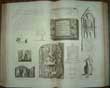
Click on picture above to view more images
How to order
|
|
(Code No. 5073)Gaultier, abbe (Aloisius Edouard Camille), 1746?-1818 & Wauthier, J. M.A plain map or emblematic chart for the geographical game of the British Islands, according to the method of the Abbe Gaultier. By Mr. Wauthier, his pupil. 1797. Neele Sc.Date. 1797.London: Harris and Son . Page size,14 1/3 x 18ins. Original copper engraved hand-coloured map. Shows:- boundaries, rivers, canals, lakes, capes, mountains, forests, mineral waters, cities, ports and bays.
|
SOLD.
|
|
(Code No. 5062)
Wild, Charles.
History and Antiquities of the Cathedral Church of Lincoln.
Date. 1837, 2nd edn.
London, H. G. Bohn. 4to, [9 1/4 x 12ins]. Pp. viii, 48 + 13 of 16 copper engraved plates, one corner of plates water stained. Original trade boards, marked with some pages loose. Sold as a working copy. £80.00
|
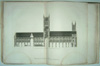
Click on picture above to view more images
How to order
|
|
(Code No. 5038)
Noble, T. & T. Rose.
The Counties of Chester, Derby, Leicester, Lincoln, and Rutland, Illustrated. From original drawings by Thomas Allom. With Historical and Topographical Descriptions.
Date. 1836.
London, Fisher, Son & Co. 4to, [9 x 10 3/4ins.] Pp.[4] 76 + Engraved vignette title + 72 Tissue guarded steel engraved plates, each with descriptive text, slight foxing. Original half calf over marbled boards with gilt-decorated spine panels, slight rubbing. £220.00
|
Click on picture above to view more images
How to order
|
|
(Code No. 5035)Church of England.(Royal Binding)The book of common prayer, and administration of the sacraments, and other rites and ceremonies of the Church, according to the use of the Church of England: together with the Psalter, or Psalms of David......Date. 1766.London, Printed by Mark Baskett, Printer to the King's most Excellent Majesty. Folio, [11 x 16ins.] Pp. Engraved frontis + [pp. 403, not paginated], text in double columns, ruled in red throughout one page split, no loss, some slight marginal nicks.Original full leather, gilt-tooled roll frame with large centrepiece stamp of the royal arms of george iii, spine in seven compartments with gilt-tooled stamps of a crown and monogram "GR". Gilt edges, rubbed & some surface leather loss. Holding firm.
|
SOLD.
|
|
(Code No. 5021)
Holland, Clive.
From the North Foreland to Penzance. Illustrated by Maurice Randall.
Date. 1908.
London, Chatto and Windus. 4to, Pp.334 + 30 coloured plates by Maurice Randall,. Original pictorial cloth gilt. Top edge gilt. No dustwrapper. £45.00
|
Click on picture above to view more images
How to order
|
|
5009. The Temptation. ( Antique Mezzotint Satirical Print). London, Printed for Carrington Bowles, 69 St Pauls, Church Yard. Image size [4 1/2 x 6ins.] [c.1769]. Original mezzotint engraved print of "The Temptation". The eager suitor looks up at a beautiful fashionable young girl, his left hand clutching a bag tantalizingly marked 500. She looks away as if her thoughts are elsewhere and holds up her right hand as a sign of rejection. London mezzotint print satires or drolls flourished between 1760 and 1800. Ref - Yale Centre for British Art.
|
SOLD.
|
|
(Code No. 5008)
The Baccanalian Turk.
( Antique Mezzotint Satirical Print).
Date. [c.1769].
London, Printed for Carrington Bowles, 69 St Pauls, Church Yard. Image size [4 1/2 x 6ins.] Original mezzotint engraved print of "The Baccanalian Turk". The figure who toasts us appears to be an Englishman in turban and robe, perhaps an actor dressed for a role. The mug (of beer) is decidedly northern European, as are the clay pipe and pot of coals for lighting it. London mezzotint print satires or drolls flourished between 1760 and 1800. Ref - Yale Centre for British Art. £50.00
|
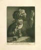
Click on picture above to view more images
How to order
|
|
(Code No. 5007)
Old Darby and Joan.
( Antique Mezzotint Satirical Print).
Date. [c.1769]
London, Printed for Bowles & Carver, 69 St Pauls, Church Yard. Image size [4 1/2 x 6ins.] Original mezzotint engraved print of "Old Darby and Joan". Showing a contented elderly seated couple. In their right hands a jug of ale and in their other hands a churchwarden's tobacco pipe. A bird and dog add to the homely bliss. London mezzotint print satires or drolls flourished between 1760 and 1800. Ref - Yale Centre for British Art. £60.00
|
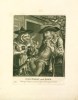
Click on picture above to view more images
How to order
|
|
(Code No. 5005)
THE ARREST, Drawn from a late real Scene.
( Antique Mezzotint Satirical Print).
Date. 1769.
Published according to the Act in 1769 by John Bowles in No. 13 in Cornhill. Image size [4 1/2 x 6ins.] Original mezzotint engraved print by Dixon ad Vivum del. et fecit.
On a London street, a young man in foppish dress grins as he peers through a spyglass directly out of the picture. From the right and slightly behind him, a bailiff with writ in hand reaches to seize the fop's arm. Behind the gentleman the street recedes, fronted by a large building on the far side. A pub sign hangs from a near building far left and a sedan chair rests in middle of the street nearby. The verse below reads:Sir Fopling Flutter through his glass inspects the Ladies as they pass// Yet still the coxcomb lacks the wit to guard against the Bailiff's Writ. London mezzotint print satires or drolls flourished between 1760 and 1800. Ref - Yale Center for British Art. £60.00
|
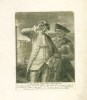
Click on picture above to view more images
How to order
|
|
(Code No. 5006)
A Democrat.
( Antique Mezzotint Satirical Print).
Date. 1769.
London, Printed for Bowles & Carver, 69 St Pauls, Church Yard. Image size [4 1/2 x 6ins.] Original mezzotint engraved print of "A Democrat".
Showing a ragged leering figure, tucked under his left arm several papers titled, Paine's Right of Man, Assassination and Equality while holding a torch in his hand to seek out disbelievers. In his right hand he grips a dagger marked Fraternity. On the wall a picture of a Guillotine.
London mezzotint print satires or drolls flourished between 1760 and 1800. Ref - Yale Centre for British Art. £50.00
|
Click on picture above to view more images
How to order
|
|
(Code No. 4989)
Hume, David ,Tobias. Smollett and Edward. Farr.
The history of England / by Hume and Smollett ; with a continuation to the reigh of Queen Victoria, by Edward Farr. [v. 2], The history of England, from the reign of William and Mary to the death of George II / by Tobias Smollett....
3 Volumes.
Date. [c.1850].
London, George Virtue. 4to, [7 1/2 x 11ins.] Pp. 918, 600, 864 + 40 Steel engraved plates, (portraits & battles) + 14 Steel engraved maps, including 11 County maps by T. Moule, (not included in content's list), decorated with coats of arms and vignette views, etc. The number of plates & maps included in these works vary according to the decision of the binder. No two copies are the same. Moule maps - Suffolk, Oxfordshire, Devonshire, North and East Yorkshire, Cheshire, Hampshire, Lincolnshire, Nottinghamshire, Gloucestershire and Cornwall, very good condition. Original full calf, gilt, Split hinges & slight marks. Holding firm. £220.00
|
Click on picture above to view more images
How to order
|
|
(Code No. 4974)William R. A. Daniell, [1769-1837].Distant view of Whitbarrow Scar, Westmoreland.Date. 1st Feb, 1816. London. Longman & Co. Image size 9 1/2 x 6 3/4. Page size 13 x 11ins. Original aquatint, drawn and engraved by William Daniell. Taken from "A Voyage round Great Britain" No. 42, Volume 2. William Daniell commenced a tour in a rowboat around Great Britain in the summers of the years 1813-16 starting and ending at Lands'-End in Cornwall. As he went he drew a series of 308 hand coloured sketches illustrating the character and prominent features of the coast. During the winter times he returned home to produce watercoloures and aquatints. A magnificient series of plates, almost all of equal quality . Valuable as a record and exquisite in its presentation. It is the most important plate book on British Topography.
|
SOLD.
|
|
(Code No. 4959)Huish. Robert.The Public and Private Life of his late Excellent and most Gracious Majesty George the Third.Date. 1821.London, Thomas. Kelly. 4to. Portrait frontis + Engraved title page + Additional title page + pp. ii Dedication; + pp. viii Introduction; + pp. 720 Text; + pp. 721-724 Index. + 16 Copper engraved full-page plates, slight foxing. Full calf, boards detached.
|
SOLD.
|
|
(Code No. 4950)William R. A. Daniell, [1769-1837].Castle-head Westmoreland.Date. 1st Feb, 1816.London. Longman & Co. Image size 9 1/2 x 6 3/4. Page size 15 x 11ins. Original aquatint, drawn and engraved by William Daniell. Taken from "A Voyage round Great Britain" No. 43, Volume 2.William Daniell commenced a tour in a rowboat around Great Britain in the summers of the years 1813-16 starting and ending at Land's-End in Cornwall. As he went he drew a series of 308 hand coloured sketches illustrating the character and prominent features of the coast. During the winter times he returned home to produce watercoloures and aquatints. A magnificent series of plates, almost all of equal quality. Valuable as a record and exquisite in its presentation. It is the most important plate book on British Topography.
|
SOLD. |
|
(Code No. 4945)
Snagg, R. (Pub).
The Curiosities, Natural and Artificial, of the Island of Great Britain. containing a full and accurate Description of whatever is remarkable and worthy of notice in the Works of Nature and Art.
Date. [c.1780.]
Volumes 3 & 4 only, bound in 1 volume of a 6 volume set.
London. R. Snagg. 8vo, [5 1/4 x 8 1/2ins.] Pp. 209-390. 1-392. Including areas - Printed pages 32, Cornwall. + pp.59 Somersetshire. + pp.35 Lincolnshire. + pp.20 Nottinghamshire. + pp.30 Derbyshire. + pp.15 Leicestershire. + pp.19 Warwickshire. + pp.23 Northamptonshire. + pp.7 Rutlandshire. + pp.7 Cambridgeshire. + pp.35 Buckinghamshire. + pp.16 Bedfordshire. + pp.11 Huntingdonshire. + pp.37 Suffolk. + pp.43 Norfolk. + pp.129 Yorkshire. Original half calf gilt, slight rubbing. Marbled boards. Listing the towns, village in each English county with their histories and stately homes etc. £65.00
|
Click on picture above to view more images
How to order
|
|
(Code No. 4944)
Millar, George Henry .
(Antique Map ).
A New and Correct Map of England & Wales from the latest & best Improvements.
Date. 1782.
London. Page size [9 x 15ins]. Original copper engraved map, with original outline hand colouring, very slight cropping to left side.Taken from Millar's The New and Universal System of Geography. £65.00
|
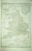
Click on picture above to view more images
How to order
|
|
(Code No. 4939)
Iles Britannique.
(Antique Map of England, Wales, Scotland and Ireland.)
Date. 1860
Paris, Migeon ,11, Rue de Moulin Vert. Page size [13 3/4 x 18 1/2ins.] . Original hand-coloured steel engraved map, very good. Taken from "Géographie Universelleis" £60.00
|
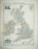
Click on picture above to view more images
How to order
|
|
(Code No. 4936)An account of the CARMANIA'S Victory over the German Armed Liner CAP TRAFALGAR.Date. [c.1920.]Liverpool, Cunard Steam Ship Co, Ltd. 4to, [7 x 9/14ins.] Pp 32, + 16 Photogravure plates, Original decorated soft covers, spine hinge split & slight marks.Cap Trafalgar wascompleted in October 1913 she was a German large ocean liner however due to WWI she became an auxiliary cruiser. In September 1914 she was attacked by HMS Carmania & sank leaving it to be the only armed merchant cruiser to be sunk in warfare by its own kind. Rare copy.
|
SOLD.
|
|
(Code No. 4924)
CARY, John, 1754-1835.
(Antique Map.)
GREAT BRITAIN and IRELAND with ye JUDGES CIRCUITS.
Date. 1789.
London. Image size [475 x 355 mm.] Hand coloured copper engraved map of the British Isles, slight nick to border. Scale about 57 miles to 1 inch, and a triangular table of distances between towns. Two panel inset maps of the Western Isles and Shetland Isles. Separate two bar scales. Eight line "Explanation". Graduated map. border..Taken from William Camden's Britannia, translated from Latin by Richard Gough. Facing pp.CXLV11.Vol.1. £140.00
|
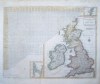
Click on picture above to view more images
How to order
|
|
(Code No. 4911)
KNIGHT, Charles.
Old England A Pictorial Museum of Regal, Ecclesiastical, Municipal, Baronial, and Popular Antiquities.
2 Volumes.
Date, [c.1850.]
London. James Sangster & Co. Folio, [10 1/2 x 14 ins.] Pp 392 & 404, some foxing + 40 chromolithographic plates ( using wood and metal relief blocks), all with tissue guards, marginal foxing + Hundreds of wood engravings. Original cloth gilt, slight marks & slight split to hinges. Holding firm. All edges gilt. £85.00
Charles Knight's colour printed plate books were the first ever published for the mass market. The number of coloured plates for this work varies between 24 and 40 depending on the edition.
|
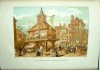
Click on picture above to view more images
How to order
|
|
(Code No. 4866)
Howard, Joseph Jackson; Frederick Arthur. Crisp.
Visitation of England and Wales.
Volume 7.
Date. 1899. No.203 of 500 limited copies. Signed by editor.
Privately Printed. 4to, [8 1/2 x 11 1/2ins.] Pp [6], 187, [xii, additions.] Black & white & coloured plates throughout. Listing, named family pedigrees, their signatures, coats of arms, engraved portraits and silhouettes, etc. Original quarter velum styled gilt, marked. Top edges gilt other edges untrimmed. £60.00
|
Click on picture above to view more images
How to order
|
|
(Code No. 4851)Walker, J. and C.Hobson's Fox-Hunting Atlas; containing Seperate Maps of Every County in England, and the Three Ridings of Yorkshire; comprising Forty-Two Maps, showing the Roads, Railways, Canals, Parks, etc.Date. [c.1870.]London. J. and C. Walker. Folio, [10 x 15ins.] 42 Original hand-coloured English County foxhunting engraved maps, showing over 100 hunts. Published as a foxhunter guide. Printed by county with clearly coloured boundaries with the hunt's individual named meets, coverts and kennels. Original gilt-decorated half-morocco with raised spine bands, slight rubbing.
|
SOLD.
|
|
(Code No. 4841)
TYTLER, Sarah, pseud. [i.e. Henrietta Keddie.]
Life of Her Most Gracious Majesty the Queen. ... Edited, with an introduction, by Lord Ronald Gower.
2 Volumes bound up in 1.
Date. [1883-85.]
London, J. S. Virtue. Folio, [10 x 12 1/2ins.] Pp. 236. 234, slight foxing + 2 Steel engraved titles + 2 Aditional titles + 29 Full page steel engraved plates, (as listed), all with tissue guards. Original half morocco gilt. Raised spine bands with gilt decorated panels. All edges gilt. £80.00
|
Click on picture above to view more images
How to order
|
|
(Code No. 4826)Leigh. S.Leigh's New Pocket Road-Book of England and Wales + Leigh's New Atlas of England & Wales.2 Volumes bound up in 1.Date. 1825, 2nd edn.London. Samuel Leigh. 16mo, [3 1/2 x 5 1/2ins.] Pp. iv, 404 including, 55 Miniature English & Welsh copper engraved County Maps, (as listed), very good + Folding copper engraved general map of England & Wales, slight split to fold. Original full calf gilt, some surface loss & later spine leather.
|
SOLD.
|
|
(Code No. 4762)
LUCY Henry W, with drawings by W.L Wyllie.
The Log of the Tantallon Castle.
Date. 1896.
London, Sampson Low, Marston & Company. 8vo, [5 x 7 1/2ins.] Pp xv, 203, very good. Dedication on front free end paper. Original decorated cloth gilt, slight rubbing. £50.00
On the afternoon 12th june 1895 the SS Tantallon Castle left Tilbury in order to be present at the opening of the Keil Canal. Among the 100 guests were Statesmen, scientists, etc. including Baden-Powell and W. E.Gladstone.
|
Click on picture above to view more images
How to order
|
|
(Code No. 4755)WHITE, John, M.R.C.S.Lessons on Housewifery... and cottagers' families.Date. 1849.London, Groombridge. 12mo, [3 1/2 x 6ins.] Pp x, 105, [2]. listing household duties, health, exercise, food, warmth, nursing the young & sick, and accidents, cooking, soap making, soups, pies, puddings, bread, making shirts and stockings, washing cloths, etc. Original cloth gilt, rubbed & slight marks. Dedication on front end paper. Rare copy.
|
SOLD.
|
|
(Code No. 4754)Anon.Everybody's Confectionery Book. containing the whole art of making cakes, buns, tarts, biscuits, pies...wines, etc.Date. 1865.Halifax. W. Nicholson & Sons. 12mo, [5 x 3ins.] Pp. 128, very good. Dedication on front end paper. Art of making cakes, buns, tarts, pies, custards, cheesecakes, gingerbread, bride cake, jellies, creams, marmalades, blanc mange, trifles, sugar boiling, spices, preserves, wines, etc. Original cloth gilt, slight rubbing. All edges gilt.
|
SOLD.
|
|
(Code No. 4746)
Prophecies of Robert Nixon, Mother Shipton, and Martha, the Gypsy.
Date. [c.1860.]
London. Published for the Booksellers. 12mo, [3 1/2 x 5ins.]Pp 258 + Steel engraved frontis, lacks lower fly leaf. Original cloth gilt. £50.00
Ursula Southeil (c. 1488 - 1561) (possibly Ursula Sonthiel), better known as Mother Shipton, was an English soothsayer and prophetess who is said to have made dozens of unusually accurate predictions, including the Great Plague of London, the Spanish Armada, and the Great Fire of London.
Prophecies of Robert Nixon, relate to the family living at Vale Royal Abbey mansion at the time of the 1714 and 1745 Jacobite rebellions. It seems the prophecies of Robert Nixon were invented or modified to suit the political situation at the time. From Wikipedia, the free encyclopedia .
|
Click on picture above to view more images
How to order
|
|
(Code No. 4742)
Anon.
(Hand Drawn Ink Sketches).
Figures for Landcape Composition selected from Paintings and Prints with a few Original Designes.
Date. [c. 1810]. Paper watermarked, 1810.
8vo, [5 1/2 x 8 1/2ins.]. 59 Hand Drawn Ink Sketches of Figures for Landscape Composition on 27 pages drawn in the style of, Paul Farinto, David Cox, Alken, Morland, Shaw Bath, Wilson, Claud, Wynants, Gainsborough, Pyne, Prout, Muller and Horizonte, names listed next to figure.. No prints. Original half morocco gilt, rubbed slight split to lower hinge.£120.00
|
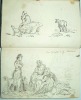
Click on picture above to view more images
How to order
|
|
(Code No. 4737)The Centenary of the Isle of Man Steam Packet Co. Ltd. Centenary.Date. 1830-1930.Liverpool. Causton. 4to, 7 1/2 x 10ins. 1930. Pp.111. Illustrated throughout. Original gilt decorated covers. .The Isle of Man Steam Packet Company (Manx: Sheshaght Phaggad Bree Ellan Vannin) is the oldest continuously operating passenger shipping company in the world, celebrating its 175th anniversary in 2005.The company provides freight, passenger and vehicle services between the port of Douglas, Isle of Man and four ports in the United Kingdom and Republic of Ireland. From Wikipedia, the free encyclopedia.
|
SOLD.
|
|
(Code No. 4724)WOODWARD, Horace B.Stanford's Geological Atlas of Great Britain,[Based on Reynold's Geological Atlas], with Plates of Characteristic Fossils....Date. 1904.London , Edward.Stanford. 8vo, [6 x 7 1/2ins.] Pp. x, 139 + 34 Coloured geological British double page county maps + 16 black & white plates of fossils, very good. All loose, (perished gutta-percha}. Original cloth gilt, slight rubbing.
|
SOLD.
|
|
(Code No. 4705)Johnson, Mrs. T. Fielding.(Signed by the Author.)Glimpses of Ancient Leicester, in Six Periods .Date. 1906.Leicester, Clarke and Satchell. 8vo, 6 x 9ins. Pp xv, 439 + Illustrated throughout with folding maps, etc. Original cloth gilt, very good. Leicester is a city and unitary authority area in the East Midlands of England. It is the county town of Leicestershire. The city lies on the River Soar and at the edge of the National Forest.
|
SOLD.
|
|
(Code No. 4699)
R.M.S. "Queen Mary" " A Noble Tribute to the Imagination of Man"
Date. [c.1935.]
London, Cunard White Star, Folio [13 x 11] . Tipped in colour illustrations of the fitting of the Queen Mary in art deco styles. Illustration of wood sculpture by James Woodford, sketches by Vanessa Bell, friezes by Maurice Lambert . Original decorated wrappers, slight rubbing. £80.00.
RMS Queen Mary sailed the North Atlantic Ocean from 1936 to 1967 for the Cunard Line (then Cunard White Star Line). Built by John Brown and Company, Clydebank, Scotland, she was designed to be the first of Cunard's planned two-ship weekly express service from Southampton to Cherbourg to New York, in answer to the mainland European superliners of the late 1920s and early 1930s.
|
Click on picture above to view more images
How to order
|
|
(Code No. 4698)
Taffrail .Taprell Dorling. Captain.
Cunard White Star Launch of the Queen Elizabeth in the Presence of Their Majesties, the King & Queen, at the Yard of John Brown & Co. Ltd,, Clydebank, Tuesday, September 17, 1938.
Date. 1938.
Clydebank: John Brown & Cunard White Star. Folio [13 x 11] . Not paginated. Double page coloured prints + photographs of the various stages of construction by Stewart Bale, slight nicks to some outer edges. Original decorated covers, slight nicks to outer edges. £50.00
Stewart Bale Ltd, 1911-1980(?) then one of the country's leading commercial photographic companies, earned a reputation for the excellent quality.The National Museum of Liverpool acquired the entire photographic archive in 1986 and held an exhibition of his work at the Museum of Liverpool Life, 2002.
|
Click on picture above to view more images
How to order
|
|
(Code No. 4691)Rose, Thomas.Westmorland, Cumberland, Durham, and Northumberland, Illustrated from Original Drawings by Thomas Allom, George Pickering, &c. With Descriptions by T. Rose.Date. [c.1832.] London. Fisher, Sons, & Co. 4to, 9 x 11ins. Pp 220 + 214 of 215 Steel engraved plates, each with a half page of descriptive text. Original full morocco gilt, rubbed. Raised spine bands gilt with gilt decorated panels. All edges gilt.
|
SOLD.
|
|
(Code No. 4683)
Teesdale, Henry.
(3 Antique Maps of Yorkshire.)
Yorkshire.
Date. 1829.
London, Published by Henry Teesdale & Co 302, Holborn. Page size 19 x 14 1/2ins. 3 Original steel engraved maps with original hand-colour, splits to centre folds, strengthened on back of maps. £85.00
|
Click on picture above to view more images
How to order
|
|
(Code No. 4672)Ortelius. Abraham, (1527-1598).(Antique Map of England and Wales.)Angliae Regni florentissimi nova descriptio auctore Humfredo Lhuyd Denbygiense. 1573.Date. [c.1600.] Antwerp. Plantin Press, Image size 18 x 15 inches. Page size 22 x 17 3/4 inches. Spanish text on reverse.Original copper engraved map, centre fold mark. Taken from the Theatrum Orbis Terrarum. Ortelius (Abraham Ortels) (April 2, 1527 - June 28, 1598) was a Belgian cartographer and geographer, generally recognised as the creator of the first modern atlas. On May 20, 1570, Gilles Coppens de Diest at Antwerp issued Ortelius' Theatrum Orbis Terrarum, the "first modern atlas" (of 53 maps). Three Latin editions of this (besides a Dutch, a French and a German edition) appeared before the end of 1572; twenty-five editions came out before Ortelius' death in 1598; and several others were published subsequently, for the atlas continued to be in demand until about 1612.
|
SOLD.
|
|
(Code No. 4663)
28 Bound up sermons delivered at London Churches between 1703 and 1707.
Date [c.1709.]
London. Various publishers. 8vo, 4 1/2 x 7 1/2ins. . Pp. (approx) 16 per sermon. Sermons preach'd before Queen Anne, Union of England & Scotland, the Duke of Marlborough's victories in Europe, the Royal Hospital Oratory at Greenwich, Societies, manners, weddings, coronation, etc. Original panelled calf with later morocco spine, chipped and rubbed. Holding firm. £120.00
|
Click on picture above to view more images
How to order
|
|
(Code No. 4611)
O'RELL, Max. (pseud. of Leon-Paul Blouet).
John Bull and his Island. Translated from the French by the Author.
No Date. [c.1889.]
London. Field & Tuer, Simpkin, Marshall. 8vo, 5 x 7ins. Pp viii,295, [1], some pencil marginal notes. Original half calf gilt, slight rubbing. A French critics amusing view of England and its people in the 1880s. £45.00
|
Click on picture above to view more images
How to order
|
|
(Code No. 4603)Our National Cathedrals (The Richest Architectural Heritage of the British Nation): Their History and Architecture from their foundation to Modern Times, with Special Accounts of Modern Restorations.Volume 1 of 3.Date. 1887.London, New York , Ward, Lock & Co., 4to, 8 x 10ins. Pp xii, 240, slight foxing + 60 Coloured engraved prints + 8 Steel engraved ground plans + many text illustrations, slight foxing. Original gilt decorated cloth, faded and hinge cloth split. Holding firm. Cathedrals shown :- Salisbury Cathedral, Canterbury Cathedral, York Cathedral, Wells Cathedral, Rochester Cathedral, Winchester Cathedral, Lincoln Cathedral and Oxford Cathedral.
|
SOLD.
|
| (Code No. 4582)
Smith. J.
(Antique Print of the Lake District.)
Lodore Waterfall.
Date. March, 1792.
London. R. Blamire. Page size 17 1/4 x 12 1/2ins. Image size 15 1/2 x 10ins. Original copper coloured, (modern colouring), engraved print by Meriget, 2 small holes to surface image, (1/4 ins). Modern mount. £80.00
Lodore Falls are located near the Grange end of Derwentwater. The waterfall, a must for Victorian tourists staying at Keswick, is formed by the beck from Watendlath Tarn cascading over huge boulders for a distance of some 100 feet. Although the falls are spectacular after periods of heavy rain, they dry to a trickle in periods of prolonged dry weather.
|
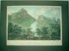
Click on picture above to view more images
How to order
|
| (Code No. 4574)
Old Castles of England.
Date. 1862.
London. Nelson and Sons. 12mo, 4 x 6ins. Pp 154, [4, Adverts], some slight foxing + 4 Lithographic view plates, Original gilt-decorated cloth, slight rubbing. Listing 32 British castles and their histories, etc. £45.00
|
Click on picture above to view more images
How to order
|
| (Code No. 4550)
Cary, John. CARY’S NEW ITINERARY OR AN ACCURATE DELINEATION OF THE GREAT ROADS, Both Direct and Cross throughout England and Wales; With many of the Principal Roads in Scotland. Date. 1828,11th Edn. London. J.Carey. 8vo, [5 1/2 x 7 3/4ins]. Pp. [6], 41,123, [66], 1087, [5], (in two columns). Large map is mentioned on title but not present in this copy + 6 folding maps, [as listed in contents), Isle of White, creased. Modern half calf gilt, |
SOLD
|
|
(Code No. 4523)Ogilby, John.Britannia volume the first or an Illustration of the Kingdom of Englandand.Wales.Date. 1939. Facsimile reprint of the 1675 edition.London, Alexander Duckham & Co. Oblong 4to, 12 1/2 x 10ins. 100 coloured strip maps. Original cloth with three gilt title labels. Fine Copy. Still housed in the original publisher's box, some wear.The Britannia was the first true road atlas anywhere, and the first to use the 1760 yards for the mile.
|
SOLD
|
|
(Code No. 4505)Ortelius. Abraham, (1527-1598).(Antique Map of Ireland.)Eryn. Hiberniae Britannicae Insulae, nova descriptio. Irlandt.Date. 1600-02.Antwerp. Plantin Press, Image size 19 1/2 x 13 1/2 inches. Page size 22 x 17 3/4 inches. Spanish text on reverse. Original copper engraved map, very good condition. Taken from the Theatrum Orbis Terrarum. Ortelius (Abraham Ortels) (April 2, 1527 - June 28, 1598) was a Belgian cartographer and geographer, generally recognised as the creator of the first modern atlas. On May 20, 1570, Gilles Coppens de Diest at Antwerp issued Ortelius' Theatrum Orbis Terrarum, the "first modern atlas" (of 53 maps). Three Latin editions of this (besides a Dutch, a French and a German edition) appeared before the end of 1572; twenty-five editions came out before Ortelius' death in 1598; and several others were published subsequently, for the atlas continued to be in demand until about 1612.
|
SOLD.
|
|
(Code No. 4498DP)Buck. Samuel and Nathaniel.(10 Antique Prints of Northumberland.)Norham Castle, Brinkbury Priory, Tinemouth Monastery & Castle, Prudhoe Castle, Bothal Castle, Chillingham Castle, Dunstanburgh Castle, Belso Castle, Horton Castle, and Widdrington Castle .All Dated. 1728, 1st edition, not the later 18th century reprints.Page size 18 x 11 ins. Image size 14 x 7 1/2 ins. 10 Original copper engraved prints. South East view of Norham Castle, South West view of Brinkbury Priory, North view of Tinemouth Monastery & Castle, South view of Prudhoe Castle, North view of Bothal Castle, West View of Chillingham Castle, South West view of Dunstanburgh Castle, South view of Belso Castle, South East view of Horton Castle, and East view of Widdrington Castle . The brothers, Samuel and Nathaniel Buck made a series of etched panoramas and views of British towns, castles and abbeys. The engravings describes, below the image, the history of the castles from Norman times, including the changes of ownership + dedications and coat of arms.
|
SOLD.
|
| (Code No. 4495)Ortelius. Abraham, (1527-1598).(Antique Map of England, Scotland and Ireland).Angliae, Scotiae, et Hiberniae, sive Brittanicar: Insularum Descriptio.Date 1600-02.Antwerp. Plantin Press, Image size 19 1/2 x 13 1/2 inches. Page size 22 x 17 3/4 inches. Spanish text. Original copper engraved map, very good condition. Taken from the Theatrum Orbis Terrarum. Ortelius (Abraham Ortels) (April 2, 1527 - June 28, 1598) was a Belgian cartographer and geographer, generally recognised as the creator of the first modern atlas. On May 20, 1570, Gilles Coppens de Diest at Antwerp issued Ortelius' Theatrum Orbis Terrarum, the "first modern atlas" (of 53 maps). Three Latin editions of this (besides a Dutch, a French and a German edition) appeared before the end of 1572; twenty-five editions came out before Ortelius' death in 1598; and several others were published subsequently, for the atlas continued to be in demand until about 1612. |
SOLD.
|
| (Code No. 4491)
PATERSON, Daniel & Mogg, Edward.
PATERSON'S ROADS. Being An Entirely Original and Accurate Description of all the Direct and Principal Cross Roads in England and Wales with part of the roads of Scotland ....
Date. n.d. [1829-32], 18th edn.
London. Longman, Rees, and others. 8vo [223 x 150 mm] Pp 715, 44, (appendix table}, vg. 10 FOLDING MAPS by E, MOGG, large folding general map, frayed edge & repaired split. The road book lists the towns, countryseats, turnpike roads and inns that supply post horses etc. Also an appendix table of populations, circuits of the judges, packet boats with their respective ports and the departure times plus postage rates in Great Britain. Original boards, detached. £80.00
|
Click on picture above to view more images
How to order
|
| (Code No. 4474)Philippe Buache or Philippe de Prétot, Etienne André. [1708-1782]. Royal Censor, Professor (history)Les Isles Britannique comprenant L'Anglererre, L'Ecosse, et L'Irland..(Antique Map of the British Isles.)Date. ca1780.Paris. Angers. Page size 17 1/2 x 11 1/4ins. Original copper engraved map by J.F.J Vallet, taken from an original drawing by Moithey. |
SOLD.
|
| (Code No. 4469)
SUCKLING, Alfred Inigo. Rev.
The History and Antiquities of the County of Suffolk....
Volume 2, only of 2 volumes.
Date. 1846.
London, John Weale. 4to, 9 1/2 x 11 1/2ins. Pp l. 460, foxing spots & splits to title page + 23 Full-page lithographic hand coloured and black and white engraved plates. Many text plates throughout, some foxing spots. Areas listed - Lowestoft, Gunton, Halesworth, Henham, Dunwich, Leiston, etc. Many of the Suffolk county families with a view of their houses accompanied with a descriptive text are listed. Part unopened. Modern spine retaining the original marbled boards, rubbed. Ink spine title label, poor. £150.00
|
Click on picture above to view more images
How to order
|
| (Code No. 4468)
(Antique Map)
Morden, Robert
Cumberland.
Date. 1695, 1st edn.
London. Printed by F.Collins, for A. Swale. Page size [18 x 14 3/4ins.] Original copper engraved map by Robert Morden. Taken from Camden's Britannia. £80.00
|
Click on picture above to view more images
How to order
|
|
(Code No. 4414)Where Shall We Go?A Guide to the Healthiest and Most Beautiful Watering Places in the British Islands, including Remarks on Climate and Information Generally Useful to Those Seeking a Temporary Change of Abode.Date. ca1880, 10th edn.Edingburgh: A.& C. Black. 8vo, [5 x 6 3/4ins.] Pp. xii, 276,108 adverts + 3 folding maps, ( England & Wales, Scotland and Ireland) + 4 Full-page plates.(Scarborough, Clifton, Hastings and Bridge of Allan}. Dedication on front free end paper. Original gilt-decorated cloth, Fine copy.
|
SOLD
|
| (Code No. 4405)GREEN, William.The Tourist's New Guide containing a Description of the Lakes, Mountains and Scenery in Cumberland, Westmorland, and Lancashire.... With some account of their bordering towns and villages....Volume 1 only,Date. 1819.Kendal: R.Lough and Co. 8vo, [ 5 1/2 x 8 1/2ins.] Lacking half title + Folding map frontis, slight split to fold + Title + pp. v-xi, Preface + pp. v-vii, index to first volume + pp. 1-461 Text, slight foxing + Errata, slight foxing + 13 engraved aquatints + 4 soft ground etchings. Original half calf, boards detached.Area visited and described: - Coniston Water, Levers Water, Newdale,Tilberthwaite, Hawkshead, Kendal, Ambleside, Stock Gill, Windermere, Skelgill, Curwen Island, Langdale, Grasmere, Loughrill Tarn, Wansfell Pike, Rydal Water, Penrith, Patterdale. Ullswater, Grisedale, River Lowther, Haws water, Rydal water, Grasmere, Raven Crag and Helvellyn. |
SOLD.
|
|
(Code No. 4404)CLARE. FORBES, Mansfield [Editor]Clare College 1326-1926.2 Volumes.Cambridge.University Press. Large 4to [10 1/2 x 13 1/4ins.] 1928-30. Pp. xxxvi, xl, 661 + Many illustrations, very good condition. Original cloth gilt, slight rubbing. Heavy books, E-mail for postage rate.
|
SOLD
|
| (Code No. 4399)
The London Magazine or, Gentleman's Monthly Intelligencer.
Vol. 22 for the Year 1753.
London. R Baldwin. 8vo, [6 x 8ins.] 1753. Pp 614, 21, index ,(lacking pp. 98-101) + 7 Copper engraved County maps by T.Kitchin, (Westmoreland, Isles of Scilly, Worcestershire, Canal map of the Seven & Trent, Yorkshire, Dorsetshire, Islands of Jersey, etc) + 11 Copper engraved prints of English Towns,etc, (Uprnor Castle, Worcester, Chester, York, Oxford, Exchange Bristol & Birmingham, Misc, some cropped + a few pages with marginal staining) + 10 of 11(not bound in) Copper engraved portraits. Original full calf with later spine, still firm. £250.00
|
Click on picture above to view more images
How to order
|
|
(Code No. 4396)
Buck, Samuel (& Nathaniel).
( Antique Print.)
The South-East view of RABY CASTLE, in the Bishoprick of Durham.
Date. 1728,1st edition.
London. Image size 14 x 7 1/2ins. Original copper engraved print drawn and engraved by Samuel & Nathaniel Buck, nick affecting the engraved surface, (1inch). £45.00
The brothers, Samuel and Nathaniel Buck drew and engraved a series of etched panoramas of British towns, castles and abbeys etc including the history of the castles. Print numbered 7 in the left hand blank margin, signifying that it is the 1st edition, not the later 18th century reprint.
The castle was begun by John, 3rd Baron Nevill in approximately 1360. Cecily Neville, who was the mother of the Kings Edward IV of England and Richard III of England was born there. The Nevilles lost the castle (and many more of their possessions) after they led the failed Rising of the North in favour of Mary, Queen of Scots in 1569.
|
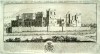
Click on picture above to view more images
How to order
|
| (Code No. 4384)
Nightingale, J, Rev.
SHROPSHIRE & SOMERSETSHIRE.
Volume 8. Part 1.
The Beauties of England and Wales.
Date. 1813.
London. J Harris. 8vo. Pp. 616, (47) index, Engraved title + 31 Copper engraved plates, slight browning & one marginal worm hole. Original half calf gilt, rubbed and split to hinges with some surface loss. Binding still holding firm.£65.00
Between the years 1801 and 1818 the authors undertook a topographical study of England and Wales, travelling many thousand of miles on foot, gathering information for their "Beauties of England and Wales", publishing at regular intervals. Counties listed in alphabetical order.
|
Click on picture above to view more images
How to order
|
| (Code No. 4381)Britton John & W. Edward Brayley.Yorkshire.Volume 16.London. Vernor and Hood, 8vo. 1812. Pp.viii 931, (28) index, Engraved title + 24 Copper engraved plates, worm holes + foxing spots throughout. Original half calf gilt, rubbed and split to hinges with some surface loss. Binding still holding firm.Between the years 1801 and 1818 the authors undertook a topographical study of England and Wales, travelling many thousand of miles on foot, gathering information for their "Beauties of England and Wales", publishing at regular intervals. Counties listed in alphabetical order. WORKING COPY. |
SOLD.
|
| (Code No. 4331)
Stanford. Edward.
(2 Antique Maps.)
A Railway Map of the British Isles & Map of the British Isles - Railways & Industrial.
Date. 1901.
London. Edward Stanford. & The Times. Page Size 22 1/2 x 26 1/2 ins & 17 1/2 x 23ins. Original coloured engraved maps, with inset maps of the Orkney and Shetland Isles. Scale (approx) 10 miles to 1in and 30 miles (approx) to 1in, very good condition.
Rail was the most popular means of transport for goods and people throughout the Victorian era and well into the 20th century. £45.00
|
Click to view more images
How to order
|
| (Code No. 4330)Stanford. Edward.A Stereographical Map of the British Isles.Date. 1901.London. Edward Stanford. Page Size 22 1/2 x 26 1/2 ins. Original coloured engraved map with inset map of the Orkney and Shetland Isles. Scale (approx) 10 miles to 1in, very good condition.Stereographs were meant to be viewed in 3-D with a stereoscope. Looking closely at the image in 3-D allowed the viewer to enter the scene and examine the map's contours in more detail. |
SOLD.
|
| (Code No. 4329)
Stanford. Edward.
Geological map of the British Isles by Edward Best.
Date 1901.
London. Edward Stanford. 1901. Page Size 22 1/2 x 26 1/2 ins. Original coloured engraved map by Edward Best, with inset map of the Orkney and Shetland Isles. Including a colour coded reference to the several Geological Groups. Scale (approx) 10 miles to 1in. Some offsetting. £45.00
|
Click to view more images
How to order
|
|
(Code No. 4328)Geological map of England and Wales.(Geological map in two parts, nos 62 & 63)Date. [c.1880].London, Size of the 2 parts, (approx) 20 x 26ins. Original hand coloured engraved, north & south maps, 15 miles to 1in. Including a colour coded reference to the several Geological Groups. Very good condition.
|
SOLD.
|
| (Code No. 4312)Britton John & W. Edward Brayley.Cambridgeshire, Cheshire and Cornwall.Beauties of England and Wales.Volume 2.London. Vernor and Hood, 8vo. 1801. Pp. 524 (25) index + Engraved title + 22 Copper engraved plates, foxing spots throughout. Original half calf, rubbed and split to hinges with some surface loss. Binding still holding firm.Between the years 1801 and 1818 the authors undertook a topographical study of England and Wales, travelling many thousand of miles on foot, gathering information for their "Beauties of England and Wales", publishing at regular intervals. Counties listed in alphabetical order. |
SOLD.
|
|
(Code No. 4284)
Rees, Thomas.
SOUTH WALES.
The Beauties of England and Wales or Original Delineation, Topographical, Historical, and Descriptive of Each County.
Date. 1815.
London. Harris; Longman & Co. 8vo, [6 x 8 1/2 ins.] Volume xviii. Pp viii 917 (55) + 30 copper engraved plates, slight water staining. Original half calf, poor. Describing the counties of Brecknockshire, Glamorganshire, Pembrokeshire, Cardiganshire, Carmarthenshire, and Radnorshire, £90.00
|
Click to view more images
How to order
|
| (Code No. 4268)A View of Millum Castle, in Cumberland, ...(Watercolour Painting)No Date, ca1790.England. Page size, [9 x 13 1/2 ins.] Original Watercolour by an unknown artist, nicks to margins & dust marks to edges. Millum-castle, which, with the surrounding estate, and large manor of Millum, stands near the Duddon Sands in the county of Cumberland, |
SOLD.
|
|
(Code No. 4261)Sketch Book.No date ca1830.England. Oblong 4to, [11 3 /4 x 9 1/4 ins.] A series of 6 pen and sepia sketches + 5 pencil sketches by an amateur artist. Showing landscapes, houses, castles, boats and fishermen and corn mills. Original soft covers, chipping and slight marks.
|
SOLD.
|
| (Code No. 4259)
9 Loose copper engraved prints.
Date. 1813.
London: R. Ackermann's Repository of Arts. Page size [7 1/2 x 10 1/2 ins.] 9 Loose copper engraved prints showing the various trades, characters, Customs, Dress, etc. £70.00
|
Click to view more images
How to order
|
| (Code No. 4245)Lamborn, P. S.(Antique Print.)A View of King's College and part of Clare Hall in the University of Cambridge.England. No date,ca1750. Page size, [22 x 15 1/2 ins.] Image size, [20 x 14 ins.] Original copper engraved print, drawn & engraved by P S. Lamborn, cropped, creases and slight nicks into the engraved area. |
SOLD.
|
|
(Code No. 4237)Gates, Edward.Victorian Furniture Trade Catalogue.No Date,ca1880.England. 4to, [11 x 9 ins.] 534 engraved examples of Chairs, Wardrobes, Mirrors, Tables, etc. All pages with Edward Gates' engraved initials. It would appear to be a tradesman's furniture sample book for the 1880s, a few pages loose and one page creased. Original cloth gilt, slight rubbing and marks. Rare Copy.
|
SOLD
|
| (Code No. 4216)
HALL, Samuel Carter.
(5 Antique Prints.)
Levens Hall in Westmoreland.
Date, Ca1850.
London . Ca1850. Page size [14 1/2 x 11 ins.] 5 Lithograph plates of Levens Hall, taken from "The Baronial Halls, and ancient picturesque edifices of England". Slight foxing and marks to blank margins. £50.00
|
Click on picture above to view more images
How to order
|
| (Code No. 4215)
Hearne, T. & William Byrne.
(2 Antique Prints).
Wetherell Priory & Egremont Castle, Cumberland.
Date. 1778.
London. William Byrne.Page sizes [12 1/2 x 10 1/2 ins,] 2 Original hand-coloured copper engraved plates by W. Byrne & S. Middleton. (Modern colouring). £40.00
|
Click on picture above to view more images
How to order
|
|
(Code No. 4208)Pigot, James & Co.NORTHUMBERLAND.NATIONAL COMMERCIAL DIRECTORY for 1828-29.London. 1828-9. 8vo, 245 x 150mm. Pp (59) slight foxing. Folding map by J.Pigot of Northumberland with vignette of St Nicholas Church, Newcastle, slight foxing.An early directory on Northumberland listing most of the principle towns, their history including the names, trades and addresses of the inhabitants, from the Accountants to the Wollen drapers. Plus carriers by land (Coaches) to carriers by water, giving times of departure and route to be taken. Not bound.
|
SOLD
|
| (Code No. 4196)
Richardson's Map of South Eastern and Central England.
Date. [c.1910].
London & Manchester. 4to, [13 x 8 ins]. Linen backed sectional coloured map by Richardson, Size 38 1/2 x 48ins, (in 2 sheets), folding to 13 x 8 ins. Scale, 1in to 5 miles + Listing the various motor car speed limits that operated in each town of the South Eastern and Central England + Inset map of the geology of the area + Population list for major towns, 2 splits to folds, (2 1/2 ins each.) Original cloth gilt, faded.. £40.00
|
Click on picture above to view more images
How to order
|
|
(Code No. 4193)Camden, William.CAMDEN'S BRITANNIA: or a Chorographical Description of Great Britain and Ireland, Together with the Adjacent Lands......Volume 2 only.London. Awnsham Churchill. 1722, 2nd edn. Folio, [12 x 18 1/2 ins]. Pp.1 - 1526 Text, (in 2 columns) + pp. (1) Appendix (v blank) + pp. (29) Annals of Ireland + pp. (11) O Neal's + pp. Kings of Man + pp. (1) Insertions + pp. (33) Dr Holland & O Neal's + pp. (91) Index + pp. (1) Errata + Lacks British County folding Maps by Robert Morden + 3 Full-page plates + many text illustrations throughout. Descriptive text for the counties of Wales, pp.698-839 + Yorkshire, Durham, Lancashire, Westmoreland, Cumberland, pp. 846-1526 + Scotland, Ireland and the Small Islands, pp. 1114-1526. Original full calf gilt, rubbed with some surface loss. Raised spine bands.
|
SOLD
|
| (Code No. 4185)
ROSSELL, SAMUEL M.A. Ordinary of Newgate Jail.
( Prison Chaplain.)
THE PRISONER'S DIRECTOR and The CLERGYMAN'S COMPANION in Visiting the Goals.
2 volumes in 1.
Date. 1742.
London. Applebee, for the author. 8vo, [4 x 7 ins.] Pp [xiv] 271.[x] 176, lacks pp.133-136, a few pencil annotations. Original full calf, poor. Rare copy.
"THE PRISONER'S DIRECTOR: Compiled for the Instruction and Comfort of Persons under Confinement. Whether for Debt, for Capital, or other Crimes; more especially for those under Sentence of Death. Containing proper and necessary Directions to the Former, how to improve their Solitude and Confinement, to their Spiritual Advantage: And Instructions to the Latter, how to behave themselves during their Imprisonment, and to prepare for Death.
The CLERGYMAN'S COMPANION, in Visiting the Goals. Containing a Collection of Curious Pieces, written by some of our most Eminent Divines. Together with several Publick Offices used in, or prepared for the Churches of England, Ireland and Denmark". £250.00.
|
Click on picture above to view more images
How to order
|
| (Code No. 4184) Kenworthy Joseph. The Early History of Stocksbridge District. (Near Sheffield, Yorkshire.) No 15.Sheffield. Kenworthy. July 1915. 8vo, [10 x 6 1/4 ins.] Pp 100 + illustrations throughout. Original printed soft cover, chipping to edges. Listing, the History of Broomhead Hall, St Mary's Church, Bolsterstone, etc. |
SOLD
|
|
(Code No. 4172)
SLATER, I and PIGOT & Son.
ROYAL NATIONAL COMMERCIAL DIRECTORY AND TOPOGRAPHY OF THE COUNTIES OF
CHESTER, CUMBERLAND, DURHAM, LANCASTER, NORTHUMBERLAND, WESTMORLAND AND YORKSHIRE . . . With a Large Sheet Map of England & Wales.......
Date. [c.1848].
Manchester. 4to, [10 x 15 1/2 ins]. 7 Steel engraved original hand coloured county maps by Pigot. Lacks large sheet map of England Wales. Original decorated covers, chipping with slight loss to edges. Rare copy. £300.00
|
Click on picture above to view more images
How to order
|
| (Code No. 4149)
Camden William / SAXTON (CHRISTOPHER).
(Antique Map of Nottinghamshire)
NOTTINGHAMSHIRE.
Nottinghamshire. Notingamiae Comitatus Olim pars Coritanorum.....
Date. 1637.
London. Printed by F.K.R.Y. Image size 10 1/4 x 12ins. Hand coloured copper engraved map, (modern colouring) with a watermark in the paper of a large heraldic device and numbered 27 in bottom left corner denoting the 3rd 1637 edition, slight splits to centre fold. Engraved by William Kip, taken from William Camden's "Britannia". Guaranteed to be over 300 years old. £90.00
|
Click on picture above to view more images
How to order
|
| (Code No. 4126)Paterson, Daniel.A TRAVELLING DICTIONARY: or, alphabetical tables of the distance of all the principal Cities, Borough, Market and Sea-port Towns in Great Britain.London. T. N. Longman. 1798, 7th edn. 8vo, [4 3/4 x 7 1/2 ins]. Pp iv, 215, vg. "The Whole being a Second Part to the New and Accurate Description of the Roads" Listing about 50 thousand distances every City or Town is distant from any other. Original trade quarter calf over marbled paper, faded and worn. |
SOLD.
|
|
(Code No. 3278) Harry. Bryant.House and Cottage Construction.3 Volumes. (Complete.)London. Caxton Publishing Company. No Date, ca1930. 4to. Pp xii 220, vii 229 & vii 207 with index ,vg. Coloured and black and white illustrations throughout.Original cloth gilt, vg. D/w, some nicks to outer edge.Showing all aspects of building and house designs especially houses in the Edwin Lutyens, Arts and Craft style. Bathrooms, fireplaces, porches, thatching and tilework etc.
|
SOLD
|
|
(Code No. 4117)Twenty Four Views and Scenery of Stamford & Neighbourhood(Lincolnshire.)London. Rock & Co. 1860. Oblong 8vo, [7 1/2 x 5 1/2 ins.] 24 Steel engraved plates of Stamford & Neighbourhood, Lincolnshire, very good condition. Original cloth gilt, lacking front end paper and slight rubbing.
|
SOLD
|
|
(Code No. 4052)
Horner. John.
(Antique Print.)
Old Market, HALIFAX. as it appeared in 1800.
Date, [c.1840].
Page size 14 x 11 ins. Image size 9 x 12 ins. Original lithograph of Halifax, Yorkshire, some foxing and laid on to card, taken from a drawning by John Horner, engraved by C. Hullmandel. £50.00
|
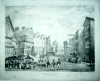
Click on picture above to view more images
How to order
|
| (Code No. 4050)KEERE, Pieter van den.(Antique Map).Northumberland.Date. 1627.London. Humble. George. Map image size 5 x 3 1/4 ins. Map page size 6 x 4 ins. Hand coloured copper engraved miniature map of Northumberland by Van De. Keere, English text on the back of map. Abridged from John Speed's The Theatre of the Empire of Great Britain. vg. Guaranteed to be over 350 years old. |
SOLD.
|
|
(Code No. 4047)CROMWELL, Thomas Kitson.Excursions through England...Kent.. Essex.. Surrey.. Sussex.. Ireland.. Norfolk.. Suffolk.London, Longman, Hurst, Rees, Orme & Brown: 1818[-22] 12mo. [7 x 4 1/2 ins.] 122 Copper engraved topographical view plates, including 8 engraved title pages: - Showing. 5 of Kent, 14 of Essex, 9 of Surrey, 7 of Sussex, 37 of Ireland, (mostly Dublin area), 16 of Norfolk, 13 of Suffolk, and 13 of various other English Counties + Title Pages, some browning throughout + 3 plates damaged. Original half calf gilt, rubbed.
|
SOLD
|
|
(Code No. 4043)London. D. Midwinter. 1719, 1st and only edition. Folio, [ 11 x 16 ins]. No further volumes published due to Harris's death. Portrait frontis + Title, (as above) + pp. iii Dedication + pp. i-iv Preface + pp. ii An Ode in Praise of Kent + pp. i-iv Subscribers + pp. 1-592 Text + pp. 1- xl Index, some browningOriginal full calf, ruled blind stamped. Raised spine bands with elaborate gilt-tooled panels, some wear.This volume lists the histories, natural history, topography and genealogy of the families of Kent, etc
|
SOLD
|
|
(Code No. 4039)
Browne. Tom.
(30 Cartoon Plates.)
In Other People's Shoes.
Date. [c.1910].
London. Lang & Co. 4to, [11 1/2 x 9 ins]. 30 Humorous Cartoon Plates by Tom Browne. Showing, Rudyard Kipling, Baden Powell, William Cody, Lord Kitchener, etc. Original decorated soft covers, hinges split and slight water staining. Rare Copy. £70.00
|
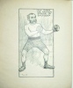
Click on picture above to view more images
How to order
|
|
(Code No. 4030)JOHN.A MAP OF THE SOUTH PART OF THE WEST RIDING OF YORKSHIRE. From the BestAuthorities.London. Richard Gough. 1798. Image size 20 1/2 x 12 3/4 ins, or 520 x 320.5 mm Original copper engraved folding coloured map, nick to engraved border, (1/2 in).
|
SOLD
|
|
(Code No. 4028)England. ca1867. Oblong folio, 17 x 11 ins.Engraved full page cartoon plates of the Parliamentary election for the town of Bradford, Yorkshire in 1867. Between Henry William Ripley and Edward Miall. Henry William Ripley (1814 - 1882) was a partner in Edward Ripley and Son, an important dyeing company based in Bradford, he was on the moderate wing of the Liberal party.Edward Miall (8 May 1809 - 30 April 1881) was an English journalist, apostle of disestablishment, founder of the Liberation Society, universal suffrage, Free trade, direct taxation, and non-intervention with the affairs of other nations, and the abolition of capital punishment.
|
SOLD
|
| (Code No. 4019)Bartholomew. John, (1860-1920)Bartholomew's Survey Atlas of England and Wales Atlas, The Survey Atlas of England and Wales, editor John Bartholomew, published under the patronage of the Royal Geographical Society, by The Edinburgh Geographical Institute, Edinburgh.Edinburgh. 1903. Folio, [18 x 13 ins]. Half title +Title (as above) + Preface + List of plates + Contents + Dedication + Editor's Notes + pp. 1-27 Text + 11 General coloured maps showing the physical features, geology, climatologic, population, and political divisions of the country + 66 Coloured ordnance survey maps covering the whole of England and Wales, scale 2 miles to 1in + 16 Town plans on 6 sheets, drawn, engraved, printed and published by the "The Edinburgh Geographical Institute", maps in very good condition. Original half morocco, lacks spine and covers detached. All edges gilt. Weight 10.5Kg.One of the first bound atlases in this modern format, previously atlases of England and Wales were shown as a series of individual counties. |
SOLD
|
| (Code No. 4018)3 Antique Maps of the British Isles.Richardson's Chart of the British Isles, Showing Railways, Steamship Routes, etc.Richardson's New Map of the British IslesBacon's New Commercial & Reference Chart of the British Isles.London & Manchester. ca1910. 4to, [13 x 8 ins]. 3 Linen backed folding coloured maps. Bacon and 2 by Richardson, (different layouts). Sizes 49 x 76 ins, (in 2 sheets), folding to 13 x 8 ins. Scale 1 in to 15 miles. Original cloth gilt. |
SOLD.
|
| (Code No. 4015)
Smith, Charles.
(2 Antique Maps of Yorkshire).
A New Map of the County of Yorkshire.
Date. 1818, 3rd edn.
London. C. Smith. Page size 25 x 22 ins. Image size 20 1/2 x 17 1/2 ins. 2 Original hand coloured copper engraved double page maps. Sheffield and Wetherby section. and the Bernard Castle to Ripley section, split to folds, one split just affecting engraved border. £50.00
|
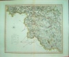
Click on picture above to view more images
How to order
|
|
(Code No. 4005)NASH, Joseph. (1809-1878).(22 [most loose], Large Antique Lithographic Prints ).The Mansions of England in the Olden Time.London. Thomas M'Lean.1839. Folio, [22 x 15ins.] 2 Lithographic titles + Dedication + List of Plates + 22 of 110 lithographic plates by Hullmandel, mostly interiors. Showing :- 5 of Haddow Hall Derbyshire, 5 of Wroxton Abbey Oxon, triplicate & duplicate, Broughton Castle Oxon (duplicate), Charlcote Warwickshire (duplicate), 3 Compton Wynyates, Warwickshire, (one & duplicate), 3 Aston Hall Warwickshire, Gate House, Kenilworth, Warwickshire and Chastleton, Oxon. Original cloth gilt, rubbed.
|
SOLD
|
| (Code No. 4003)
Cox. Thomas.
Magna Britannia et Hibernia Antiqua & Nova: or, a new, exact, and comprehensive survey of the ancient and present state of Great Britain.
Volume 6 only.
Westmoreland, Wiltshire, Worcestershire and Yorkshire.
Date. 1731.
London. E. And R. Nutt. 4to, [8 x 9 ins.] Title (as above) + pp. Text 1-710, very good. Lacks 4 maps. Original reverse full calf with raised spine bands, split to front hinge, still holding firm. £90.00
This volume describes the histories, natural history, topography and genealogy of the families, etc of the counties of Westmoreland, Wiltshire, Worcestershire and Yorkshire.The work, usually attributed to Thomas Cox, was first published in monthly numbers and was afterwards collected into 6 vols, of which the 1st and 2nd volumes came out in 1720 and the remaining 4 vols, from 1724 to 1731.
|
Click on picture above to view more images
How to order
|
|
(Code No. 3996)
DAVISON, Thomas Raffles.
Rambling Sketches. Drawn by T. R. Davison. With notes by William E. A. Axon.
Date. [c.1880].
London & Manchester.The British Architect. Folio, [10 x 15 ins.] 130 Full-page engraved plates, (single sided), of English and Welsh architectural scenes, etc by a roving architect Thomas Raffles Davison. Original quarter morocco, rubbed with some loss. Holding firm.
The scenes are mostly of the southeast and south west of England showing churches inns and half timbered houses with their interiors, etc. £120.00
|
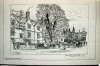
Click on picture above to view more images
How to order
|
|
(Code No. 3986)SMITH. John Warwick [1749-1831].( Large Antique Print.)The Ferry on Windermere Lake.Date. March, 1792.London. R. Blamire. Image size 12 1/4 x 9 1/2 ins. Page size 17 1/2 x 13 ins. Hand coloured copper engraved plate by J. Merigot, two minute wormholes. Not contemporary colouring. Merigot worked in London 1797-98. Also he was a landscape painter. Active in Paris 1772-91 and London by 1797. He published a series of views of Paris, Rome etc.John Smith was based in Warwick but made tours of Derbyshire, Devon and North Wales; he was elected a member of the Old Watercolour Society in 1806.
|
SOLD.
|
|
(Code No. 3977)London. Longman & Co. 1816. Image size 9 1/2 x 6 3/4. Page size 14 x 9 1/2 ins. Original hand coloured aquatint, drawn and engraved by William Daniell, vg. Taken from "A Voyage round Great Britain" No 43, Volume 2. Guaranteed to be over 180 years old. William Daniell commenced a tour in a rowboat around Great Britain in the summers of the years 1813-16 starting and ending at Land's-End in Cornwall. As he went he drew a series of 308 sketches illustrating the character and prominent features of the coast. During the winter times he returned home to produce the watercolours and aquatints.
|
SOLD
|
|
(Code No. 3987)London. R. Sayer & Carrington Bowles. 1766-77. Image size 9 3/4 x 7 3/4 ins. Hand coloured copper engraved folded map, brown mark to bottom border. Not contemporary colouring.
|
SOLD
|
| (Code No. 3973)KNIGHT, Charles.Old England A Pictorial Museum of Regal, Ecclesiastical, Municipal, Baronial, and Popular Antiquities.2 Volumes.Date. [c.1880].London. James Sangster & Co. Folio, [10 1/2 x 14 ins.] Pp 392 & 404, some foxing + 24 Printed colour plates from wood and metal relief blocks, four plates with opposite text page part sticking to colour plate surface + Hundreds of wood engravings. Original half calf with gilt decorated spine bands, rubbing and splits to hinges. Holding firm.Charles Knight's colour printed plate books were the first ever published for the mass market. |
SOLD.
|
|
(Code No. 3971)Wakefield , J.Avalonian Guide, to the of Town Glastonbury, and its Environs.Il Crociato in Egitto [The Crusader in Egypt], An Heroic Opera in two Parts by ROSSI sung at the Haymarket,1825.a Popular History and Description of St Paul's Cathedral. 1825 13th edn.Glastonbury. J. Wakefield. J, Ebers & Nichols, and Son. 1821-25. 12mo.[7 x 4 1/4 ins]. Pp 63, 87, 72, ( 8, Advert for a Diorama, Two Views; Ruins of Holyrood and the Cathedral of Chartres). Text illustrations. Original full calf gilt, top of spine missing. Giacomo Meyerbeer (1791-1864) wrote "Il Crociato in Egitto"; he gained a strange distinction of being the last operatic composer of importance to write for the male soprano voice, ( Castrati ). Glastonbury is situated amidst rivers and streams and was in earlier times, named the Island of Avalon.
|
SOLD.
|
|
(Code No. 3956)
CAMDEN, WILLIAM.
Camden Britannia: Or: A Chorographical Description of the Flourishing Kingdoms of England, Scotland, and Ireland, and the Islands Adjacent....
Volume 1 of 3.
Date. 1789.
London. Printed by John Nichols. folio, [17 x 11ins]. Pp xxii, cxlix, 351, index, lacks some pages + 23 Full page copper engraved plates, (as listed). No Maps. Original full calf gilt, poor. £130.00
|
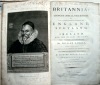
Click on picture above to view more images
How to order
|
|
(Code No. 3954)Camden William.(Antique Map of Northamptonshire).NORTHAMPTONSHIRE. Northamtoniae comitatus.... SAXTON (CHRISTOPHER).London. Printed by F.K.R.Y., 1637. Image size 11 x 14ins. Hand coloured copper engraved map,very good condition,with a watermark in the paper of a large heraldic device and numbered 23 in bottom left corner denoting the 1637 3rd edition. Engraved by William Kip, taken from William Camden's "Britannia".
|
SOLD.
|
|
(Code No. 3930)
Moll, Hermann.
(Antique Map).
The East Riding of Yorkshire.
Date 1724.
London. Size 12 1/2 x 8 1/2 ins. Hand coloured antique map.. Coins struck at York decorate sides of map + scale in miles and 9 line hundreds list. Graduated border. Guaranteed to be over 250 years old. £55.00
|
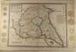
Click on picture above to view more images
How to order
|
|
(Code No. 3931)
Moll, Hermann.
(Antique Map).
The North Riding of Yorkshire.
Date 1724.
London. . Size 12 1/2 x 8 1/2 ins. Hand coloured antique map, nicks to borders just affecting engraved area. Coins struck at York and Roman altars decorate sides of map plus scale in miles and 12 line hundreds list. Graduated border. Guaranteed to be over 250 years old. £45.00
|
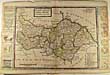
Click on picture above to view more images
How to order
|
|
(Code No, 3923) Travelling on the Liverpool and Manchester Railway.1831. Plate 2 .A Train of the Second Class for outside Passengers. - with three Third Class Carriages behind.London. Raphael Tuck & Sons. 1894. Image size 23 x 7 1/2 ins. Coloured chromolithograph of the Liverpool and Manchester Railway, crease to one corner. The first view shows the locomotive 'Jupiter' hauling first class carriages, illustrating the way in which the gentry were transported in the early years of the railways. The second view shows the locomotive 'North Star' pulling second class carriages in which passengers were exposed to the elements, thus illustrating the differences in standard.
|
SOLD
|
|
(Code No. 3904)Antique Town Plan of South West London.Chelsea, Knightsbridge.London.1866. I Original engraved town plan of London. 2 nicks to blank margins not affecting image. Map sheets sold "1s per sheet coloured" Area shown: - Walham Green , Green Park top right also named houses, roads, parks, etc.
|
SOLD
|
|
(Code No. 3902)RAFFALD, Elizabeth.The Experienced English Housekeeper, For the Use and Ease of Ladies, Housekeepers, Cooks, Etc.London & Manchester. Dean. 1807, [ 5 x 8 ins ]. Pp 344. 100s of receipts, pages 136-137 taped (no loss) + Copper engraved portrait frontis + 2 Copper engraved folding plates + Full page plate. Original full calf gilt, rubbed with surface loss. The Family history (1818-28), of the Cooke Family, contemporary hand written list on front end papers.
|
SOLD
|
| (Code No. 3870)Radcliffe, F.P. Delme.The Noble Science of Fox-Hunting.London. Rudolph Ackermann. 1839. 8vo, [7 x 10 ins]. Pp xii, 327, Two pages with splits, no loss + Steel engraved frontis, foxed + 8 Full page engraved plates, one plate with marginal foxing + Vignette head & tailpieces. Original cloth gilt, new spine retaining original cloth, slight loss. |
SOLD.
|
|
(Code No. 3909)A History of Wiltshire Vol. 5.(Victoria History of the Counties of England).London. Oxford University Press. 1957, 4to. Pp xxi 383. Illustrated throughout. Original cloth gilt, very good. dust jacket, nicks and chipping to edges.
|
SOLD
|
| (Code No. 3859).SAXTON, A. H.Bygone Erdington A brief Record, with Photographs of Men, Places and Events in the Village.Birmingham, A. H. Saxton Limited. 1928, 1st edn. 4to, [8 x 10 ins.] Pp (7). 243. Photographic images throughout, very good condition. Original cloth gilt, slight rubbing and faded spine. Erdington was mentioned in the Domesday Book under the name Hardintone and for much of its history was part of the parish of Aston. After a brief period as an urban district at the end of the 19th century, it was absorbed into the growing city of Birmingham in 1911. |
SOLD.
|
| (Code No.3849.)
Paterson, D, [1739 -1825].
A New and Accurate Description of the all the Direct and Principal Cross Roads in Great Britain...
Date. 1799,12th edn.
London. Longman and Rees. . 8vo, [5 x 7 ins]. Pp lxii, Index to the roads from london + pp.1-759 text.. 2 Folding maps, one damaged. Lacks front cover, Showing all the roads and distances from London and listing place names market days, rivers, inns, country seats and their owners, packet boats etc. £75.00
|
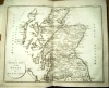
Click on picture above to view more images
How to order
|
| (Code No. 3843.)
Bacon. G. W: Bacon's New Chart of North and Central England and Part of Wales.
Date. [c.1905].
Manchester. G W Bacon & Co. Page size 38 1/2 x 49 ins, folding to 10 x 8 1/2 ins. 26 Sectional coloured folding linen backed map, very good condition. Showing, area motoring speed limits, (average 10 MPH) and area motor registration numbers.
The Motor Car Act 1903, raised the speed limit to 20mph, with a limit of 10mph by the Local Government Boards, and introduced heavy fines for speeding and reckless driving. Fines were also introduced for driving unlicensed vehicles. Original cloth boards, split to hinges. £90.00
|
Click on picture above to view more images
How to order
|
| (Code No. 3835).Mather. William. (of Bedford, Schoolmaster.)The Young Man’s Companion. Or Arithmetick made easie; with plain directions for a young man to attain to read and write true English, and short-hand ...Date. 1702, Nov 16th.London. J.How and others. 12mo, [3 1/2 x 6 ins]. Title, frayed edges, with some loss + pp. (5) To the Reader, frayed edges, with some loss + pp. (13) Contents, slight fraying edges, with some slight loss + pp. (2) Advert + pp. 1-480 Text, slight fraying to edges, with some slight loss + text illustrations & a few full page plates, slight fraying edges, with some slight loss. Original full calf, slight loss. Later calf spine gilt with raised spine bands. Subjects: - sciences, geography, sporting, religion etc. |
SOLD.
|
| (Code No. 3818).
Gay, John.
(Antique Print).
Bumklnet and Blouzelind. Sometimes this Crook drew Hazel Boughs adown, and stuff'd her Apron wide with Nuts so Brown.
Date. [c.1800].
London. Image size 9 x 6 1/2 ins. Page size 10 1/4 x 8 1/4 ins. An original stipple engraving with etched highlights, slight marks to blank margin. Engraved by K, Parsons. Depicting a scene from THE SHEPHERD'S WEEK. IN SIX PASTORALS. Friday; or, the Dirge. By JOHN GAY. (1685-1732), £45.00
|
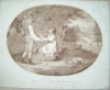
Click on picture above to view more images
How to order
|
| (Code No. 3816).
Byng. [Edward].
(Antique Sporting Print)
A Deer Hunter of the Last Age, in Cap and Jack. Nb, The Coat is Called a Jack.
Date. January 1st 1782.
London. 112 Great Titchfield Street; Image Size 12 x 14 1/2 ins. Page size 12 1/2 x 17 3/4 ins. Original copper engraving by Ryley, C. R. (Charles Reuben), 1752-1798, nicks to edges. The engraving is of Henry Good of Bower Chalk, Wiltshire?. £140.00
|
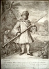
Click on picture above to view more images
How to order
|
|
(Code No. 3815).London. ca1800. Image size 21 1/2 x 15 ins. Page size 24 x 18 ins. Original printed colour stipple engraving with additional original hand-colouring from a painting by T. Barker (British, last quarter 18th century), top blank margin cropped. Laid onto a board. This plate was copied on to pottery figures, Worcester china and was the first of a series based on the same theme, in each case using the well-known Bath character George Kelson as a model.
|
SOLD
|
|
(Code No. 3724).Bath. 1930. Folio, [15 x 10 1/2 ins.] Image sizes 7 x 8 1/2 ins to 17 x 9 1/2 ins, (approx). 95 Titled coloured sporting prints by Arthur Briscoe (8), Gregory Robinson (6), Charles Pears (12), Frank A. Mason (4), Norman Wilkinson (6), Frank Wallace (5), W.R.S. Stott (4) and H.Collier (50). Showing Sailing, Rugby, Tennis, Football, Hunting, Fishing and Cricket. Assembled by Joan Symons. Half morocco gilt. Lacks spine.
|
SOLD
|
|
(Code No. 3711).
Blome, Richard.
( Antique Map.)
Nottinghamshire. A Mapp of Nottingham Shire with its Wapontak By Ric: Blome by his Matjs Comand.
Date. 1673.
London. Tho. Roycroft. Page size 12 1/4 x 14 1/2 ins. Image size 10 x 13 ins. Original copper engraved hand coloured map of Nottinghamshire. Phillip Earl of Chesterfield's coat of arms. Taken from Blome's Britannia Atlas. £95.00
|
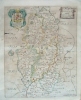
Click on picture above to view more images
How to order
|
| (Code No. 3704).
CRANE. W.
(Antique Print).
The Menai Bridge.
Date. [c.1840].
Chester. Page size 13 1/4 x 10 ins. Image size 11 1/2 x 7 1/2 ins. Original lithographic print of the Menai Bridge. Thomas Telford (1757-1834) started work on the Menai Suspension Bridge in 1819, and it was completed and opened on 30th Jan 1826. He was also responsible for the extensive improvements on the Holyhead to London road. His improvements to the road took 9 hours off the previous journey time. £60.00
|
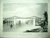
Click on picture above to view more images
How to order
|
| (Code No. 3700.)
DAWSON K . Robert.
[Antique Town Plan]
TAMWORTH in Staffordshire. From the Ordnance Survey.
Date. 1832.
London. Cartwright. Page size 18 x 14 ins. Pp 2. Original engraved lithograph Town Plan, original outline hand colouring with colour coded explanation of boundary of old borough, proposed boundary and boundaries of parishes or town and rivers from the survey by R K . Dawson, Lieut', RE. Scale 2" to 1 Mile, vg. The plan shows manor houses ,parks, roads, woods, industries etc From the Report of Commissioners of Boundaries...England and Wales. £30.00
|
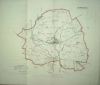
Click on picture above to view more images
How to order
|
| (Code No. 3699).
DAWSON K . Robert.
[Map & Antique Town Plan]:
STAFFORD & STAFFORDSHIRE. From the Ordnance Survey.
Date. 1832.
London. Cartwright. Page sizes 17 x 13.1/2 ins & 14 x 13 1/2 ins. Pp 2 + 2 Original engraved lithographs. Town Plan & map with original outline hand colouring with colour coded explanation of boundary of old borough, proposed boundary and boundaries of parishes or town and rivers from the survey by R K . Dawson, Lieut', RE. Scale 2" to 1 Mile, vg. The plan shows manor houses ,parks, roads, woods, industries etc. From the Report of Commissioners of Boundaries...England and Wales. £45.00
|
Click on picture above to view more images
How to order
|
|
(Code No. 3698).
DAWSON K . Robert.
[2 Antique Town Plans].
WALSALL and The Wards Bridge and St George.Staffordshire. Report of Commissioners of Boundaries.
Date. 1832.
London. Cartwright.Page sizes 17 x 13.1/2ins & 13 1/2 x 13 ins. Pp 3. 2 Original engraved lithograph Town Plans, Original outline hand colouring with colour coded explanation of boundary of old borough, proposed boundary and boundaries of parishes or town and rivers from the survey by R K . Dawson, Lieut', RE. Scale 1" to 1 Mile, vg. One plan shows manor houses, parks, roads, woods, industries and the Wards Bridge and St George with a scale of 4" to 1 Mile etc. From the Ordnance Survey. Report of Commissioners. Boundaries and Wards of Certain Boroughs... England and Wales. £40.00
|
Click on picture above to view more images
How to order
|
|
(Code No. 3695).Whitaker's Almanack with John Heywood's Special supplement for Lancashire. 1911.Manchester. John Heywood. 1911. 8vo, [ 5 x 7 1/2 ins ]. Pp ix, 504 + pp. 1 to 87 Lancashire Supplement + pp. 793 to 972, (as listed), a few pages with creases, vg. Listing members of the Army, Royal Navy, Civil Service, Infantry Regiments, etc. Original trade boards with string tie, rubbed.
|
SOLD
|
|
(Code No. 3694)London. General Post Office. 1911. 8vo, [ 5 1/2 x 8 ins.] Pp 876, (2), Some pages creased with some nicks to edges + folding map, vg. Original trade boards with string tie, rubbed.
|
SOLD
|
|
(Code No. 3693).London. Offices: Fleet Street. 1923. 8vo, [ 5 1/2 x 8 ins ]. Pp [4] 292, 600, [2] + Folding map, vg. Original trade boards with string tie, rubbed.
|
SOLD
|
| (Code No. 3692).Williams, F. S.Our Iron Roads: Their History, Constuction and Administation.London. Bemrose & Sons. 1884, 5th edn. 8vo, [ 8 1/2 x 9 ins.] Pp 520. Illustrated throughout. Original decorated cloth gilt, slight rubbing and slight split to top of front hinge. All edges gilt. |
SOLD.
|
|
(Code No. 3691).London. Henry Blacklock & Co. Ltd., 7th mo. (July), 1916. No.996. Pp lxv, 1, 1a, 1-1210, (2), some pages creased and map damaged. Original trade boards with string tie, rubbed and front hinge split.
|
SOLD
|
|
(Code No. 3689).
ROLT, L.T.C.
Red for Danger: a History of Railway Accidents and Railway Safety.
Date. 1956.
London: The Bodley Head, 8vo. Pp 225. Dust wrapper, slight nicks to edges, vg. £25.00
|
Click on picture above to view more images
How to order
|
| (Code No. 3681).Baily's Magazine. Sports and Pastimes.8 Volumes.Volumes - 30, 57, 58, 59, 60, 61, 62 and 64.London. 1877, 1892 - 94 and July - Dec 1895. 8vo [ 223 x 145 mm ]. Beautiful steel engraved plates and other illustrations , including Angling, Cricket, Hunting, Horse racing,Golf, Yachting etc.Contemporary half calf gilt, marbled boards,marbled edges, one hinge split, some scuffing. vg. Vol 30, raised spine bands gilt, Slight damage to title label, minor scuffing, vg. |
SOLD.
|
|
(Code No. 3678).
Macphee. G.G - W, Naismith - W. N. Ling & J A. Parker.
5 Volumes.
Ben Nevis. -1936, The Islands of Scotland, (Excluding Skye) - 1934, New Edn, General Guide-Book -1933, revised, The Northern Highlands -1936, The Western Highlands-1947 3rd edn.
Edinburgh, The Scottish Mountaineering Club Guide. 8vo. Pp 101, 100, 120 xl, 135 & 136. illustrations, photogravures large folding plates & diagrams. Original cloth gilt, Dust wrappers, slight nicks with slight loss. £100.00
|
Click on picture above to view more images
How to order
|
|
(Code No. 3540).
Peile. Solomon. Charles Frederick, Lieut.
Lawn Tennis as a Game of Skill. With Latest Revised Laws as Played by the Best Clubs.
Date. 1885, 2nd English edn.
London. William Blackwood. 8vo, [4 1/2 x 7 ins.] Half title + Title + Contents + 1-86 text, slight water staining to end papers. Ink dedication on front past down. Original decorated boards, rubbed. £300.00
|

Click on picture above to view more images
How to order
|
| (Code No. 3675.)Scrap Album.England. 1830-47. 4to, [10 x 12 ins.] 156 Steel and lithographic black & white and original hand coloured engraved plates, (Complete), that Includes 75 uncoloured scenes and views + 30 Beautiful ladies and children fashion and portrait engraved plates + 21 engraved plates of People,etc + 9 Original hand coloured beautiful ladies fashion and portrait engraved plates + 6 Original hand coloured engraved view plates + 8 Pencil sketches + 8 ladies hand coloured fashion plates, (loose). Full morocco gilt with a glazed scene on upper and lower covers, rubbed. All edges gilt. FINE COPY. |
SOLD.
|
|
(Code No. 3671).ca1870. 4to, [10 x 11 ins.] Albumen photographs by an unknown and photographs by G.W.W and others of English scenes. Image sizes 6 1/2 x 8 1/4 ins to 3 1/2 x 2 1/2. Original pen and ink sketch surrounding the photographic images. Original gilt decorated cloth, split to hinges and rubbing.
|
SOLD
|
|
(Code No. 3669).London. Printing & Publishing. ca1850. 4to, [11 x 8 ins]. Pp 392, 319, 432 iv, 338, 384 and 378 xxix + Title pages +2 Additional steel engraved vignette titles + 49 Portraits +74 Steel engraved plates + 2 Plans + 7 Maps with outline hand colour by John Tallis. Original half calf, slight chipping to top of spine and slight rubbing.
|
SOLD
|
|
(Code No. 3644)
Bacon. G, W.
(2 Folding Wall Maps, North & South).
Map of England & Wales Showing Railways, Roads, and Distances.
Date. [c.1920].
Oxford. G W, Bacon, Chart Publishing Co., Sizes 40 x 25 ins each. Folding to 7 x 10 ins. 2 Coloured, sectional linen backed wall maps of the British Isles with an inset map of "Main Roads out of London", one section with split to hinge. Also showing Railway Company's lines with abbreviation key, Principal racecourses, Aerodromes & Seaplane stations: R.A.F and Civil.. Scale 1in = 8 mls, Original cloth gilt, slight marks. £40.00
|
Click on picture above to view more images
How to order
|
|
(Code No. 3641)
Gill. Thomas,
Comprising the History and Antiquities of Easingwold and its Neighbourhood.
Date. 1852 1st edn.
London & Easingwold. Size 6 x 9 ins. Pp xiii, 456 + Lithograph frontis + 13 Lithograph view plates including plan + Steel engraved view, all with tissue guards + text illustrations , some foxing. Modern half calf gilt, vg. £65.00
|
Click on picture above to view more images
How to order
|
| (Code No. 3639)
Victorian Scrap Album.
Tour through England, Wales and Europe. Date 1855 to 1871.
Date.1855 - 1871.
Folio [11 x 13 ins]. Approx 38 groups of Dried Flowers pasted on to each page, some full page, interspersed with approx 62 steel engraved views. Areas shown, Chester, Liverpool, Lake District, Tynmouth, Gloucester, Dover, Folkestone, etc. 9 of Wales, 30 views of the North of England, 22 views of the South of England and 8 loose contemporary photographs all with tissue guards. Half morocco gilt with raised spine bands, slight scuffing. The first tour started April 1855, second tour a year later, with a slight reference to a tour in 1871. As a memento, the unnamed tourist assembled the flowers, grasses and steel engraved views of each area visited, with ink annotations giving place name and date of visit. £180.00
|
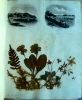
Click on picture above to view more images
How to order
|
|
(Code No. 3633)Examples of Modern British Art. Forty Masterpieces by the Most Celebrated Painters of the English School.....London. Bickers and Son. 1877. Folio, 11 x 15 ins. Half title + Title + Preface + Plate List + 40 Plates, reproduced by the permanent Woodbury process with a separate text index accompanying each plate, (as listed). All text and plates loose, (perished gutta - percha binding). Artists, William Hogarth, Richard Wilson, Joshua Reynolds, Thomas Gainsborough, Benjamin West, George Moreland, John Martin, Thomas Sydney Cooper, and Edwin Landseer, etc. Original gilt decorated cloth, slight chipping and marks.
|
SOLD.
|
|
(Code No. 3623)
14 Photographs of the Building of the Liverpool Docks. (Loose).
Date. [c.1880].
Liverpool. ca1880. Image size (Approx), 10 3/4 x 8 1/4 ins. Page Size (Approx), 13 1/2 x 10 1/2 ins. 14 Photographs of the Liverpool Docks pasted on to thick card on both sides of the page. Shown:- Langdon Dock, Lighthouse, Alexander Dock, Engine House Langdon Dock, Canada Basin, Dock Entrance, Graving Dock Langdon, Engine House Langdon Dock, Foremen South Dock, Masonry of Dock Entrance, Shed Alexander Dock, Dock Wall Alexander Dock, Commencement of Herculaneum Dock, Herculaneum Dock & Petroleum Shore. £400.00
|
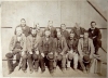
Click on picture above to view more images
How to order
|
|
(Code No. 3626)
(Coaching prints).
Two Sporting Prints.
Date. [c.1840] & [c.1900].
London. Page sizes, 25 x 18 1/2 ins + 26 x 20 ins (hunting print). Hand coloured aquatint coaching print, cropped & marginal nicks + Coloured print (chromolithographic) hunting print, cropped & marginal nick. £40.00
|
Click on picture above to view more images
How to order
|
|
(Code No. 3618)Image sizes 3 1/2 x 4 x 1/2 ins to 11 x 8 ins (approx). 118 Photographs, ( Frith & Co , J V. & G.W.W), pasted into an album. Approx, 59 UK Cathedrals, Abbeys, ( interior and exterior ). Approx, 11, Continental Europe. The rest, UK street scenes, towns, etc. Modern half calf gilt.
|
SOLD
|
|
(Code No. 3614)London.Slater, Fleet St. (1846). Image size13 1/2 x 8 1/4 ins.ins. Page size 16 x 11 ins. Original hand coloured steel engraved map, with vignette view of "Ashborn Church." Showing, distances from London, villages, hundreds ( indicated by numbers ). Top centre, a star compass indicator. The adjacent counties are coloured in outline.
|
SOLD
|
|
(Code No. 3613)
(Antique Map).
Wallis, J.
Map of Derbyshire.
Date. 1812.
London. S.A.Oddy. Image size 7 x 10 1/2 ins. Page size 15 1/4 x 10 ins. Original hand coloured copper engraved map, slight off setting. Showing, distances from London, villages, hundreds (indicated by numbers, and colours). Title in a hatched lozenge crossing a star compass indicator. £35.00
|
Click on picture above to view more images
How to order
|
| (Code No. 3612)Smith, Charles.A New Map of the County of Derby Divided into Hundreds.Date. 1818, 3rd edn.London. C, Smith.Image size 17 1/2 x 19 1/4 ins. Page size, 20 x 24 1/2 ins. Original hand coloured copper engraved folded, (as published) map. A nicely engraved map, coloured in hundreds, showing towns ( with their distances from London), The main roads are carried across the county boundary and their destination given. It is the first map of the county to be based on the meridian of Greenwich. |
SOLD.
|
|
(Code No. 3611)London. John Cary. 1811, Apr 28th, 3rd edn. Image size 18 1/2 x 20 1/4 ins. Page size, 21 x 25 1/2 ins. Original hand coloured copper engraved folded (as published) map, nicely engraved , coloured in hundreds, showing towns The main roads are carried across the county boundary and their destination given. The map is based on the meridian of Greenwich. The map's lay out has a remarkable resemblance to the Charles Smith's map of 1801, Cary unfortunately also copied some of Smith's minor errors.
|
SOLD
|
|
(Code No. 3610)London. C, Smith. Jan 6th, 1801, 1st edn. Image size 17 1/2 x 19 1/4 ins. Page size, 20 x 24 1/2 ins. Original hand coloured copper engraved folded, (as published) map. A nicely engraved map, coloured in hundreds, showing towns ( with their distances from London), The main roads are carried across the county boundary and their destination given. It is the first map of the county to be based on the meridian of Greenwich.
|
SOLD
|
|
(Code No. 3609)BYRNE, WILLIAM & Thomas Hearne.(15 Antique Prints of Derbyshire.)Britannia Depicta; A Series of Views . . . in Great Britain.London. Caddel & Davies. 1817. Page Size 17 x 11 1/2 ins. Image size 9 x 6 ins. Beautiful copper engraved view of Derbyshire, (Loose), from original drawings by J.Farington R.A, J.W. Smith, J.M W. Turner, &c. Engraved by F.H. Hays and others. Taken from "Britannia Depicta" this being the Derbyshire section.
|
SOLD
|
|
(Code No. 2452)Aldin Cecil. (Antique Chromolithographic Print).Chess Players. SIGNED IN PENCIL BY CECIL ALDIN in bottom left hand blank margin. Size 27 x 19 ins. Image size 15 x 24 ins. Entered at Stationers' Hall - Copyright - Entered According to Act of Congress in the Year 1901, by Lawrence & Bullen Ltd in the Office of Librarian of Congress, at Washington. and Copyright 1901. Published by Lawrence & Bullen Ltd 16 Henrietta Street, Covent Garden, London, WC. Contemporary Mount. Guaranteed to be 100 years old.
|
SOLD.
|
|
(Code No. 3553)Britton John & W. Edward Brayley.Bedfordshire + Berkshire + Buckinghamshire.Beauties of England and Wales. Volume 1.London. Vernor and Hood, 8vo. 1801. Pp.409 (8) index + Engraved title + 21 Copper engraved plates, slight foxing & damp stain to some corners. Original half calf, rubbed and split to hinges. Binding still holding firm. Between the years 1801 and 1818 the authors undertook a topographical study of England and Wales, travelling many thousand of miles on foot, gathering information for their "Beauties of England and Wales", publishing at regular intervals, county volumes in alphabetical order.
|
SOLD.
|
| (Code No. 3555)
Britton John & W. Edward Brayley.
Cumberland + Isle of Man + Derbyshire.
Beauties of England and Wales.
Volume 3.
Date. 1802.
London. Vernor and Hood, 8vo. Pp. 552 (20) index + Engraved title + 28 Copper engraved plates, slight foxing & damp stain to some corners. Original half calf, rubbed and split to hinges. Binding still holding firm. Between the years 1801 and 1818 the authors undertook a topographical study of England and Wales, travelling many thousand of miles on foot, gathering information for their "Beauties of England and Wales", publishing at regular intervals, county volumes in alphabetical order. £45.00
|
Click on picture above to view more images
How to order
|
|
(Code No. 3556)
London. Vernor and Hood, 8vo. 1808. Pp. 612 (39) index + Engraved title, foxing + 11 Copper engraved plates, slight foxing. Original half calf, rubbed and split to hinges. Binding still holding firm. Between the years 1801 and 1818 the authors undertook a topographical study of England and Wales, travelling many thousand of miles on foot, gathering information for their "Beauties of England and Wales", publishing at regular intervals, county volumes in alphabetical order.
|
SOLD
|
|
(Code No. 3552)London. Vernor and Hood, 8vo. 1803. Pp. 736 (26) index + Engraved title + 31 Copper engraved plates, slight foxing & damp stain to some corners. Original half calf, rubbed and split to hinges. Binding still holding firm.Between the years 1801 and 1818 the authors undertook a topographical study of England and Wales, travelling many thousand of miles on foot, gathering information for their "Beauties of England and Wales", publishing at regular intervals, county volumes in alphabetical order.
|
SOLD
|
|
(Code No. 3554)London. Vernor and Hood, 8vo. 1810. Pp.368,184, 239, (37 index), very good + Engraved title, waterstaining + 21 Copper engraved plates, slight foxing & damp stain to some corners. Original half calf, rubbed and split to hinges. Binding still holding firm. Between the years 1801 and 1818 the authors undertook a topographical study of England and Wales, travelling many thousand of miles on foot, gathering information for their "Beauties of England and Wales", publishing at regular intervals, county volumes in alphabetical order.
|
SOLD
|
|
(Code No. 3551)London. Vernor and Hood, 8vo. 1807. Pp. 808 (31) index + Engraved title + 17 Copper engraved plates, slight foxing. Original half calf, rubbed and split to hinges. Binding still holding firm. Between the years 1801 and 1818 the authors undertook a topographical study of England and Wales, travelling many thousand of miles on foot, gathering information for their "Beauties of England and Wales", publishing at regular intervals, county volumes in alphabetical order.
|
SOLD
|
|
(Code No. 3550)Pevsner, Nikolaus. BUILDINGS OF ENGLAND.3 Volumes.Buckinghamshire + Suffolk + Oxfordshire.London. Penguin Books. 8vo. Buckinghamshire (ISBN: 0140710191),D/j, very good + Suffolk (ISBN: 0140710205),D/j, very good + Oxfordshire, (ISBN: 0140710450), D/j, very good.
|
SOLD
|
|
(Code No. 3549)Pevsner, Nikolaus. BUILDINGS OF ENGLAND.3 Volumes.Cambridgeshire + Norfolk, Norwich & North-East + Norfolk North-West & South.London. Penguin Books & Yale. 8vo. Cambridgeshire (ISBN: 0300095864), unopened still in its sealed plastic cover + North-East Norfolk and Norwich (ISBN: 014071023X), unopened still in its sealed plastic cover + North-West & South Norfolk, (ISBN: 0140710248), D/j, very good.
|
SOLD
|
|
(Code No. 3548)Pevsner, Nikolaus. BUILDINGS OF ENGLAND.3 Volumes.GLOUCESTERSHIRE, The Cotswolds. + GLOUCESTERSHIRE, The Vale and the Forest of Dean + HEREFORDSHIRE.London. Penguin Books, 8vo. Gloucestershire, ISBN: 014071040X, D/j slight nick to top of spine + Gloucestershire, ISBN: 0140710418,D/j , very good + Herefordshire, ISBN: 0140710256, D/j slight nick to top of spine.
|
SOLD
|
|
(Code No. 3547)Pevsner, Nikolaus. BUILDINGS OF ENGLAND.3 Volumes.South Lancashire + Cheshire + Shropshire.London. Penguin Books, 8vo. South Lancashire, ISBN: 0140710361, D/jvery good + Cheshire, ISBN: 0140710426, D/j, Small piece missing from top of spine + Shropshire, ISBN: 0140710167, D/j ,very good.
|
SOLD.
|
|
(Code No. 3546)Nikolaus Pevsner, (ed). & Hubbard Edward. (BUILDINGS OF WALES).2 Volumes.POWYS, Montgomeryshire, Radnorshire & Breconshire + CLWYD, Denbighshire and Flintshire.London. Penguin Books, University of Wales Press. 8vo. Powys, (ISBN: 0300096275), D/j very good + Clwyd, (ISBN 0140710515), D/j, slight nick to top of spine.
|
SOLD
|
|
(Code No. 3545)Pevsner, Nicholas. BUILDINGS OF ENGLAND.4 Volumes.Yorkshire The North Riding + West Riding, York + East Riding + County Durham.London: Penguin Books Ltd and Yale University Press (2), 8vo. North Riding ISBN: (0300096658),unopened still in its sealed plastic cover + West Riding, (0300096623), unopened still in its sealed plastic cover + York & East Riding, ISBN: 0140710434, D/j, very good + County Durham, ISBN: 0140710094. D/j price clipped,
|
SOLD.
|
|
(Code No. 3528)London. Carrington Bowles. Image size 20 1/2 x 13 1/2 ins. ca1770. Original hand coloured copper engraved map. Numerous descriptive notes are scattered around the map, nicks to blank margins, lacks blank margin to top of image. Image area very good.
|
SOLD
|
|
(Code No. 3527)Speed [John] (Antique Map.)RUTLANDSHIRE,
London. Sudbury & Humble. Image size approx 380 x 510mm (approx 15 x 20 inches).1 611 1st edn. Copper engraved map. Inset town plan of Stanford & Oukham. Title, Coat of arms imprints and scale within elaborate cartouches. Compass indicator. Latin text on verso. Taken from Speed's "The Theatre of the Empire of Great Britain". Two worm holes, cropped to right side and slight surface loss to bottom centre. Guaranteed to be over 350 years old. |
SOLD
|
|
(Code No. 3521)
London. H. Bohn. Page size 11 x 8 1/2 ins. 1847, reprint of the 1791 edn. Engraved mezzotint map by G.M, showing Punch riding on a dolphin contrived to represent England and Wales.
|
SOLD
|
| (Code No. 3513)
Boydell. J.
( Antique Print )
A View of Matlock Bath, in Derby Shire.
Date. 1749.
London. J. Boydell. Image size 17 1/2 x 11 1/4 ins. Page size 21 1/2 x 14 ins. Original copper engraved plate, drawn and engraved by J. Boydell, vg. Guaranteed to be over 250 years old. £200.00
|
Click on picture above to view more images
How to order
|
|
(Code No. 3511). Colonel.Large EarlyOrdnanceSurvey.Map.Cheshire, Lancashire,Yorkshire and Lincolnshire.London.Ordnance Map Office. Approx size 91 1/2 x 49 inches. 1840-43, reprint of the 1824 edition. 28 Loose linen backed maps that includes 24 sections of approx size, 12 x 14ins each & 4 sections, 12 x 7 ins each. Numbered in ink on the back of each map section, 1 to 28 in a contemporary hand. Piano key border. Scale, 1 inch to a statute mile. Areas- Congleton (Cheshire) S/W. Worsthorne near Burnley, (Lancashire), N/W. Kingston on Hull, & River Humber, (Yorkshire), N/E. South Horncastle, (Lincolnshire), S/E.
|
SOLD
|
|
(Code No. 3468)London. Bassett & Chiswell, 1676. Image size approx 380 x 510mm (approx 15 x 20 inches). Hand coloured copper engraved map. Inset views of Denbigh. Title, Coat of arms imprint and scale within elaborate cartouches. Compass rose. Taken from Speed's "The Theatre of the Empire of Great Britain" Water staining to blank margins.Guaranteed to be over 300 years old.
|
SOLD
|
| (Code No. 3466)
Walmesley.
( Antique Coloured Print )
Near Mellach Court, South Wales.
Date. Jan 8th 1810.
London. J. Murphy, Fitzroy Square. Page size 20 x 14 ins. Image size 12 x 8 1/2 ins. Original hand coloured aquatint engraving by Hill from the original drawings by Walmesley. Guaranteed to be over 150 years old. £88.00
|

Click on picture above to view more images
How to order
|
|
(Code No. 3464)Pugh. Edward.( 2 Large Antique Prints )
"This View of Bathafern, from Coedmarchan Rocks" & "This View of Llanfwrog. Ruthin and Llanbedr"London. E. Pugh, Great Queen's Street. Image sizes 12 x 9 ins. July 1794. Original aquatint print by W.Ellis from the original drawings by E. Pugh, nicks to blank margins and creasing. Guaranteed to be over 200 years old.
|
SOLD
|
| (Code No. 3463)
Wood. J G.
(5 Large Antique Aquatint Prints)
View of Llangollen Vale" "Part of Dyffwys near Corwen" "The Village of LLangollen from Craig Y Gath" "Llangollen Bridge" and "A Fall on the Dee near Llangollen.
Date. Oct, 1793.
London. J.G. Woods, New Bond Street. Image sizes approx 12 x 9 ins. Original aquatint print by M.C.Prestel from the original drawings by J.G. Woods. Guaranteed to be over 200 years old. Very rare. £500.00
|
Click on picture above to view more images
How to order
|
|
(Code No. 3460)
Anon.
(Antique Print)
St. Winefride's Well, Holywell, North Wales.
Date. [c.1780].
London. R. Sayer, Fleet Street. Image size 15 3/4 x 9 1/4 ins. Original hand coloured copper engraved print. English and French text. Guaranteed to be over 200 years old. £90.00
|
Click on picture above to view more images
How to order
|
|
Code No 3456.London: Cassell and Company, Limited. 4to. ca1870. Special edition.. Pp 320 approx per volume. Illustrated with steel and woodcut full page and text engravings throughout, light foxing. Original gilt decorated cloth., slight rubbing. Weight of books approx 6kg.
|
SOLD
|
|
(Code No. 3451)
CARY, J.
(2 Antique Maps + TEXT)
Maps of CUMBERLAND & ROMAN or PICTS WALLS. from the best Authorities.
Date. 26th March 1805.
London. John Stochdale. Folio [21 1/2 x 15 1/2 ins & 11 x 17 3/4 ins, image sizes 20 x 14 & 10 x 16ins,] Pp 421 to 487, including 8 full page plates+ 2 Copper engraved folding maps engraved by John Cary taken from Camden's Britannia. Maps showing town, village,hundreds (indicated by numbers), meres, turnpike Elaborate star compass indicator. "Reference to the Hundreds" and scale and title. No covers. Guaranteed to be over 150 years old. £100.00
|
Click on picture above to view more images
How to order
|
|
(Code No. 3446)Hunt, C & G. (Antique Coaching Print)"The Age, Brighton Coach at the Bull and Mouth, Regent Circus Piccadilly".London. J. Moore. Page size 19 1/2 x 15 ins. Image size 16 1/4 x 11 3/4 ins. 1829. Superb hand coloured aquatint, engraved by G & C Hunt from the original drawing by E.F. Lambert, with wide margins, on wove paper, slight water staining to bottom of blank margin. The hand colouring is of the highest quality.
|
SOLD
|
|
(Code No. 3445)( Antique Print )"A North West "London. J. Boydell. 1749. Image size 17 x 11 ins. Page size 21 1/2 x 16 ins. Original copper engraved plate, drawn and engraved by J. Boydell, vg. Guaranteed to be over 250 years old.
|
SOLD
|
|
(Code No. 3441)
London. J Deeley. Image size 19 1/2 x 14 ins. Page size 22 1/2 x 18 ins. March, 1812. Original hand coloured aquatint, some nicks to blank margins and 5 foxing spots.Guaranteed to be over 150 years old.
|
SOLD
|
| (Code No. 3370) Image size 18 x 13 ins. Page size 20 1/2 x 15 1/2 ins. ca1600. Original copper engraved coloured map. Repairs on back to edges. Some printer's creases & marks to blank margins. Superb ornate cartouche, watered-silk rendering of the sea. Separate scale, |
SOLD
|
|
(Code No. 3355) Bacon. G. W(Antique Map) Bacon's Popular Map of England and Wales from the Ordnance Survey. London. G. W. Bacon & Co. Size 25 1/2 x 34 1/2 ins, folding to 7 1/2 x 5 ins. 1876. Beautiful hand coloured sectional linen backed map engraved on steel by E. Weller, Arranged around the map area there are 8 vignette town plans & their environs. London, Birmingham, Manchester, Sheffield, Leeds, Liverpool, Durham and Newcastle. Scale 12 miles to the inch. Coloured coded listings of railways, canals, County boundaries and Parliamentary Divisions. Original blind stamped cloth ,vg.
|
SOLD.
|
| (Code No. 3353) Cameron, J. Colonel [1836-1905] & James, Henry, Sir, [1803-1877]. Index to the Ordnance Survey of YORKSHIRE. Engraved at the Ordnance Survey Office, Southampton under the direction of Colonel J. Cameron, R.E. ca1860. 32 sectional linen backed steel engraved map, part outline colour. Size 27 x 40 ins folding to 7 x 5 1/2ins. Showing the listing of the Ridings their Parishes, parks, railways, roads, boundaries, marches etc.Original cloth boards, slight marks. |
SOLD.
|
|
(Code No. 2466).Saxton. Christophorus.( Antique Map )Nottinghamshire. ( Notingamiae Comitatus Olim pars Coritanorum).Date. 1610 or 1637 edition.London. Size 15 x 14 ins. Image size 12 1/2 x 10 1/2 ins. Center folding double page copper engraved map of Nottinghamshire engraved by William Kip. Ornamental strap work cartouche to title and separate distance scale. From the 2nd or 3rd edition of Camden's Britannia, ( reverse of map is blank ). Good colour and condition.
|
SOLD.
|
| (Code No. 3304)The Times' Contour Motoring Map of ENGLAND and WALES in 10 Sheets, Scale 3 Miles to 1 inch.London. Geographia Ltd. No date, ca1930. De luxe edition. Approx size 395 x 310 ins, folding to approx 10 x 15 1/2 ins. Large- scale linen backed 80 sectional coloured contour motoring map by Alexander Gross, some slight marks, vg. Divided into 10 mile squares. Roads, footpaths, stations, golf cources etc, coloured coded. Original slipcase with strap handle, lock and rear perspex window, some ware, no loss. Front paper title label, part missing. |
SOLD
|
|
(Code No. 3349) London. T. Kitchin. Image size 11/4 x 71/2 ins. Page size 15 x 10 ins.1780. Original folding copper engraved map with outline hand colouring, Decorative title cartouche includes fishing boat and barrels etc. Graduated border, scale, 30 miles to the Inch.
|
SOLD
|
|
(Code No. 3273) Boydell. J.
( Antique Print )
"A North West View of Rhuddlan Castle Flint "
Date. 1744.
London. J. Boydell. Image size 17 x 11 ins. Page size 22 1/2 x 16 1/2 ins. Original copper engraved print drawn and engraved by J. Boydell, vg. £180.00
|
Click on picture above to view more images
How to order
|
|
(Code No. 3229DP)Buck. Samuel and Nathaniel.(Guaranteed Antique Print)The North-West Prospect of MAIDSTONE, in the County of Kent.Date. 1738,1st edn ,London. (not the later 18th Century or early 19th Century reprint ). Page size 32 x 31 1/2 ins. This panoramic copper engraving, of Maidstone is by the most important and best 18th century topographical artists, the brothers, Samuel and Nathaniel Buck who drew and engraved a series of panoramas and views of English and Welsh towns, castles and abbeys etc. They published approx' 420 of the single page engraved views and by far the most rare and desirable, 83 double page engraved town panoramas, this being one, showing Coat of Arms, River Medway, Maidstone's schools, houses, streets, prison, churches etc the text to base of image, lists with a numbered key, the important locations plus the town history.(Split to bottom of centre fold, strengthened on back )
|
SOLD.
|
|
(Code No. 3335)Covens, J. & Mortier, C.( Antique Print )The Landing of William of Orange at Brixham, 5th of November 1688. "Vertrek van S.K.H. Na Engeland" Date. [c.1725]Amsterdam. Cóvens & Mortier, Page size 23 1/2 x 18 1/2 1ns. Original folding copper engraved plate by R. de Hooge. French & Dutch text, very good condition. The view is in two parts. Named war ships laying at anchor, and the provisions, cattle, horses etc, being brought ashore, The locations of Exeter, Brixham and Taunton are indicated, The print is guaranteed to be over 250 years old. William of Orange landed in Brixham with his Dutch army, on 5 November 1688, during the Glorious Revolution and issued his famous declaration "The Liberties of England and The Protestant Religion I Will Maintain". Many local people still have Dutch surnames, being direct descendants of soldiers in that army.
|
SOLD.
|
|
(Code No 3230DP) London. March 26th 1739,1st edn, (not the later 18th Century or early 19th Century reprint ). Page size 32 x 31 1/2 ins. This panoramic copper engraving of Woolwich is by the most important and best 18th century topographical artists, the brothers, Samuel and Nathaniel Buck who drew and engraved a series of panoramas and views of English and Welsh towns, castles and abbeys etc. They published approx' 420 of the single page engraved views and by far the most rare and desirable, 83 double page engraved town panoramas, this being one, showing ships, Woolwich's landing places, dock-yard and the River Thames etc. The text to base of image, lists with a numbered key, the important locations plus the town history.(Split to text area, strengthened on back )
|
SOLD
|
|
(Code No.3228. DP)Buck. Samuel and Nathaniel.(Guaranteed Antique Print)The North-West Prospect of SHEEERNESS, in the County of Kent .Date. March 26th 1739, 1st edn,London. (not the later 18th Century or early 19th Century reprint ). Page size 32 x 31 1/2 ins. This panoramic copper engraving of Sheerness is by the most important and best 18th century topographical artists, the brothers, Samuel and Nathaniel Buck who drew and engraved a series of panoramas and views of English and Welsh towns, castles and abbeys etc. They published approx' 420 of the single page engraved views and by far the most rare and desirable, 83 double page engraved town panoramas, this being one, showing the River Medway, ships, the Nore, the Shore House, landing places and the Minster etc.(Split to bottom of centre fold, strengthened on back plus a crease to centre fold area.)
|
SOLD.
|
|
(Code No. 2702)Buck, Samuel and Nathaniel.(Guaranteed Antique Print)South Prospect of READING. Berkshire.Date. 1734.London. Page size approx. 860mm x 450mm or 34 x 18 ins. This panoramic copper engraving of READING is by the most important and best 18th century topographical artists, the brothers, Samuel and Nathaniel Buck who drew and engraved a series of panoramas and views of English and Welsh towns, castles and abbeys etc. They published approx' 420 of the single page engraved views and by far the most rare and desirable, 83 double page engraved town panoramas, this being one, showing ships, The text to base of image, lists with a numbered key, the important locations plus the town history. Minor splits to blank margins.
|
SOLD.
|
|
(Code No. 3250)Tallis. John.PLYMOUTH, UK.(Guaranteed Antique Town Plan)..Date. [c.1850]London. Page size 15 x 11 ins. Original single page steel engraved Town Plan of PLYMOUTH drawn and engraved by J. Watkins, the plan drawnby J. Rapkin + 3 vignette views of Plymouth Sound, Plymouth and The Column. Slight foxing to border.
|
SOLD.
|
| (Code No. 3252)Tallis. John. BRADFORD UK.London. ca1850. Page size 15 x 11 ins. Original single page steel engraved Town Plan of BRADFORD, Yorkshire, drawn and engraved by J. Watkins, the plan drawn by J. Rapkin + 7 vignette views of RC Church, St Peters Church, Cemetery, Imfirmary, Terminus of the Bradford and Halifax Railway, Airdale Colege and St George's Hall, Vg. |
SOLD
|
|
(Code No. 3298)From the Weekly Dispatch Atlas.ENGLAND and WALES in TWO PARTS, (NORTH & SOUTH )(Large-Scale Antique Map).Date. [c.1860].London. Day & Son. Page sizes, (approx), 24 x 18 ins. 2 LARGE FOLDING HAND COLOURED LITHOGRAPHIC MAPS Engraved by E. Weller, very good condition.
|
SOLD.
|
|
(Code No. 3297)From the Weekly Dispatch Atlas.THE BRITISH ISLES.( Large-Scale Antique Map)Date. [c.1860].London. Day & Son. Page size, (approx), 24 x 18 ins. LARGE FOLDING HAND COLOURED LITHOGRAPHIC MAP Engraved by B.R. Davies, 2 marginal nicks not affecting engraving.
|
SOLD.
|
| (Code No. 2497) London. Tho, Roycroft. 1676 1st Edition. Folio [9 x 13 1/2 ins]. Pp (10), 582, (5) + 4 Full page illus + Many text illus, druids and large armorial shields etc + One double page map of Europe + One extra folding plate. Early 19th century full calf gilt, slight scuffing to edges. Gilt-tooled spine panels with raised spine bands gilt, slight scuffing to top and bottom of spine,(no loss). Marbled edges and end papers. |
SOLD
|
| (Code No. 2639) Amsterdam, 1606. Image size 35.5 x 45.5cm Hand coloured copper engraved map of North Scotland by Gerard Mercator. Superb ornate cartouche, watered-silk rendering of the sea. Separate scale, (Scottish miles) Very Good condition. |
SOLD
|
|
Return to top
|
|