SITE CONTENT
Antique Maps & Prints
Britain
Antique Maps - World
Antique Books
Cartographers
Early Prints
Other Stock
|
| Books & Maps of the Middle East |
Images |
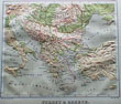
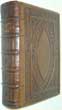
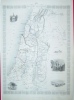
(Code No. 6739)
Bevan, G. Phillips.
(Antique Map).
Relief Map of TURKEY & GREECE.
Date. [c.1885].
London. Swan, Sonnenschein & Allan. Page size, approx [12 x 11 ins.] . A coloured map with accompanying text, embossed to show physical geography in 3 dimensions, very good condition.......... £35.00 |
Click on picture above to view more images
How to order |
(Code No. 6713)SPEED, John. (1552-1629).(Antique Map).The Kingdome of PERSIA with the cheef Citties and Habites described.Date. 1676.London: Thomas Bassett & Richard Chiswell. Page size [21 1/2 x 17ins]. . Original copper engraved framed map, Glass picture frame front and back of map. Strengthened to back of map, top and bottom of centre fold, nick to left side just affecting engraved image. Showing: - Title cartouche, side vignettes of Isfahan, Hormuz, Tabris, and Tehran also Illustrating Persian nobleman, citizen, countryman......
|
SOLD.
|
(Code No. 6616)Salaman, Malcolm C & Norbertine von BRESSLERN-ROTH.Bresslern Roth.Date. 1930, Series:London : The Studio ; New York : W. E. Rudge. 4to, [12 x 9 3/ins]. [Masters of the Colour Print. no. 7. Pp. 6 + 8 Coloured prints of a North Africa tour & natural history, very good condition. Original printed boards, Spine with loss.Norbertine of Bresslern-Roth (1891 - 1978) was an Austrian painter and graphic designer.......
|
SOLD.
|
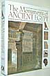
(Code No.6590)
Gillispie, Charles Coulston and Michel Dewachter.
Monuments of Egypt :
the Napoleonic edition : the complete plates of antiquity from the Napoleonic Description de l'Egypte / edited with introduction and notes by Charles Coulston Gillispie and Michel Dewachter.
Date. 1987.
Konecky & Konecky, Old Saybrook. 4to, [10 x 11 1/2ins].. Pp. 46, (French text) + 27 coloured plates + approx, 400 black and white plates, very good condition. Original cloth gilt. Dust jacket, very good condition. Heavy book...... £40.00 |
Click on picture above to view more images
How to order |
(Code No. 6580)Weller, E.(Antique Map).Arabia. The Red Sea and Persian Gulf.Date. [c.1880].Edinburgh. Blackie & Son.. Page sizes, [22 3/4 x 16ins]. Double page colour printed map. Listing:- Sea of Omar, Straits of Bab el Mandeb, Suez Canal, Persian Gulf, etc, very good condition......
|
SOLD.
|
(Code No. 6325)Cole, B.The Port of OPHIR.(2 Antique Maps on one page, Africa and Greece).Date. 1760.London: Stanley Crowder. Page size [8 x 7ins]. Original copper engraved folding map of the The The Ancient way to Tarshish.., very good condition.....
|
SOLD.
|
(Code no. 6324)Porter, Josiah. Leslie.2 Volumes.Five Years in Damascus; Including an Account of the History, Topography and Antiquities of that City, with Travels and Researches in Palmyra, Lebanon and the Hauran..Date. 1855, 1st edn.London, John Murray. 8vo, [5 1/4 x 8ins.] Pp. x,[1], 395. vi, [1], 372, 32 adverts + Large loose folding map of Damascus, hand coloured in outline by J.C. Walker, from a personal survey by J. L. Porter, split to fold, repaired + 2 Folding maps + 29 Engraved plates, (as listed), very good condition. Original gilt-decorated cloth, rubbing, slight nick to top of spine.........
|
SOLD.
|
(Code No. 6150)
Thomson, William. M.
The Land and the Book;
or, Biblical Illustrations drawn from the Manners and Customs, the Scenes and Scenery of the Holy Land.
Date. 1870.
London, T. Nelson and Sons. 8vo, Pp. 718 + Folding map + 12 coloured lithographic full page prints, very good. Dedication on front free end paper. Original full blind-stamped morocco gilt over bevelled boards. Raised spine bands with blind-stamped ornate pattern, slight rubbing. Gilt edges........ £65.00 |
Click on picture above to view more images
How to order |
(Code No. 5965)
TRISTRAM, H.B.
The Land of Israel;
A Journal of Travels in Palestine, undertaken with Special Reference to its Physical Character.
Date. 1865 1st edn.
London. Society for Promoting Christian Knowledge. Large 8vo, [6 1/2 x 9 ins]. Pp. xx, 652,+ Coloured frontis, slight foxing + 3 Coloured plates, slight foxing + B/w full page & text illustrations throughout, (as listed) + 2 Folding coloured map. Original cloth with gilt-stamped pictorial decorated upper cover. Gilt decorated spine, slight chipping to top & bottom, slight loss........ £85.00 |
Click on picture above to view more images
How to order |
(Code No. 5890)Tallis, John.Syria.[Antique Map.]Date. [c.1850].London. J & F Tallis. Page size, [15 x 10 1/2ins]. Original steel engraved map with original outline hand colouring. Four vignette views. Decorated border, vg. John Tallis' maps are the last decorative, regional maps to be published......
|
SOLD.
|
(Code No. 5856)Budge, E. A. Wallis.THE BOOK OF THE DEAD.(Ancient Egypt).Facsimiles of the Papyri of Hunefer, Anhai, Kerasher and Netchemet with Supplementary Text from the Papyrus of Nu. With Transcripts, Translations, Etc.Date. 1899.London, British Museum, Longmans. Large folio, [16 x 23 3/4in]. Pp. xi, 64 + 20 Coloured lithographic prints + 77 lithographic plates of text & illustrations, (as listed), very good condition. Listing:- Papyri of Hunefer in hieroglyphics, Papyri of Anhai in hieroglyphics, Papyri of Kerasher in hieroglyphics, Papyri of Netchemetin hieroglyphics, Papyri of Nu transcripted in hieroglyphics all with translations. Original half morocco gilt, leather loss & splits. Holding firm.Sir Ernest Alfred Thompson Wallis Budge (1857 – 1934) was an English Egyptologist, Orientalist, and philologist who worked for the British Museum and published numerous works on the ancient Near East.....
|
SOLD.
|
(Code No. 5847)
Bowen, Emanuel .
(Antique map).
A new and accurate map of NUBIA & ABISSINIA ,
together with all the kingdoms tributary thereto, and bordering upon them. Laid down from the latest & best authorities and regulated by astronl. observations. By Emanl. Bowen.
Date. 1747.
London. William Innys, Richard Ware..... Image map size [13 1/2 x 17 ins]. Copper engraved map by E. Bowen, slight fold split, old repair to back of map. Elaborate title panel within decorative rural scene. Compass rose and scale line. Graduated border. Areas shown, Egypt, Nile, Red Sea and Arabia....... £120.00 |
Click on picture above to view more images
How to order |
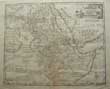
(Code No. 5846)
Mercator, Gerhard, 1512-1594.
(ANTIQUE MAP).
EGYPT.
" Title - Appendix Tab,iii. Africae Aegyptum Inferiorem Exhibens".
Date. [c.1620].
Utrecht, Francois Halma. Page size [22 x 17ins]. Image size [14.6 x 9.7ins]. Copper engraved map with elaborate title cartouch with gradations of latitude and longitude in inner border. Showing 2 galleons. Fine copy..... £100.00 |
Click on picture above to view more images
How to order |
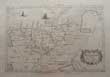
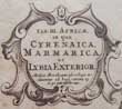
(Code No. 5845)
Mercator, Gerard.
(Antique Map).
NORTH AFRICA.
" Tab. III , Africae, in qua Cyrenaica, Marmarica, ac Lybia Exterior ".
Date. [c.1695].
Amsterdam and Utrecht. Image map size 18 1/4 x 13 1/4 ins. Copper engraved map by Gerard Mercator. Elaborate title cartouche. Decorated with animals and a dragon. Graduated borders. Areas shown Egypt to Morocco. Wide margins., slight foxing spots.....£110.00 |
Click on picture above to view more images
How to order |
(Code No. 5690)
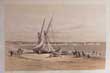
McFarlane, John. David Roberts (illustrator).
The Holy Bible ... ...containing the old and new testaments, according to the authorized version with the marginal readings, and original and selected parallel references, printed at length, and the commentaries of Henry and Scott .
Date. 1857.
Glasgow : Richard Griffin and Company. Folio, [11 x 14ins]. Pp. 1276 + 31 Tinted lithographic views from the original sketches by David Roberts, marginal foxing spots throughout and two splits just affecting engraved surface, (approx 1/2 inch) + 6 Plans and maps. Engraved frontis & title, foxed. Original half morocco gilt, split hinges and rubbed. Still Holding.
David Roberts RA ( 1796 – 1864) was a Scottish painter. He is especially known for a prolific series of detailed lithograph prints of Egypt and the Near East that he produced during the 1840s from sketches he made during long tours of the region (1838–1840). These, and his large oil paintings of similar subjects, made him a prominent Orientalist painter. He was elected as a Royal Academician in 1841...... £700.00
|
Click on picture above to view more images
How to order |
(Code No. 5673)Fairbairn, Patrick. Rev'.(ed).2 Volumes.The Imperial Bible-Dictionary, historical, biographical, geographical, and doctrinal. Including the natural history, antiquitties, manners, customs, religious rites, ceremonies and scriptures ....... Illustrated by nummerous engravings.Date. 1875. London, Blackie & Sons. 4to, Pp. 1152 + 27 Steel engraved view prints including 4 maps & plans, (as listed), slight foxing. Original half calf gilt. Raised spine bands with blind stamped decorated panels, rubbed. Weight:- 5.6kg....
|
SOLD.
|
(Code No. 5447)
Russell, Michael.
History of Ancient and Modern Egypt. Its Temples and Monuments.
Date. 1853,10th edn.
London: Thomas Nelson. 8vo, [5 x 7 1/4ins]. Pp. 542 + Engraved title + Folding Map + 11 Full page wood-cut tissue guarded plates, marginal foxing. Gilt-tooled roll frame with large blind stamped centrepiece device. spine in six compartments with gilt-tooled floral designs. Gilt edges, slightly rubbed... £60.00 |
Click on picture above to view more images
How to order |
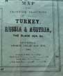
(Code No. 5348)
PHILIP, George.
Philip's Map of the Seat of War.
(Crimean campaign, 1854.)
Date. 1854.
Liverpool, George Philip and Son, Image size [26 x 18ins] folding to [4 x 5 1/2ins.]. Large folding engraved Map of the Frontier Provinces of Turkey, Russia & Austria, The Black Sea, &c. Scale (approx), 1inch to 40 miles. some slight splits to folds.
The Crimean War (October 1853 – February 1856) was a conflict fought between the Russian Empire and an alliance of the French Empire, the British Empire, the Ottoman Empire, the Kingdom of Sardinia, and the Duchy of Nassau. The war was part of a long-running contest between the major European powers for influence over territories of the declining Ottoman Empire. Most of the conflict took place on the Crimean Peninsula, but there were smaller campaigns in western Turkey, the Baltic Sea, the Pacific Ocean and the White Sea....£60.00 |
Click on picture above to view more images
How to order |
(Code No. 5310)
ROLLIN , M.
8 Volumes, (complete).
The Ancient History of the Egyptians, Carthaginians, Assyrians, Babylonians, Medes and Persians, Macedonians and Grecians .
Date. 1817, 13th edn.
London, F.C and J Rivington....8vo, [5 1/2 x 9ins.]Pp. clxxxiii, 329. xii, 528. xv, 557.xii, 522. x, 449. xi, 516. xii, 512. vii, 453 + Engraved portrait frontis + 15 folding maps, 5 split into fold area , no loss + 3 engraved plates. Original full calf gilt, leather loss & marks. All volumes holding. £120.00 |
Click on picture above to view more images
How to order |
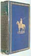
(Code No. 5300)Kelman, John.Illustrated By Margaret Thomas.From Damascus to Palmyra.Date. 1908.London, Adam and Charles Black. 4to, [7 x 9ins.] Pp. xvi, 367, [1] + 71 Coloured plates + 15 Uncoloured plates + Folding map, very good condition. Original pictorial floral cloth. Top edge gilt, slight foxing to outer edges.
|
SOLD.
|
(Code No. 5271)Noel Rawnsley.The Resurrection of Oldest Egypt. Being the Story of Abydos as told by the Discoveries of Dr. Petrie.Date. 1904.Signed by the Author on page 49.Middlesex, The Beaver Press. 8vo, [9 x 6ins.] Pp. [10], 124 + 24 illustrations, some foxing. Title printed and coloured by hand. Original cloth, faded spine and marked.Professor Sir William Matthew Flinders Petrie FRS (1853 – 1942), known as Flinders Petrie, was an English Egyptologist and a pioneer of systematic methodology in archaeology. He held the first chair of Egyptology in the United Kingdom, and excavated at many of the most important archaeological sites in Egypt, such as Naukratis, Tanis, Abydos and Amarna.
|
SOLD.
|
(Code No. 5126)Bonne, Rigobert.(Antique Map).Carte de L'Arabie du Golfe Persique, et de la Mer Rouge, ave L'Egypte, la Nubie et L'Abissinie. ingénieur hydrographe de la Marine.Date. 1780.Paris, Bonne. Page size [16 x 10 1/2ins]. Image size [8 1/2 x 12 1/2 ins.] Original Copper engraved map of the Arabian Peninsula by Andre, slight marks to the top edge of map.
|
SOLD.
|
| (Code No. 4639)Margoliouth, D. S.Cairo, Jerusalem & Damascus.Date. 1907. London, Chatto & Windus, 4to. Pp. xvi, 301. Tipped in colour frontispiece, protected by tissue guard + 57colour plates + 4 line drawings, very good condition. Dedication on frontfree end paper. Original decorated cloth gilt, spine slightly faded.
|
SOLD.
|
| (Code No. 4606)Valentine. L, (ed).Palestine Past and Present: Pictorial and Descriptive.Date. [c.1893].London and New York. Frederick Warne & Co. 4to, [8 x 10 1/4 ins.] Pp liv, 435 + 8 Chromolithographic (printed colour) plates, with tissue guards + Many woodcut illustrations throughout, slight foxing. Original gilt decorated cloth, faded spine and rubbed.
|
SOLD.
|
(Code No. 4333)Gross. Alexander.(2 Large Scale Maps.)Arabia & Palestine. London. Geographers' map Co Ltd. nd, ca1920. Map image size 20 x 25 1/2 ins. Original folding coloured maps of Arabia & Palestine.. Very good condition.
|
SOLD
|
(Code No. 4071)
Tallis, John.
Ancient Palestine. [Antique Map]
London. Ca 1850. Size Approx 370 x 260mm. Original steel engraved map with original outline hand colouring. Four vignette views that includes the town of Nazarth. Decorated border, vg. £40.00
|
Click on picture above to view more images
How to order |
| (Code No. 4004) The Ancient History of the Egyptians, Carthaginians, Assyrians, Babylonians, Medes and Persians, Macedonians, and Grecians.Volume 4.London. Knapton.
1754, 8vo, [5 1/4 x 8 ins]. Pp 348 + Engraved frontis + 2 folding maps by D'Anville, Asia Minor, (Page size 13 x 11 ins), and A Map of the retreat of the Ten Thousand, (Page size 9 3/4 x 12 ins). Original full calf gilt, rubbed and split to hinges. Holding firm.
|
SOLD
|
| (Code No. 3988)
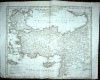
Anville, Jean Baptiste Bourguignon, [1697-1782 ]
Asiae, quae vulgo Minor dicitur, et Syriae tabula geographica....
Paris. D'Anville. ca1790. Image size 18 x 15 ins. Original double page copper engraved map with inset maps of the Mysia and Bosphorus. "Drawn and engraved from D'Anville's Atlas for John Harrison, London". Close cropped bottom blank margin not affecting engraved area. £150.00
|
Click on picture above to view more images
How to order |
| (Code No. 3861).
Halma. Francois,
( Antique Map of the Holy Land.)
Tabula Geographica Terrae Sanctae Auctore J. Bonfrerio Societat Jesu.
Amsterdam. ca1710. Image size 44 1/2 x 15 ins. Original copper engraved folding map, taken from the original by the Flemish theologian, Jacques Bonfrere, two sheets joined, as issued. Oriented with north at top left. There appears to be two editions of this fine map, this is the much more rare large edition (44 1/2 x 15 ins), the other smaller edition measures (25.5 x 8.5 ins), slight nicks to blank margins. £300.00
|
Click on picture above to view more images
How to order |
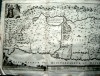
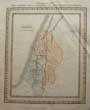
| (Code No. 3802).
Lloyd B.F.
(Antique map of Palestine).
PALESTINE "B.F.Lloyd & Cos New Sixpenny Maps, Embracing the Most Recent Discoveries"
Glasgow. D. Macdonald, 51 Argyll Street. ca1850. Page size 15 x 17 1/2 ins. Image size 14 1/2 x 13 ins. Original steel engraved hand coloured map, crease mark to top right corner..... £60.00
|
Click on picture above to view more images
How to order |
| (Code No. 3329).London. James Wyld. ca1840. Page Sizes approx 23 1/2 x 17 ins. Original
hand coloured copper engraved maps by James Wyld, nicks to blank margin
edges. Newspaper cuttings on back of one map, not affecting map image. |
SOLD |
| (Code No.3026)
London. Ca 1850. Size Approx 370 x 260mm. Original steel engraved
map with original outline hand colouring. Four vignette views.
Decorated border. Centre fold, vg. |
SOLD
|
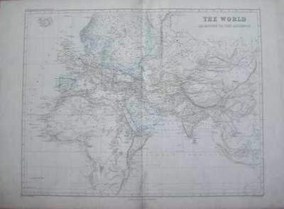
(Code No. 3311)
Smith, William, Dr .
( Antique Map.)
Ancient World, (World Map).
London. John, Murray. ca1870. Page
size, approx, 19 1/2 x 27 1/2 ins. Original hand coloured double
page map, engraved and drawn by E, Weller
& others.(all loose, no text or covers). Taken from Dr .William
Smith's Ancient Atlas. £45.00 |

Click on picture above to view more images
How
to order |
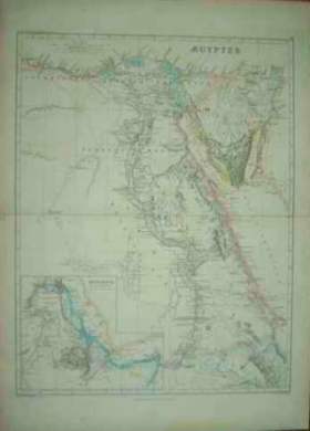
(Code No. 3310)
Smith, William, Dr .
(Antique Map.):
Egyptus, (Egypt.)
London. John, Murray. ca1870. Page size,
approx, 19 1/2 x 27 1/2 ins. Original hand coloured double page
map, engraved and drawn by E, Weller
& others.(all loose, no text or covers). Taken from Dr .William
Smith's Ancient Atlas. £45.00 |
Click on picture above to view more images
How
to order |
(Code No. 3309)Smith, William, Dr .( Antique Map.): Arabia & India,London.
John, Murray. ca1870. Page size, approx, 19 1/2 x 27 1/2 ins. Original
hand coloured double page map, engraved and drawn by E, Weller & others.(all loose, no text or covers). Taken from Dr .William
Smith's Ancient Atlas.
|
SOLD.
|
(Code No. 3308)Smith, William, Dr . (10 Antique Maps.):Britannia, Jerusalem,
Holy Land, Successors of Alexander, Africa Septentrionalis, The
Holy Land (Northern Division),The Holy Land (Southern Division),
Gallia, Ruins of Babylon & Environs of Jerusalem,
London. John, Murray. ca1870. Page size, approx, 19 1/2 x 27 1/2
ins. 10 Original hand coloured double page maps, engraved
and drawn by E, Weller & others.(all loose, no text or covers). Taken from
Dr .William Smith's Ancient Atlas. Two maps the "Ruins of Babylon
& Environs of Jerusalem" are single page. Approx page
sizes, 14 x 19 1/2 ins.
|
SOLD.
|
Return to top
|
|